Copper Mountain Topo Map Idaho
To zoom in, hover over the map of Copper Mountain
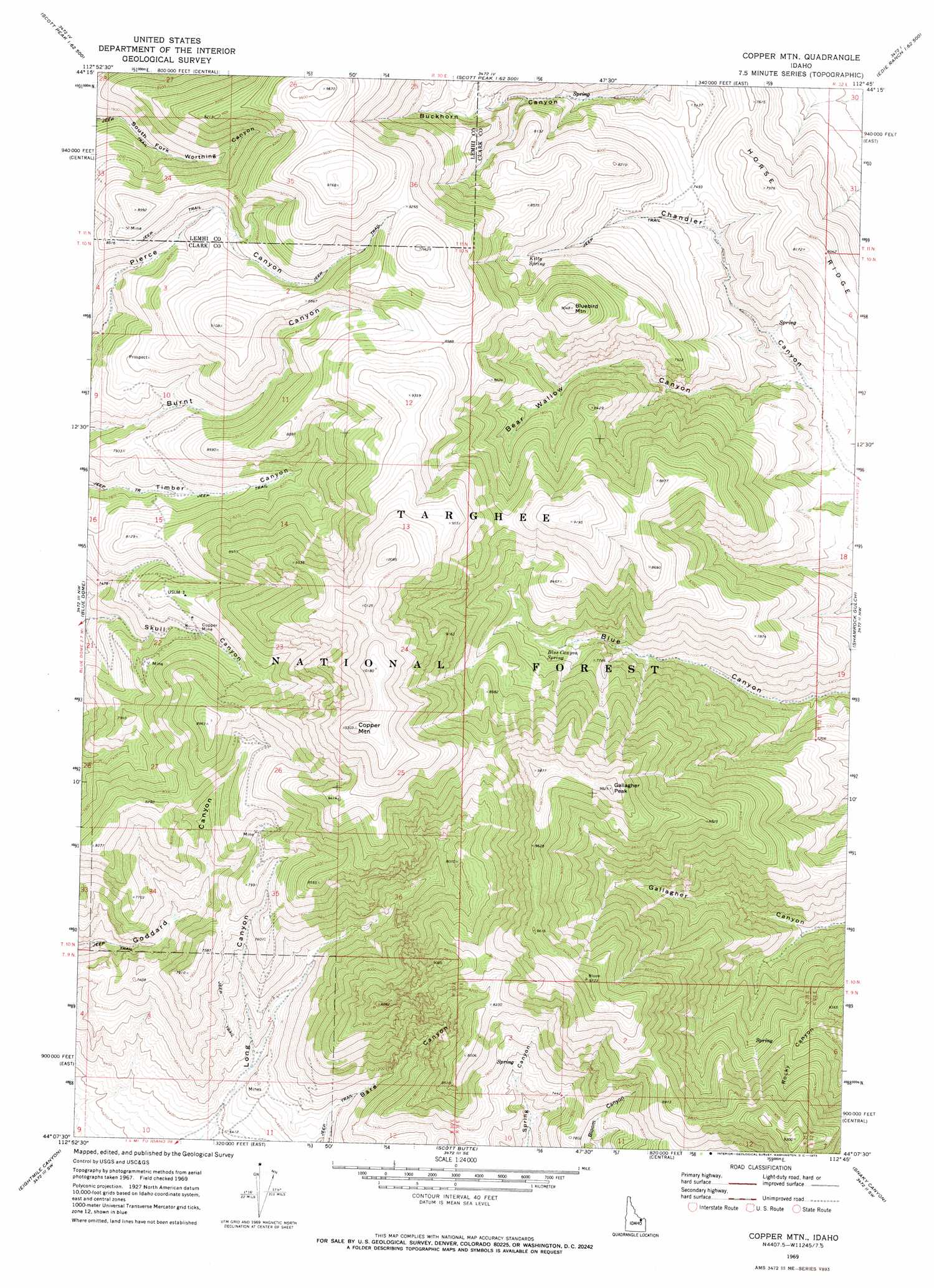
USGS Topo Quad 44112b7 - 1:24,000 scale
| Topo Map Name: | Copper Mountain |
| USGS Topo Quad ID: | 44112b7 |
| Print Size: | ca. 21 1/4" wide x 27" high |
| Southeast Coordinates: | 44.125° N latitude / 112.75° W longitude |
| Map Center Coordinates: | 44.1875° N latitude / 112.8125° W longitude |
| U.S. State: | ID |
| Filename: | o44112b7.jpg |
| Download Map JPG Image: | Copper Mountain topo map 1:24,000 scale |
| Map Type: | Topographic |
| Topo Series: | 7.5´ |
| Map Scale: | 1:24,000 |
| Source of Map Images: | United States Geological Survey (USGS) |
| Alternate Map Versions: |
Copper Mtn ID 1969, updated 1973 Download PDF Buy paper map Copper Mountain ID 2011 Download PDF Buy paper map Copper Mountain ID 2013 Download PDF Buy paper map |
| FStopo: | US Forest Service topo Copper Mountain is available: Download FStopo PDF Download FStopo TIF |
1:24,000 Topo Quads surrounding Copper Mountain
Cottonwood Creek |
Eighteenmile Peak |
Deadman Lake |
Fritz Peak |
Edie Creek |
Nicholia |
Italian Canyon |
Scott Peak |
Heart Mountain |
Rocky Creek |
Diamond Peak |
Blue Dome |
Copper Mountain |
Shamrock Gulch |
Lidy Hot Springs |
Fallert Springs |
Eightmile Canyon |
Scott Butte |
Snaky Canyon |
Lidy Hot Springs Se |
Howe Ne |
Tyler Peak |
Richard Butte |
Circular Butte Nw |
Monteview |
> Back to 44112a1 at 1:100,000 scale
> Back to 44112a1 at 1:250,000 scale
> Back to U.S. Topo Maps home
Copper Mountain topo map: Gazetteer
Copper Mountain: Ridges
Horse Ridge elevation 2492m 8175′Copper Mountain: Springs
Blue Canyon Spring elevation 2296m 7532′Kitty Spring elevation 2448m 8031′
Copper Mountain: Summits
Bluebird Mountain elevation 2762m 9061′Copper Mountain elevation 3130m 10269′
Gallagher Peak elevation 2991m 9812′
Copper Mountain: Valleys
Bear Wallow Canyon elevation 2038m 6686′Long Canyon elevation 1949m 6394′
Copper Mountain digital topo map on disk
Buy this Copper Mountain topo map showing relief, roads, GPS coordinates and other geographical features, as a high-resolution digital map file on DVD: