Heart Mountain Topo Map Idaho
To zoom in, hover over the map of Heart Mountain
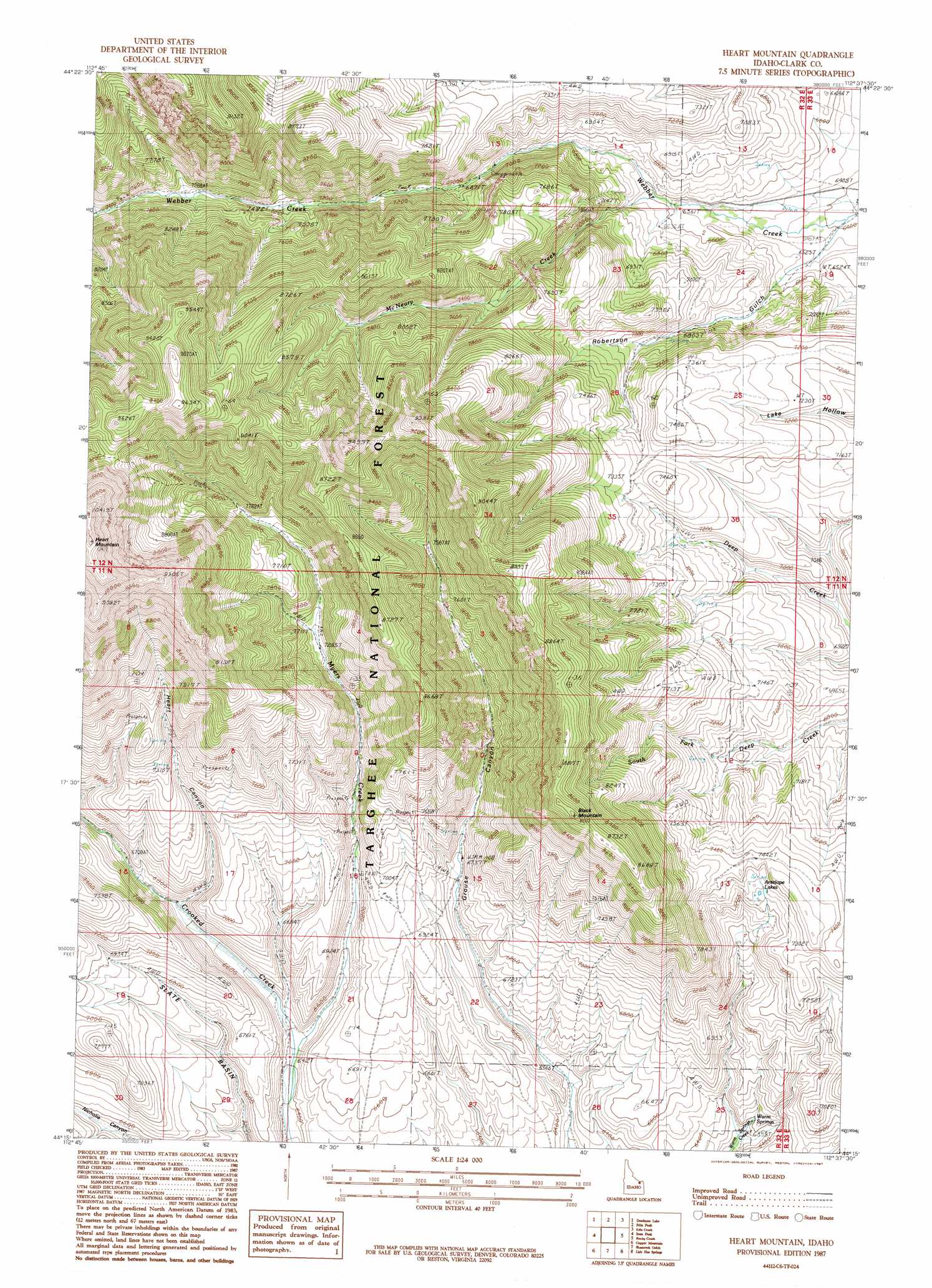
USGS Topo Quad 44112c6 - 1:24,000 scale
| Topo Map Name: | Heart Mountain |
| USGS Topo Quad ID: | 44112c6 |
| Print Size: | ca. 21 1/4" wide x 27" high |
| Southeast Coordinates: | 44.25° N latitude / 112.625° W longitude |
| Map Center Coordinates: | 44.3125° N latitude / 112.6875° W longitude |
| U.S. State: | ID |
| Filename: | o44112c6.jpg |
| Download Map JPG Image: | Heart Mountain topo map 1:24,000 scale |
| Map Type: | Topographic |
| Topo Series: | 7.5´ |
| Map Scale: | 1:24,000 |
| Source of Map Images: | United States Geological Survey (USGS) |
| Alternate Map Versions: |
Heart Mountain ID 1987, updated 1987 Download PDF Buy paper map Heart Mountain ID 2011 Download PDF Buy paper map Heart Mountain ID 2013 Download PDF Buy paper map |
| FStopo: | US Forest Service topo Heart Mountain is available: Download FStopo PDF Download FStopo TIF |
1:24,000 Topo Quads surrounding Heart Mountain
Island Butte |
Caboose Canyon |
Gallagher Gulch |
Lima Peaks |
Snowline |
Eighteenmile Peak |
Deadman Lake |
Fritz Peak |
Edie Creek |
Tepee Draw |
Italian Canyon |
Scott Peak |
Heart Mountain |
Rocky Creek |
Indian Creek |
Blue Dome |
Copper Mountain |
Shamrock Gulch |
Lidy Hot Springs |
Small |
Eightmile Canyon |
Scott Butte |
Snaky Canyon |
Lidy Hot Springs Se |
Cedar Butte Sw |
> Back to 44112a1 at 1:100,000 scale
> Back to 44112a1 at 1:250,000 scale
> Back to U.S. Topo Maps home
Heart Mountain topo map: Gazetteer
Heart Mountain: Basins
Slate Basin elevation 2011m 6597′Heart Mountain: Lakes
Antelope Lakes elevation 2227m 7306′Heart Mountain: Springs
Warm Springs elevation 1989m 6525′Heart Mountain: Streams
McNeary Creek elevation 2015m 6610′Myers Creek elevation 1938m 6358′
Heart Mountain: Summits
Black Mountain elevation 2695m 8841′Heart Mountain: Valleys
Heart Canyon elevation 2019m 6624′Robertson Gulch elevation 1966m 6450′
Heart Mountain digital topo map on disk
Buy this Heart Mountain topo map showing relief, roads, GPS coordinates and other geographical features, as a high-resolution digital map file on DVD: