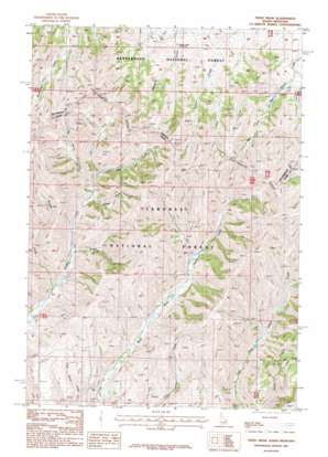
Tepee Draw Topo Map Idaho
To zoom in, hover over the map of Tepee Draw
USGS Topo Quad 44112d4 - 1:24,000 scale
| Topo Map Name: | Tepee Draw |
| USGS Topo Quad ID: | 44112d4 |
| Print Size: | ca. 21 1/4" wide x 27" high |
| Southeast Coordinates: | 44.375° N latitude / 112.375° W longitude |
| Map Center Coordinates: | 44.4375° N latitude / 112.4375° W longitude |
| U.S. States: | ID, MT |
| Filename: | o44112d4.jpg |
| Download Map JPG Image: | Tepee Draw topo map 1:24,000 scale |
| Map Type: | Topographic |
| Topo Series: | 7.5´ |
| Map Scale: | 1:24,000 |
| Source of Map Images: | United States Geological Survey (USGS) |
| Alternate Map Versions: |
Tepee Draw ID 1987, updated 1987 Download PDF Buy paper map Tepee Draw ID 2011 Download PDF Buy paper map Tepee Draw ID 2013 Download PDF Buy paper map |
| FStopo: | US Forest Service topo Tepee Draw is available: Download FStopo PDF Download FStopo TIF |
1:24,000 Topo Quads surrounding Tepee Draw
> Back to 44112a1 at 1:100,000 scale
> Back to 44112a1 at 1:250,000 scale
> Back to U.S. Topo Maps home
Tepee Draw topo map: Gazetteer
Tepee Draw: Streams
Big Spring Creek elevation 2197m 7208′Lake Creek elevation 2321m 7614′
Left Fork Middle Creek elevation 2227m 7306′
Mill Creek elevation 2227m 7306′
Poison Creek elevation 2081m 6827′
Tepee Draw: Valleys
Broad Hollow elevation 2121m 6958′Tepee Draw elevation 2185m 7168′
Tepee Draw digital topo map on disk
Buy this Tepee Draw topo map showing relief, roads, GPS coordinates and other geographical features, as a high-resolution digital map file on DVD:


