Snowline Topo Map Montana
To zoom in, hover over the map of Snowline
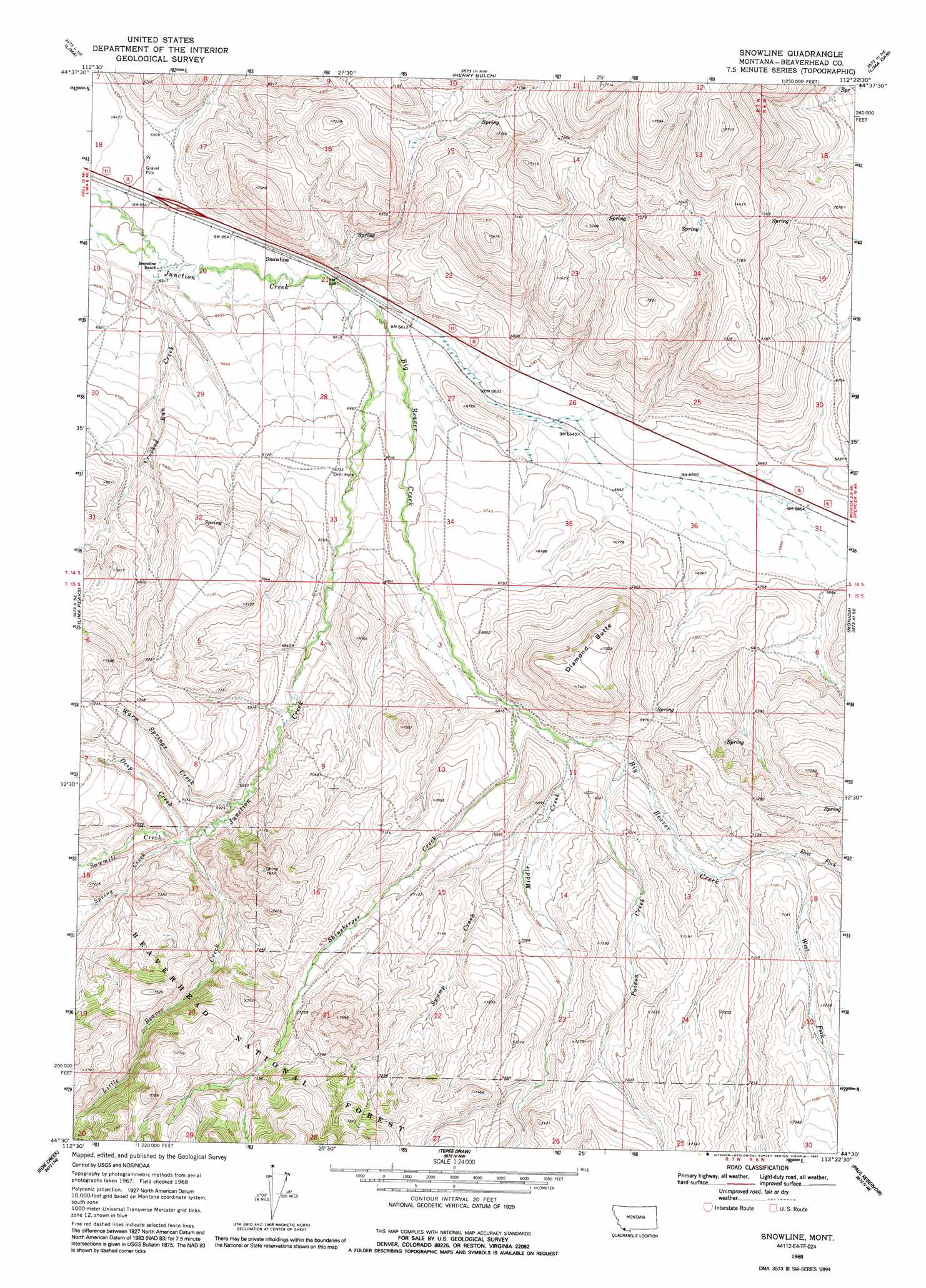
USGS Topo Quad 44112e4 - 1:24,000 scale
| Topo Map Name: | Snowline |
| USGS Topo Quad ID: | 44112e4 |
| Print Size: | ca. 21 1/4" wide x 27" high |
| Southeast Coordinates: | 44.5° N latitude / 112.375° W longitude |
| Map Center Coordinates: | 44.5625° N latitude / 112.4375° W longitude |
| U.S. State: | MT |
| Filename: | o44112e4.jpg |
| Download Map JPG Image: | Snowline topo map 1:24,000 scale |
| Map Type: | Topographic |
| Topo Series: | 7.5´ |
| Map Scale: | 1:24,000 |
| Source of Map Images: | United States Geological Survey (USGS) |
| Alternate Map Versions: |
Snowline MT 1968, updated 1972 Download PDF Buy paper map Snowline MT 1968, updated 1981 Download PDF Buy paper map Snowline MT 1968, updated 1991 Download PDF Buy paper map Snowline MT 1997, updated 2002 Download PDF Buy paper map Snowline MT 2011 Download PDF Buy paper map Snowline MT 2014 Download PDF Buy paper map |
| FStopo: | US Forest Service topo Snowline is available: Download FStopo PDF Download FStopo TIF |
1:24,000 Topo Quads surrounding Snowline
Briggs Ranch |
Rock Island Ranch |
Vinegar Hill |
Whiskey Spring |
Antone Peak |
Dell |
Lima |
Henry Gulch |
Lima Dam |
Wolverine Creek |
Gallagher Gulch |
Lima Peaks |
Snowline |
Monida |
Corral Creek |
Fritz Peak |
Edie Creek |
Tepee Draw |
Paul Reservoir |
Spencer North |
Heart Mountain |
Rocky Creek |
Indian Creek |
Thunder Gulch |
Spencer South |
> Back to 44112e1 at 1:100,000 scale
> Back to 44112a1 at 1:250,000 scale
> Back to U.S. Topo Maps home
Snowline topo map: Gazetteer
Snowline: Crossings
Interchange 9 elevation 1993m 6538′Snowline: Post Offices
Junction Ranch Post Office (historical) elevation 2004m 6574′Snowline: Streams
Big Beaver Creek elevation 2011m 6597′Deep Creek elevation 2117m 6945′
East Fork Big Beaver Creek elevation 2145m 7037′
Little Beaver Creek elevation 2117m 6945′
Middle Creek elevation 2084m 6837′
Poison Creek elevation 2099m 6886′
Sawmill Creek elevation 2120m 6955′
Shineberger Creek elevation 2076m 6811′
Spring Creek elevation 2204m 7230′
Spring Creek elevation 2120m 6955′
Swamp Creek elevation 2102m 6896′
Warm Springs Creek elevation 2104m 6902′
West Fork Big Beaver Creek elevation 2145m 7037′
Snowline: Summits
Diamond Butte elevation 2255m 7398′Snowline digital topo map on disk
Buy this Snowline topo map showing relief, roads, GPS coordinates and other geographical features, as a high-resolution digital map file on DVD: