Wolverine Creek Topo Map Montana
To zoom in, hover over the map of Wolverine Creek
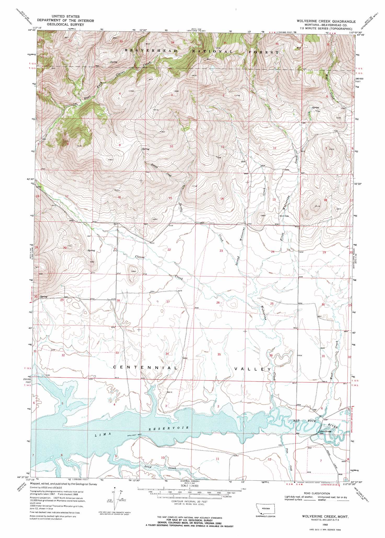
USGS Topo Quad 44112f2 - 1:24,000 scale
| Topo Map Name: | Wolverine Creek |
| USGS Topo Quad ID: | 44112f2 |
| Print Size: | ca. 21 1/4" wide x 27" high |
| Southeast Coordinates: | 44.625° N latitude / 112.125° W longitude |
| Map Center Coordinates: | 44.6875° N latitude / 112.1875° W longitude |
| U.S. State: | MT |
| Filename: | o44112f2.jpg |
| Download Map JPG Image: | Wolverine Creek topo map 1:24,000 scale |
| Map Type: | Topographic |
| Topo Series: | 7.5´ |
| Map Scale: | 1:24,000 |
| Source of Map Images: | United States Geological Survey (USGS) |
| Alternate Map Versions: |
Wolverine Creek MT 1968, updated 1972 Download PDF Buy paper map Wolverine Creek MT 1997, updated 2002 Download PDF Buy paper map Wolverine Creek MT 2011 Download PDF Buy paper map Wolverine Creek MT 2014 Download PDF Buy paper map |
| FStopo: | US Forest Service topo Wolverine Creek is available: Download FStopo PDF Download FStopo TIF |
1:24,000 Topo Quads surrounding Wolverine Creek
Price Creek |
Price Creek Ne |
Swamp Creek |
Spur Mountain |
Iron Creek |
Vinegar Hill |
Whiskey Spring |
Antone Peak |
Stonehouse Mountain |
Eureka Basin |
Henry Gulch |
Lima Dam |
Wolverine Creek |
Antelope Peak |
Metzel Creek |
Snowline |
Monida |
Corral Creek |
Big Table Mountain |
Winslow Creek |
Tepee Draw |
Paul Reservoir |
Spencer North |
Lookout Point |
Kilgore |
> Back to 44112e1 at 1:100,000 scale
> Back to 44112a1 at 1:250,000 scale
> Back to U.S. Topo Maps home
Wolverine Creek topo map: Gazetteer
Wolverine Creek: Bridges
Lyons Bridge elevation 2007m 6584′Wolverine Creek: Streams
Clover Creek elevation 2019m 6624′First Wolverine Creek elevation 2024m 6640′
Price Creek elevation 2007m 6584′
Sand Creek elevation 2006m 6581′
Sandy Creek elevation 2029m 6656′
Second Wolverine Creek elevation 2024m 6640′
Shineberger Creek elevation 2006m 6581′
Swamp Creek elevation 2098m 6883′
West Creek elevation 2007m 6584′
Wolverine Creek elevation 2006m 6581′
Wolverine Creek: Summits
Merden Peak elevation 2166m 7106′Wolverine Creek digital topo map on disk
Buy this Wolverine Creek topo map showing relief, roads, GPS coordinates and other geographical features, as a high-resolution digital map file on DVD: