Vinegar Hill Topo Map Montana
To zoom in, hover over the map of Vinegar Hill
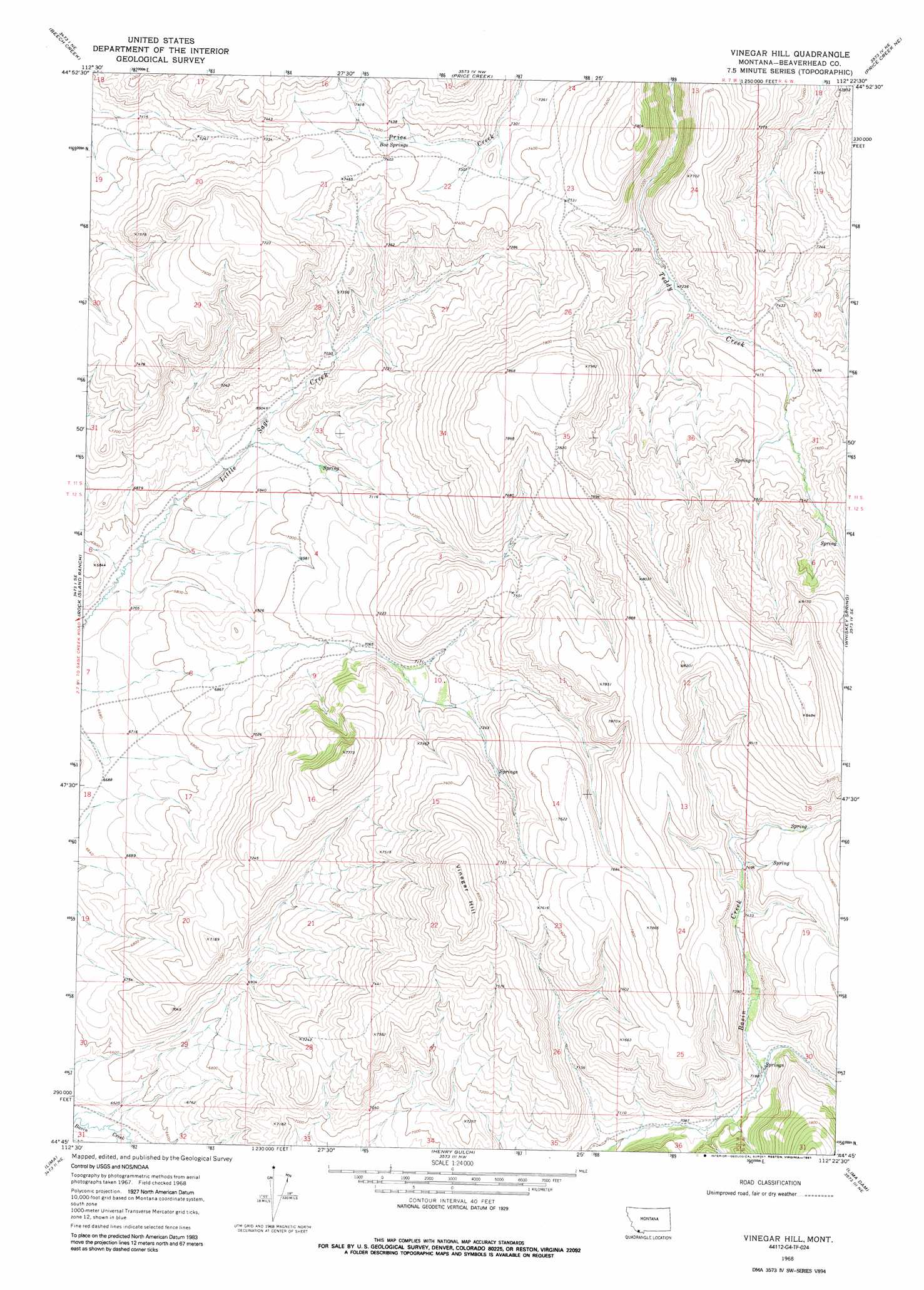
USGS Topo Quad 44112g4 - 1:24,000 scale
| Topo Map Name: | Vinegar Hill |
| USGS Topo Quad ID: | 44112g4 |
| Print Size: | ca. 21 1/4" wide x 27" high |
| Southeast Coordinates: | 44.75° N latitude / 112.375° W longitude |
| Map Center Coordinates: | 44.8125° N latitude / 112.4375° W longitude |
| U.S. State: | MT |
| Filename: | o44112g4.jpg |
| Download Map JPG Image: | Vinegar Hill topo map 1:24,000 scale |
| Map Type: | Topographic |
| Topo Series: | 7.5´ |
| Map Scale: | 1:24,000 |
| Source of Map Images: | United States Geological Survey (USGS) |
| Alternate Map Versions: |
Vinegar Hill MT 1968, updated 1972 Download PDF Buy paper map Vinegar Hill MT 1968, updated 1991 Download PDF Buy paper map Vinegar Hill MT 2011 Download PDF Buy paper map Vinegar Hill MT 2014 Download PDF Buy paper map |
1:24,000 Topo Quads surrounding Vinegar Hill
Gallagher Mountain |
Ashbough Canyon |
Elk Gulch |
Red Canyon |
Belmont Park Ranch |
Monument Hill |
Beech Creek |
Price Creek |
Price Creek Ne |
Swamp Creek |
Briggs Ranch |
Rock Island Ranch |
Vinegar Hill |
Whiskey Spring |
Antone Peak |
Dell |
Lima |
Henry Gulch |
Lima Dam |
Wolverine Creek |
Gallagher Gulch |
Lima Peaks |
Snowline |
Monida |
Corral Creek |
> Back to 44112e1 at 1:100,000 scale
> Back to 44112a1 at 1:250,000 scale
> Back to U.S. Topo Maps home
Vinegar Hill topo map: Gazetteer
Vinegar Hill: Springs
Box Springs elevation 2247m 7372′Vinegar Hill: Streams
Price Creek elevation 2214m 7263′Vinegar Hill: Summits
Vinegar Hill elevation 2485m 8152′Vinegar Hill: Valleys
Price Canyon elevation 2214m 7263′Vinegar Hill digital topo map on disk
Buy this Vinegar Hill topo map showing relief, roads, GPS coordinates and other geographical features, as a high-resolution digital map file on DVD: