Fallert Springs Topo Map Idaho
To zoom in, hover over the map of Fallert Springs
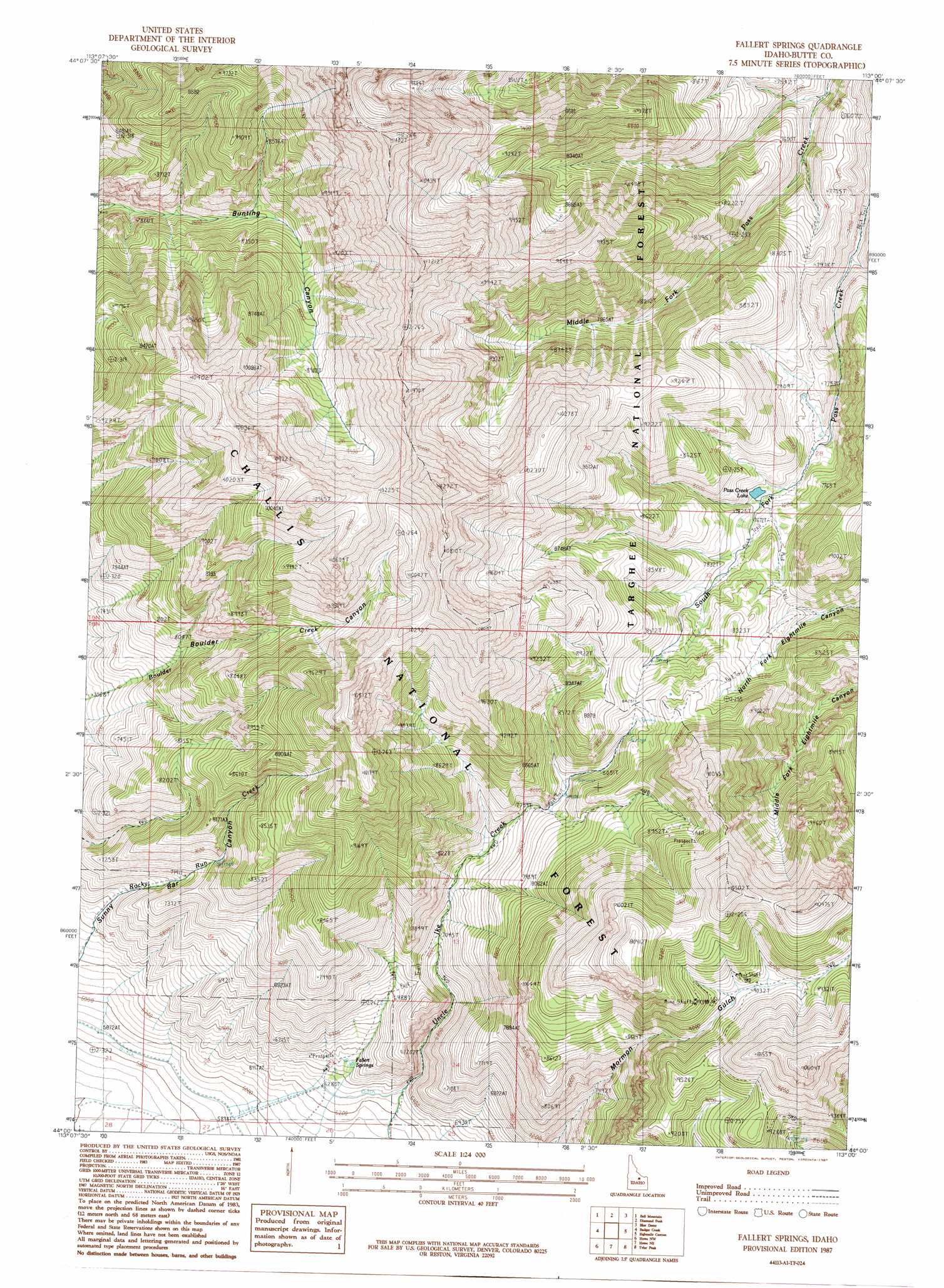
USGS Topo Quad 44113a1 - 1:24,000 scale
| Topo Map Name: | Fallert Springs |
| USGS Topo Quad ID: | 44113a1 |
| Print Size: | ca. 21 1/4" wide x 27" high |
| Southeast Coordinates: | 44° N latitude / 113° W longitude |
| Map Center Coordinates: | 44.0625° N latitude / 113.0625° W longitude |
| U.S. State: | ID |
| Filename: | o44113a1.jpg |
| Download Map JPG Image: | Fallert Springs topo map 1:24,000 scale |
| Map Type: | Topographic |
| Topo Series: | 7.5´ |
| Map Scale: | 1:24,000 |
| Source of Map Images: | United States Geological Survey (USGS) |
| Alternate Map Versions: |
Fallert Springs ID 1987, updated 1987 Download PDF Buy paper map Fallert Springs ID 2011 Download PDF Buy paper map Fallert Springs ID 2013 Download PDF Buy paper map |
| FStopo: | US Forest Service topo Fallert Springs is available: Download FStopo PDF Download FStopo TIF |
1:24,000 Topo Quads surrounding Fallert Springs
Big Windy Peak |
Coal Kiln Canyon |
Nicholia |
Italian Canyon |
Scott Peak |
Mulkey Bar |
Bell Mountain |
Diamond Peak |
Blue Dome |
Copper Mountain |
Hawley Mountain |
Badger Creek |
Fallert Springs |
Eightmile Canyon |
Scott Butte |
Sunset Peak |
Howe Nw |
Howe Ne |
Tyler Peak |
Richard Butte |
Ramshorn Canyon |
Arco Pass |
Howe |
Little Lost River Sinks |
Big Lost River Sinks |
> Back to 44113a1 at 1:100,000 scale
> Back to 44112a1 at 1:250,000 scale
> Back to U.S. Topo Maps home
Fallert Springs topo map: Gazetteer
Fallert Springs: Lakes
Pass Creek Lake elevation 2310m 7578′Fallert Springs: Springs
Fallert Springs elevation 1930m 6332′Fallert Springs: Valleys
Boulder Canyon elevation 2180m 7152′Sunny Bar Canyon elevation 2054m 6738′
Fallert Springs digital topo map on disk
Buy this Fallert Springs topo map showing relief, roads, GPS coordinates and other geographical features, as a high-resolution digital map file on DVD: