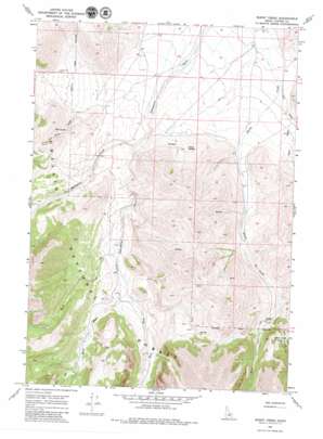
Burnt Creek Topo Map Idaho
To zoom in, hover over the map of Burnt Creek
USGS Topo Quad 44113b6 - 1:24,000 scale
| Topo Map Name: | Burnt Creek |
| USGS Topo Quad ID: | 44113b6 |
| Print Size: | ca. 21 1/4" wide x 27" high |
| Southeast Coordinates: | 44.125° N latitude / 113.625° W longitude |
| Map Center Coordinates: | 44.1875° N latitude / 113.6875° W longitude |
| U.S. State: | ID |
| Filename: | o44113b6.jpg |
| Download Map JPG Image: | Burnt Creek topo map 1:24,000 scale |
| Map Type: | Topographic |
| Topo Series: | 7.5´ |
| Map Scale: | 1:24,000 |
| Source of Map Images: | United States Geological Survey (USGS) |
| Alternate Map Versions: |
Burnt Creek ID 1967, updated 1971 Download PDF Buy paper map Burnt Creek ID 1967, updated 1979 Download PDF Buy paper map Burnt Creek ID 2011 Download PDF Buy paper map Burnt Creek ID 2013 Download PDF Buy paper map |
| FStopo: | US Forest Service topo Burnt Creek is available: Download FStopo PDF Download FStopo TIF |
1:24,000 Topo Quads surrounding Burnt Creek
> Back to 44113a1 at 1:100,000 scale
> Back to 44112a1 at 1:250,000 scale
> Back to U.S. Topo Maps home
Burnt Creek topo map: Gazetteer
Burnt Creek: Lakes
Burnt Creek Lake elevation 2492m 8175′Burnt Creek: Springs
Mud Spring elevation 2353m 7719′Poison Springs elevation 2307m 7568′
Squaw Creek Spring elevation 2373m 7785′
Burnt Creek: Streams
East Fork Burnt Creek elevation 2431m 7975′East Fork Pahsimeroi River elevation 2356m 7729′
Long Creek elevation 2167m 7109′
Mahogany Creek elevation 2234m 7329′
Rock Creek elevation 2322m 7618′
Squaw Creek elevation 2189m 7181′
West Fork Burnt Creek elevation 2431m 7975′
West Fork Pahsimeroi River elevation 2356m 7729′
Burnt Creek: Valleys
Mud Spring Canyon elevation 2286m 7500′Burnt Creek digital topo map on disk
Buy this Burnt Creek topo map showing relief, roads, GPS coordinates and other geographical features, as a high-resolution digital map file on DVD:


