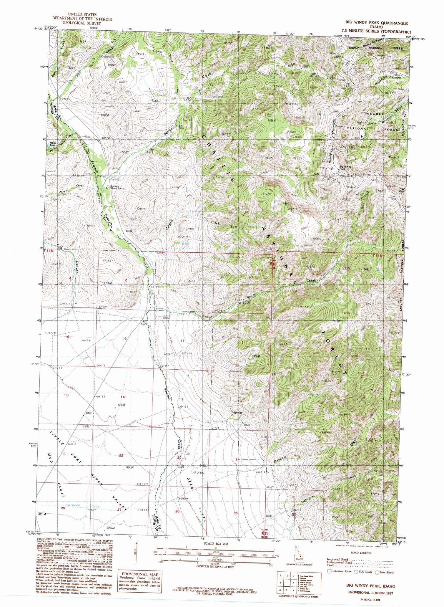
Big Windy Peak Topo Map Idaho
To zoom in, hover over the map of Big Windy Peak
USGS Topo Quad 44113c3 - 1:24,000 scale
| Topo Map Name: | Big Windy Peak |
| USGS Topo Quad ID: | 44113c3 |
| Print Size: | ca. 21 1/4" wide x 27" high |
| Southeast Coordinates: | 44.25° N latitude / 113.25° W longitude |
| Map Center Coordinates: | 44.3125° N latitude / 113.3125° W longitude |
| U.S. State: | ID |
| Filename: | o44113c3.jpg |
| Download Map JPG Image: | Big Windy Peak topo map 1:24,000 scale |
| Map Type: | Topographic |
| Topo Series: | 7.5´ |
| Map Scale: | 1:24,000 |
| Source of Map Images: | United States Geological Survey (USGS) |
| Alternate Map Versions: |
Big Windy Peak ID 1987, updated 1987 Download PDF Buy paper map Big Windy Peak ID 2011 Download PDF Buy paper map Big Windy Peak ID 2013 Download PDF Buy paper map |
| FStopo: | US Forest Service topo Big Windy Peak is available: Download FStopo PDF Download FStopo TIF |
1:24,000 Topo Quads surrounding Big Windy Peak
Yellow Peak |
Sheephorn Peak |
Purcell Spring |
Powderhorn Gulch |
Morrison Lake |
Big Creek Peak |
Iron Creek Point |
Gilmore |
Gilmore Summit |
Cottonwood Creek |
Donkey Creek |
Moffett Springs |
Big Windy Peak |
Coal Kiln Canyon |
Nicholia |
Short Creek |
Red Hills |
Mulkey Bar |
Bell Mountain |
Diamond Peak |
Massacre Mountain |
Warren Mountain |
Hawley Mountain |
Badger Creek |
Fallert Springs |
> Back to 44113a1 at 1:100,000 scale
> Back to 44112a1 at 1:250,000 scale
> Back to U.S. Topo Maps home
Big Windy Peak topo map: Gazetteer
Big Windy Peak: Springs
Y Springs elevation 2065m 6774′Big Windy Peak: Streams
Aspen Creek elevation 2045m 6709′Garfield Creek elevation 2012m 6601′
Horse Lake Creek elevation 2085m 6840′
Meadow Creek elevation 2047m 6715′
North Fork Squaw Creek elevation 2220m 7283′
Squaw Creek elevation 2045m 6709′
Warm Creek elevation 1995m 6545′
Big Windy Peak: Summits
Big Windy Peak elevation 3167m 10390′Spring Mountain elevation 3101m 10173′
Trail Peak elevation 3186m 10452′
Big Windy Peak: Valleys
Cub Canyon elevation 1964m 6443′Horseshoe Gulch elevation 2520m 8267′
Sawmill Canyon elevation 1995m 6545′
Big Windy Peak digital topo map on disk
Buy this Big Windy Peak topo map showing relief, roads, GPS coordinates and other geographical features, as a high-resolution digital map file on DVD: