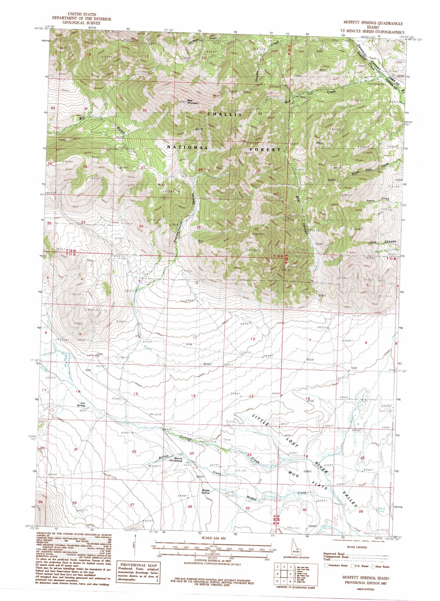
Moffett Springs Topo Map Idaho
To zoom in, hover over the map of Moffett Springs
USGS Topo Quad 44113c4 - 1:24,000 scale
| Topo Map Name: | Moffett Springs |
| USGS Topo Quad ID: | 44113c4 |
| Print Size: | ca. 21 1/4" wide x 27" high |
| Southeast Coordinates: | 44.25° N latitude / 113.375° W longitude |
| Map Center Coordinates: | 44.3125° N latitude / 113.4375° W longitude |
| U.S. State: | ID |
| Filename: | o44113c4.jpg |
| Download Map JPG Image: | Moffett Springs topo map 1:24,000 scale |
| Map Type: | Topographic |
| Topo Series: | 7.5´ |
| Map Scale: | 1:24,000 |
| Source of Map Images: | United States Geological Survey (USGS) |
| Alternate Map Versions: |
Moffett Springs ID 1987, updated 1987 Download PDF Buy paper map Moffett Springs ID 2011 Download PDF Buy paper map Moffett Springs ID 2013 Download PDF Buy paper map |
| FStopo: | US Forest Service topo Moffett Springs is available: Download FStopo PDF Download FStopo TIF |
1:24,000 Topo Quads surrounding Moffett Springs
Patterson |
Yellow Peak |
Sheephorn Peak |
Purcell Spring |
Powderhorn Gulch |
Donkey Hills Nw |
Big Creek Peak |
Iron Creek Point |
Gilmore |
Gilmore Summit |
Spring Hill |
Donkey Creek |
Moffett Springs |
Big Windy Peak |
Coal Kiln Canyon |
Burnt Creek |
Short Creek |
Red Hills |
Mulkey Bar |
Bell Mountain |
Leatherman Peak |
Massacre Mountain |
Warren Mountain |
Hawley Mountain |
Badger Creek |
> Back to 44113a1 at 1:100,000 scale
> Back to 44112a1 at 1:250,000 scale
> Back to U.S. Topo Maps home
Moffett Springs topo map: Gazetteer
Moffett Springs: Lakes
Horse Lake elevation 2193m 7194′Moffett Springs: Springs
Barney Hot Springs elevation 1959m 6427′Iron Springs elevation 1987m 6519′
Moffett Springs elevation 1948m 6391′
Moffett Springs: Streams
Barney Creek elevation 1926m 6318′Bear Creek elevation 2105m 6906′
Bull Creek elevation 2121m 6958′
Mill Creek elevation 2099m 6886′
Moffett Creek elevation 1911m 6269′
Moffett Springs: Summits
Bear Mountain elevation 3267m 10718′Moffett Springs: Valleys
Bear Canyon elevation 2050m 6725′Summerhouse Canyon elevation 2108m 6916′
Moffett Springs digital topo map on disk
Buy this Moffett Springs topo map showing relief, roads, GPS coordinates and other geographical features, as a high-resolution digital map file on DVD: