Doublespring Topo Map Idaho
To zoom in, hover over the map of Doublespring
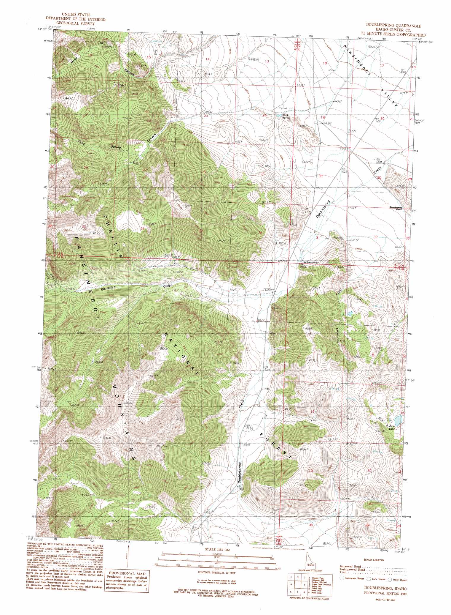
USGS Topo Quad 44113c7 - 1:24,000 scale
| Topo Map Name: | Doublespring |
| USGS Topo Quad ID: | 44113c7 |
| Print Size: | ca. 21 1/4" wide x 27" high |
| Southeast Coordinates: | 44.25° N latitude / 113.75° W longitude |
| Map Center Coordinates: | 44.3125° N latitude / 113.8125° W longitude |
| U.S. State: | ID |
| Filename: | o44113c7.jpg |
| Download Map JPG Image: | Doublespring topo map 1:24,000 scale |
| Map Type: | Topographic |
| Topo Series: | 7.5´ |
| Map Scale: | 1:24,000 |
| Source of Map Images: | United States Geological Survey (USGS) |
| Alternate Map Versions: |
Doublespring ID 1989, updated 1989 Download PDF Buy paper map Doublespring ID 2011 Download PDF Buy paper map Doublespring ID 2013 Download PDF Buy paper map |
| FStopo: | US Forest Service topo Doublespring is available: Download FStopo PDF Download FStopo TIF |
1:24,000 Topo Quads surrounding Doublespring
Grouse Peak |
May |
East Of May |
Patterson |
Yellow Peak |
Little Antelope Flat |
Meadow Peak |
Mahogany Hill |
Donkey Hills Nw |
Big Creek Peak |
Antelope Flat |
Grouse Creek Mountain |
Doublespring |
Spring Hill |
Donkey Creek |
Horse Basin |
Dickey Peak |
Borah Peak |
Burnt Creek |
Short Creek |
Jerry Peak |
Chilly Buttes |
Elkhorn Creek |
Leatherman Peak |
Massacre Mountain |
> Back to 44113a1 at 1:100,000 scale
> Back to 44112a1 at 1:250,000 scale
> Back to U.S. Topo Maps home
Doublespring topo map: Gazetteer
Doublespring: Reservoirs
Carlson Lake elevation 2483m 8146′Doublespring: Springs
Doublespring elevation 2096m 6876′Rock Spring elevation 2047m 6715′
Doublespring: Streams
Buck Creek elevation 2032m 6666′Doublespring: Valleys
Christian Gulch elevation 2142m 7027′Dead Cat Canyon elevation 2226m 7303′
Rock Spring Canyon elevation 2165m 7103′
Doublespring digital topo map on disk
Buy this Doublespring topo map showing relief, roads, GPS coordinates and other geographical features, as a high-resolution digital map file on DVD: