East Of May Topo Map Idaho
To zoom in, hover over the map of East Of May
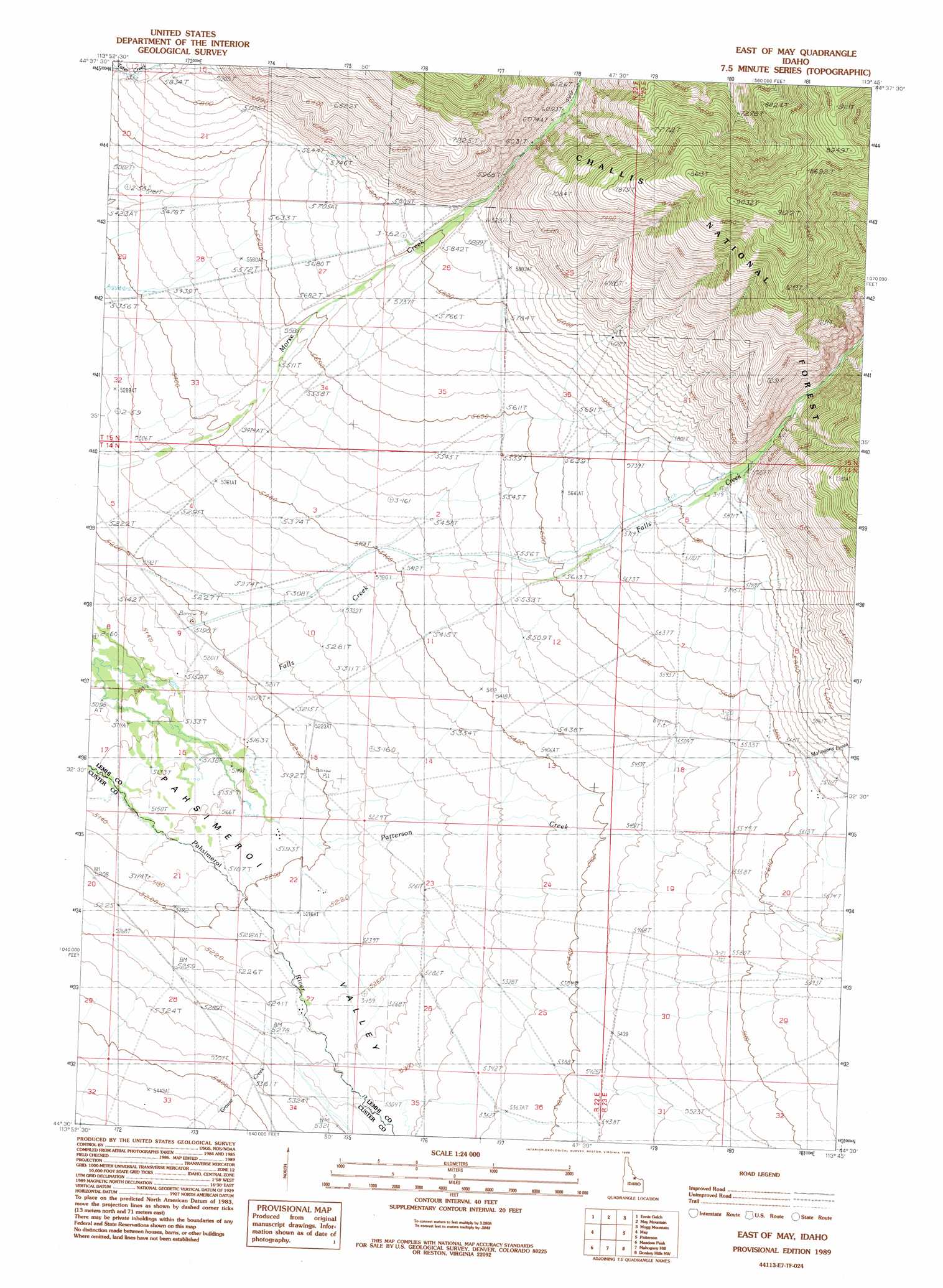
USGS Topo Quad 44113e7 - 1:24,000 scale
| Topo Map Name: | East Of May |
| USGS Topo Quad ID: | 44113e7 |
| Print Size: | ca. 21 1/4" wide x 27" high |
| Southeast Coordinates: | 44.5° N latitude / 113.75° W longitude |
| Map Center Coordinates: | 44.5625° N latitude / 113.8125° W longitude |
| U.S. State: | ID |
| Filename: | o44113e7.jpg |
| Download Map JPG Image: | East Of May topo map 1:24,000 scale |
| Map Type: | Topographic |
| Topo Series: | 7.5´ |
| Map Scale: | 1:24,000 |
| Source of Map Images: | United States Geological Survey (USGS) |
| Alternate Map Versions: |
East of May ID 1989, updated 1989 Download PDF Buy paper map East of May ID 2011 Download PDF Buy paper map East of May ID 2013 Download PDF Buy paper map |
| FStopo: | US Forest Service topo East of May is available: Download FStopo PDF Download FStopo TIF |
1:24,000 Topo Quads surrounding East Of May
Hat Creek |
Allison Creek |
Lem Peak |
Hayden Creek |
Lemhi |
Ellis |
Ennis Gulch |
May Mountain |
Mogg Mountain |
Stroud Creek |
Grouse Peak |
May |
East Of May |
Patterson |
Yellow Peak |
Little Antelope Flat |
Meadow Peak |
Mahogany Hill |
Donkey Hills Nw |
Big Creek Peak |
Antelope Flat |
Grouse Creek Mountain |
Doublespring |
Spring Hill |
Donkey Creek |
> Back to 44113e1 at 1:100,000 scale
> Back to 44112a1 at 1:250,000 scale
> Back to U.S. Topo Maps home
East Of May topo map: Gazetteer
East Of May: Streams
Grouse Creek elevation 1610m 5282′Mahogany Creek elevation 1708m 5603′
East Of May digital topo map on disk
Buy this East Of May topo map showing relief, roads, GPS coordinates and other geographical features, as a high-resolution digital map file on DVD: