Lemhi Topo Map Idaho
To zoom in, hover over the map of Lemhi
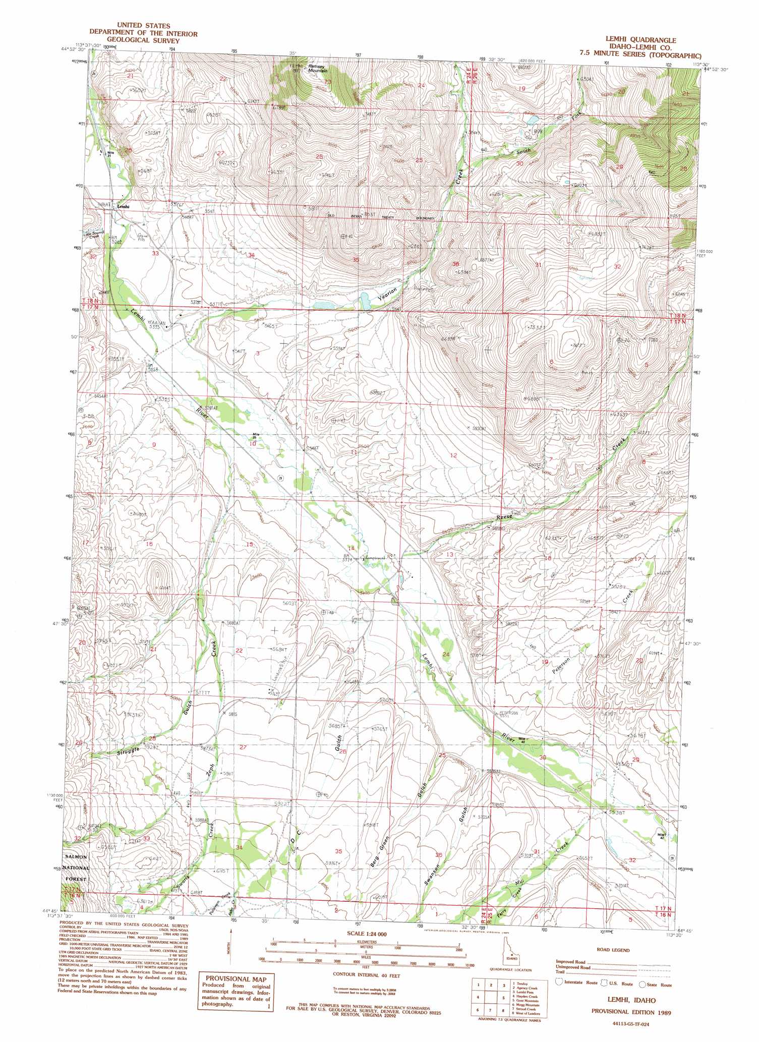
USGS Topo Quad 44113g5 - 1:24,000 scale
| Topo Map Name: | Lemhi |
| USGS Topo Quad ID: | 44113g5 |
| Print Size: | ca. 21 1/4" wide x 27" high |
| Southeast Coordinates: | 44.75° N latitude / 113.5° W longitude |
| Map Center Coordinates: | 44.8125° N latitude / 113.5625° W longitude |
| U.S. State: | ID |
| Filename: | o44113g5.jpg |
| Download Map JPG Image: | Lemhi topo map 1:24,000 scale |
| Map Type: | Topographic |
| Topo Series: | 7.5´ |
| Map Scale: | 1:24,000 |
| Source of Map Images: | United States Geological Survey (USGS) |
| Alternate Map Versions: |
Lemhi ID 1989, updated 1989 Download PDF Buy paper map Lemhi ID 2011 Download PDF Buy paper map Lemhi ID 2013 Download PDF Buy paper map |
| FStopo: | US Forest Service topo Lemhi is available: Download FStopo PDF Download FStopo TIF |
1:24,000 Topo Quads surrounding Lemhi
Sal Mountain |
Baker |
Goldstone Mountain |
Kitty Creek |
Coyote Creek |
Poison Peak |
Tendoy |
Agency Creek |
Lemhi Pass |
Everson Creek |
Lem Peak |
Hayden Creek |
Lemhi |
Goat Mountain |
Bannock Pass |
May Mountain |
Mogg Mountain |
Stroud Creek |
West Of Leadore |
Leadore |
East Of May |
Patterson |
Yellow Peak |
Sheephorn Peak |
Purcell Spring |
> Back to 44113e1 at 1:100,000 scale
> Back to 44112a1 at 1:250,000 scale
> Back to U.S. Topo Maps home
Lemhi topo map: Gazetteer
Lemhi: Dams
Ellsworth-Lower Dam elevation 1716m 5629′Lemhi: Populated Places
Lemhi elevation 1585m 5200′Lemhi: Streams
Alder Creek elevation 1868m 6128′Ferry Creek elevation 1752m 5748′
Little Sawmill Creek elevation 1597m 5239′
Mill Creek elevation 1696m 5564′
Patterson Creek elevation 1867m 6125′
Peterson Creek elevation 1685m 5528′
Reese Creek elevation 1646m 5400′
South Fork Yearian Creek elevation 1765m 5790′
Swartz Creek elevation 1816m 5958′
Walter Creek elevation 1699m 5574′
Yearian Creek elevation 1602m 5255′
Zeph Creek elevation 1627m 5337′
Lemhi: Summits
Ramsey Mountain elevation 2492m 8175′Lemhi: Valleys
Berg-Green Gulch elevation 1671m 5482′D C Gulch elevation 1664m 5459′
Struggle Gulch elevation 1714m 5623′
Swanson Gulch elevation 1685m 5528′
Lemhi digital topo map on disk
Buy this Lemhi topo map showing relief, roads, GPS coordinates and other geographical features, as a high-resolution digital map file on DVD: