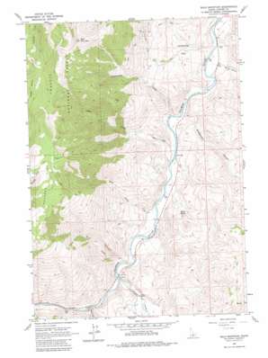
Bald Mountain Topo Map Idaho
To zoom in, hover over the map of Bald Mountain
USGS Topo Quad 44114c3 - 1:24,000 scale
| Topo Map Name: | Bald Mountain |
| USGS Topo Quad ID: | 44114c3 |
| Print Size: | ca. 21 1/4" wide x 27" high |
| Southeast Coordinates: | 44.25° N latitude / 114.25° W longitude |
| Map Center Coordinates: | 44.3125° N latitude / 114.3125° W longitude |
| U.S. State: | ID |
| Filename: | o44114c3.jpg |
| Download Map JPG Image: | Bald Mountain topo map 1:24,000 scale |
| Map Type: | Topographic |
| Topo Series: | 7.5´ |
| Map Scale: | 1:24,000 |
| Source of Map Images: | United States Geological Survey (USGS) |
| Alternate Map Versions: |
Bald Mountain ID 1963, updated 1964 Download PDF Buy paper map Bald Mountain ID 1963, updated 1981 Download PDF Buy paper map Bald Mountain ID 1963, updated 1981 Download PDF Buy paper map Bald Mountain ID 2011 Download PDF Buy paper map Bald Mountain ID 2013 Download PDF Buy paper map |
| FStopo: | US Forest Service topo Bald Mountain is available: Download FStopo PDF Download FStopo TIF |
1:24,000 Topo Quads surrounding Bald Mountain
> Back to 44114a1 at 1:100,000 scale
> Back to 44114a1 at 1:250,000 scale
> Back to U.S. Topo Maps home
Bald Mountain topo map: Gazetteer
Bald Mountain: Flats
Centennial Flat elevation 1720m 5643′Povert Flat elevation 2897m 9504′
Bald Mountain: Mines
Silver Bell Mine elevation 2877m 9438′Turtle Mine elevation 2137m 7011′
Bald Mountain: Populated Places
Crystal (historical) elevation 1632m 5354′Bald Mountain: Springs
Alkali Spring elevation 1758m 5767′Bald Mountain: Streams
Birch Creek elevation 1628m 5341′East Fork Salmon River elevation 1631m 5351′
Lyon Creek elevation 1602m 5255′
Rattlesnake Creek elevation 1597m 5239′
Sink Creek elevation 1615m 5298′
Spud Creek elevation 1638m 5374′
Bald Mountain: Summits
Bald Mountain elevation 3139m 10298′Bald Mountain: Valleys
Bradshaw Gulch elevation 1595m 5232′Malm Gulch elevation 1611m 5285′
Bald Mountain digital topo map on disk
Buy this Bald Mountain topo map showing relief, roads, GPS coordinates and other geographical features, as a high-resolution digital map file on DVD:


