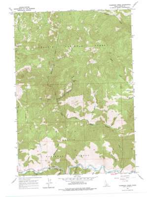
Thompson Creek Topo Map Idaho
To zoom in, hover over the map of Thompson Creek
USGS Topo Quad 44114c5 - 1:24,000 scale
| Topo Map Name: | Thompson Creek |
| USGS Topo Quad ID: | 44114c5 |
| Print Size: | ca. 21 1/4" wide x 27" high |
| Southeast Coordinates: | 44.25° N latitude / 114.5° W longitude |
| Map Center Coordinates: | 44.3125° N latitude / 114.5625° W longitude |
| U.S. State: | ID |
| Filename: | o44114c5.jpg |
| Download Map JPG Image: | Thompson Creek topo map 1:24,000 scale |
| Map Type: | Topographic |
| Topo Series: | 7.5´ |
| Map Scale: | 1:24,000 |
| Source of Map Images: | United States Geological Survey (USGS) |
| Alternate Map Versions: |
Thompson Creek ID 1964, updated 1977 Download PDF Buy paper map Thompson Creek ID 2011 Download PDF Buy paper map Thompson Creek ID 2013 Download PDF Buy paper map |
| FStopo: | US Forest Service topo Thompson Creek is available: Download FStopo PDF Download FStopo TIF |
1:24,000 Topo Quads surrounding Thompson Creek
> Back to 44114a1 at 1:100,000 scale
> Back to 44114a1 at 1:250,000 scale
> Back to U.S. Topo Maps home
Thompson Creek topo map: Gazetteer
Thompson Creek: Mines
Buckskin Mine elevation 2229m 7312′Cyprus-Thompson C Open Pit Mine elevation 2477m 8126′
Scheelite Jim Mine elevation 2077m 6814′
Twin Apex Mine elevation 2039m 6689′
Thompson Creek: Populated Places
Torreys elevation 1752m 5748′Thompson Creek: Streams
Alder Creek elevation 1927m 6322′Badger Creek elevation 1742m 5715′
Basin Creek elevation 2084m 6837′
Beaver Creek elevation 1732m 5682′
Buckskin Creek elevation 1924m 6312′
Burnt Creek elevation 1751m 5744′
Cherry Creek elevation 1780m 5839′
Cold Creek elevation 1746m 5728′
Gardner Creek elevation 1762m 5780′
Mill Creek elevation 1712m 5616′
Pat Hughes Creek elevation 1818m 5964′
Slate Creek elevation 1722m 5649′
Thompson Creek: Valleys
Oster Gulch elevation 1702m 5583′Thompson Creek digital topo map on disk
Buy this Thompson Creek topo map showing relief, roads, GPS coordinates and other geographical features, as a high-resolution digital map file on DVD:


