White Goat Mountain Topo Map Idaho
To zoom in, hover over the map of White Goat Mountain
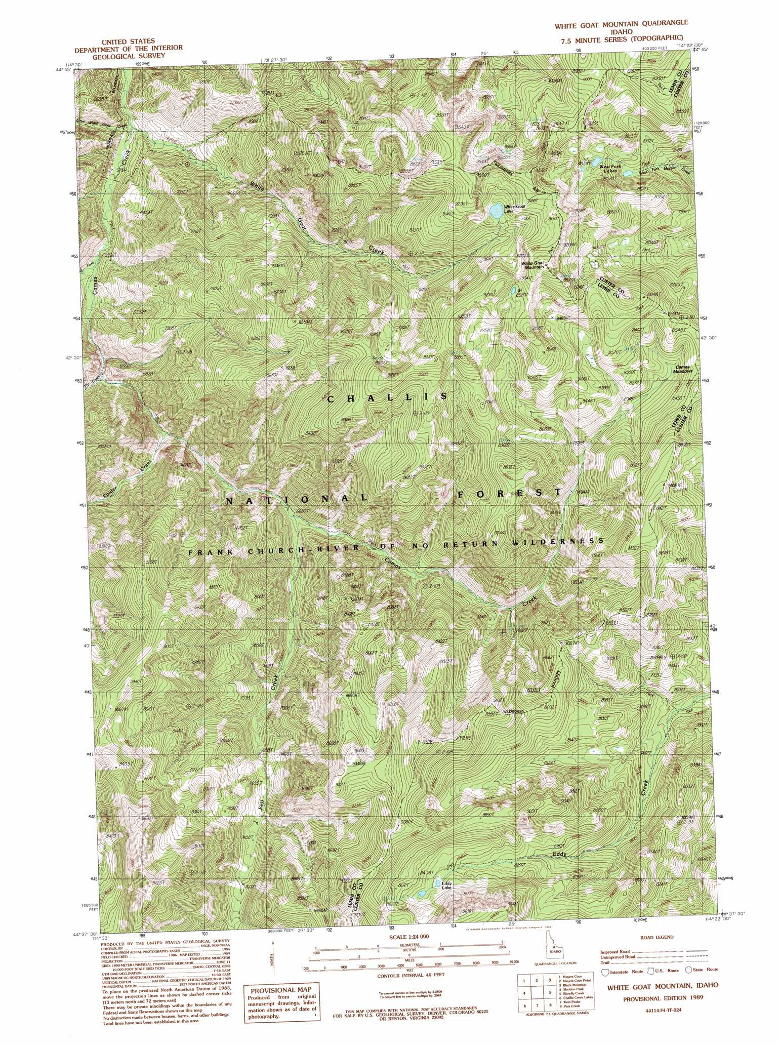
USGS Topo Quad 44114f4 - 1:24,000 scale
| Topo Map Name: | White Goat Mountain |
| USGS Topo Quad ID: | 44114f4 |
| Print Size: | ca. 21 1/4" wide x 27" high |
| Southeast Coordinates: | 44.625° N latitude / 114.375° W longitude |
| Map Center Coordinates: | 44.6875° N latitude / 114.4375° W longitude |
| U.S. State: | ID |
| Filename: | o44114f4.jpg |
| Download Map JPG Image: | White Goat Mountain topo map 1:24,000 scale |
| Map Type: | Topographic |
| Topo Series: | 7.5´ |
| Map Scale: | 1:24,000 |
| Source of Map Images: | United States Geological Survey (USGS) |
| Alternate Map Versions: |
White Goat Mountain ID 1989, updated 1989 Download PDF Buy paper map White Goat Mountain ID 2011 Download PDF Buy paper map White Goat Mountain ID 2013 Download PDF Buy paper map |
| FStopo: | US Forest Service topo White Goat Mountain is available: Download FStopo PDF Download FStopo TIF |
1:24,000 Topo Quads surrounding White Goat Mountain
Aparejo Point |
Yellowjacket |
Duck Creek Point |
Opal Lake |
Taylor Mountain |
Sleeping Deer Mountain |
Meyers Cove |
Meyers Cove Point |
Black Mountain |
Wards Butte |
Rock Creek |
Sheldon Peak |
White Goat Mountain |
Blowfly Creek |
Gooseberry Creek |
Sherman Peak |
Challis Creek Lakes |
Twin Peaks |
Pats Creek |
Challis |
Custer |
Elevenmile Creek |
Bayhorse Lake |
Bayhorse |
Bradbury Flat |
> Back to 44114e1 at 1:100,000 scale
> Back to 44114a1 at 1:250,000 scale
> Back to U.S. Topo Maps home
White Goat Mountain topo map: Gazetteer
White Goat Mountain: Flats
Camas Meadows elevation 2471m 8106′White Goat Mountain: Lakes
Eddy Lake elevation 2571m 8435′West Fork Lakes elevation 2532m 8307′
White Goat Lake elevation 2690m 8825′
White Goat Mountain: Streams
Fell Creek elevation 2016m 6614′Fly Creek elevation 1882m 6174′
J Fell Creek elevation 2018m 6620′
Little White Goat Creek elevation 1752m 5748′
South Fork Camas Creek elevation 1791m 5875′
Spider Creek elevation 1919m 6295′
White Goat Creek elevation 1752m 5748′
White Goat Mountain: Summits
White Goat Mountain elevation 2862m 9389′White Mountain elevation 2676m 8779′
White Goat Mountain digital topo map on disk
Buy this White Goat Mountain topo map showing relief, roads, GPS coordinates and other geographical features, as a high-resolution digital map file on DVD: