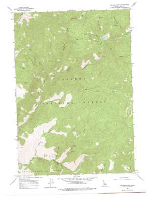
Yellowjacket Topo Map Idaho
To zoom in, hover over the map of Yellowjacket
USGS Topo Quad 44114h5 - 1:24,000 scale
| Topo Map Name: | Yellowjacket |
| USGS Topo Quad ID: | 44114h5 |
| Print Size: | ca. 21 1/4" wide x 27" high |
| Southeast Coordinates: | 44.875° N latitude / 114.5° W longitude |
| Map Center Coordinates: | 44.9375° N latitude / 114.5625° W longitude |
| U.S. State: | ID |
| Filename: | o44114h5.jpg |
| Download Map JPG Image: | Yellowjacket topo map 1:24,000 scale |
| Map Type: | Topographic |
| Topo Series: | 7.5´ |
| Map Scale: | 1:24,000 |
| Source of Map Images: | United States Geological Survey (USGS) |
| Alternate Map Versions: |
Yellowjacket ID 1963, updated 1964 Download PDF Buy paper map Yellowjacket ID 1963, updated 1977 Download PDF Buy paper map Yellowjacket ID 2011 Download PDF Buy paper map Yellowjacket ID 2013 Download PDF Buy paper map |
| FStopo: | US Forest Service topo Yellowjacket is available: Download FStopo PDF Download FStopo TIF |
1:24,000 Topo Quads surrounding Yellowjacket
> Back to 44114e1 at 1:100,000 scale
> Back to 44114a1 at 1:250,000 scale
> Back to U.S. Topo Maps home
Yellowjacket topo map: Gazetteer
Yellowjacket: Mines
Columbia Mine elevation 2070m 6791′Red Jacket Mine elevation 2214m 7263′
Tin Cup Mine elevation 1815m 5954′
Yellowjacket Mine elevation 2191m 7188′
Yellowjacket: Populated Places
Yellowjacket elevation 1805m 5921′Yellowjacket: Springs
Hot Springs elevation 1799m 5902′Yellowjacket: Streams
Anvil Creek elevation 1467m 4812′Blackeagle Creek elevation 1855m 6085′
Buckhorn Creek elevation 1538m 5045′
Camp Creek elevation 1596m 5236′
Forge Creek elevation 1435m 4708′
Hoodoo Creek elevation 1644m 5393′
Jenny Creek elevation 1572m 5157′
Lake Creek elevation 1607m 5272′
Little Jacket Creek elevation 1693m 5554′
Trail Creek elevation 1777m 5830′
Yellowjacket: Valleys
Anderson Gulch elevation 1857m 6092′Dry Gulch elevation 1411m 4629′
Little Dry Gulch elevation 1437m 4714′
Slaughterhouse Gulch elevation 1857m 6092′
Van Horn Gulch elevation 1785m 5856′
Yellowjacket digital topo map on disk
Buy this Yellowjacket topo map showing relief, roads, GPS coordinates and other geographical features, as a high-resolution digital map file on DVD:


