Miller Mountain West Topo Map Idaho
To zoom in, hover over the map of Miller Mountain West
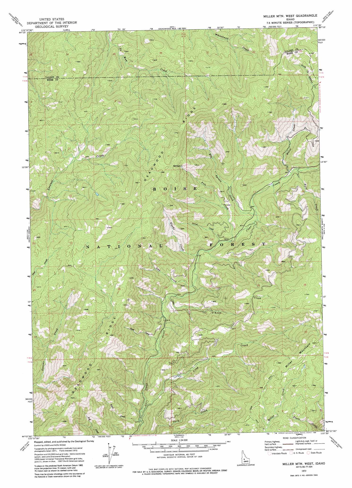
USGS Topo Quad 44115b5 - 1:24,000 scale
| Topo Map Name: | Miller Mountain West |
| USGS Topo Quad ID: | 44115b5 |
| Print Size: | ca. 21 1/4" wide x 27" high |
| Southeast Coordinates: | 44.125° N latitude / 115.5° W longitude |
| Map Center Coordinates: | 44.1875° N latitude / 115.5625° W longitude |
| U.S. State: | ID |
| Filename: | o44115b5.jpg |
| Download Map JPG Image: | Miller Mountain West topo map 1:24,000 scale |
| Map Type: | Topographic |
| Topo Series: | 7.5´ |
| Map Scale: | 1:24,000 |
| Source of Map Images: | United States Geological Survey (USGS) |
| Alternate Map Versions: |
Miller Mtn West ID 1972, updated 1976 Download PDF Buy paper map Miller Mtn West ID 1972, updated 1986 Download PDF Buy paper map Miller Mountain West ID 2011 Download PDF Buy paper map Miller Mountain West ID 2013 Download PDF Buy paper map |
| FStopo: | US Forest Service topo Miller Mountain West is available: Download FStopo PDF Download FStopo TIF |
1:24,000 Topo Quads surrounding Miller Mountain West
Bull Creek Hot Springs |
Wild Buck Peak |
Bernard Mountain |
Bear Valley Mountain |
Blue Bunch Mountain |
Boiling Springs |
Deadwood Reservoir |
Whitehawk Mountain |
Cache Creek |
Bull Trout Point |
Lightning Ridge |
Scott Creek |
Miller Mountain West |
Miller Mountain East |
Eightmile Mountain |
Grimes Pass |
Pine Flat |
Lowman |
Jackson Peak |
Tyee Mountain |
Pioneerville |
Sunset Mountain |
Big Owl Creek |
Bear River |
Swanholm Peak |
> Back to 44115a1 at 1:100,000 scale
> Back to 44114a1 at 1:250,000 scale
> Back to U.S. Topo Maps home
Miller Mountain West topo map: Gazetteer
Miller Mountain West: Forests
Boise National Forest elevation 2301m 7549′Miller Mountain West: Populated Places
Long Creek Summit Home elevation 1389m 4557′Miller Mountain West: Streams
Big Spruce Creek elevation 1621m 5318′Blacks Creek elevation 1561m 5121′
Corral Creek elevation 1577m 5173′
Cup Creek elevation 1529m 5016′
Fawn Creek elevation 1363m 4471′
Fern Creek elevation 1685m 5528′
Gold Creek elevation 1458m 4783′
Horse Creek elevation 1676m 5498′
Long Creek elevation 1355m 4445′
O'Keefe Creek elevation 1496m 4908′
Pole Creek elevation 1584m 5196′
Miller Mountain West digital topo map on disk
Buy this Miller Mountain West topo map showing relief, roads, GPS coordinates and other geographical features, as a high-resolution digital map file on DVD: