Lightning Ridge Topo Map Idaho
To zoom in, hover over the map of Lightning Ridge
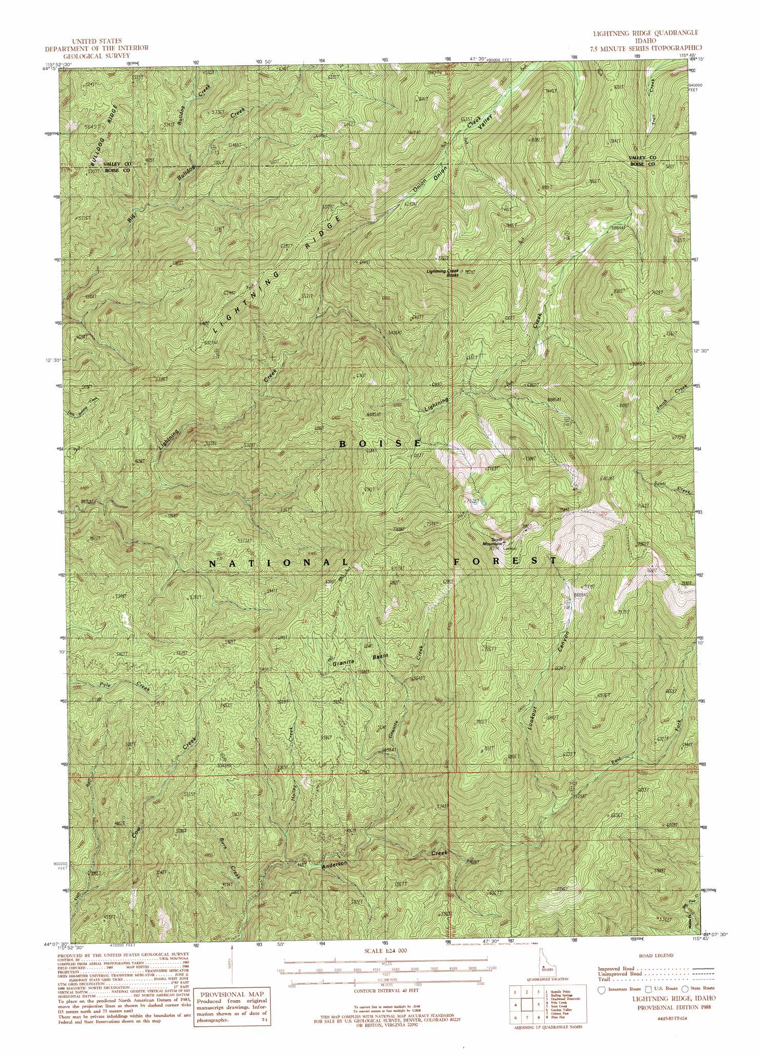
USGS Topo Quad 44115b7 - 1:24,000 scale
| Topo Map Name: | Lightning Ridge |
| USGS Topo Quad ID: | 44115b7 |
| Print Size: | ca. 21 1/4" wide x 27" high |
| Southeast Coordinates: | 44.125° N latitude / 115.75° W longitude |
| Map Center Coordinates: | 44.1875° N latitude / 115.8125° W longitude |
| U.S. State: | ID |
| Filename: | o44115b7.jpg |
| Download Map JPG Image: | Lightning Ridge topo map 1:24,000 scale |
| Map Type: | Topographic |
| Topo Series: | 7.5´ |
| Map Scale: | 1:24,000 |
| Source of Map Images: | United States Geological Survey (USGS) |
| Alternate Map Versions: |
Lightning Ridge ID 1988, updated 1989 Download PDF Buy paper map Lightning Ridge ID 2011 Download PDF Buy paper map Lightning Ridge ID 2013 Download PDF Buy paper map |
| FStopo: | US Forest Service topo Lightning Ridge is available: Download FStopo PDF Download FStopo TIF |
1:24,000 Topo Quads surrounding Lightning Ridge
Alpha |
Skunk Creek Summit |
Bull Creek Hot Springs |
Wild Buck Peak |
Bernard Mountain |
Smiths Ferry |
Sixmile Point |
Boiling Springs |
Deadwood Reservoir |
Whitehawk Mountain |
Packer John Mountain |
Pyle Creek |
Lightning Ridge |
Scott Creek |
Miller Mountain West |
Banks |
Garden Valley |
Grimes Pass |
Pine Flat |
Lowman |
Harris Creek Summit |
Placerville |
Pioneerville |
Sunset Mountain |
Big Owl Creek |
> Back to 44115a1 at 1:100,000 scale
> Back to 44114a1 at 1:250,000 scale
> Back to U.S. Topo Maps home
Lightning Ridge topo map: Gazetteer
Lightning Ridge: Basins
Granite Basin elevation 1718m 5636′Lightning Ridge: Ridges
Lightning Ridge elevation 1753m 5751′Lightning Ridge: Streams
Bulldog Creek elevation 1400m 4593′Burn Creek elevation 1254m 4114′
East Fork Anderson Creek elevation 1527m 5009′
Granite Creek elevation 1661m 5449′
Hailey Creek elevation 1308m 4291′
Little Camp Creek elevation 1576m 5170′
Onion Creek elevation 1562m 5124′
Lightning Ridge: Summits
Lightning Creek Rocks elevation 2325m 7627′Scott Mountain elevation 2486m 8156′
Lightning Ridge: Trails
Air Line Trail elevation 1632m 5354′Lightning Creek Trail (historical) elevation 1939m 6361′
Onion Valley Trail (historical) elevation 2100m 6889′
Lightning Ridge: Valleys
Lookout Canyon elevation 1664m 5459′Lightning Ridge digital topo map on disk
Buy this Lightning Ridge topo map showing relief, roads, GPS coordinates and other geographical features, as a high-resolution digital map file on DVD: