Banner Summit Topo Map Idaho
To zoom in, hover over the map of Banner Summit
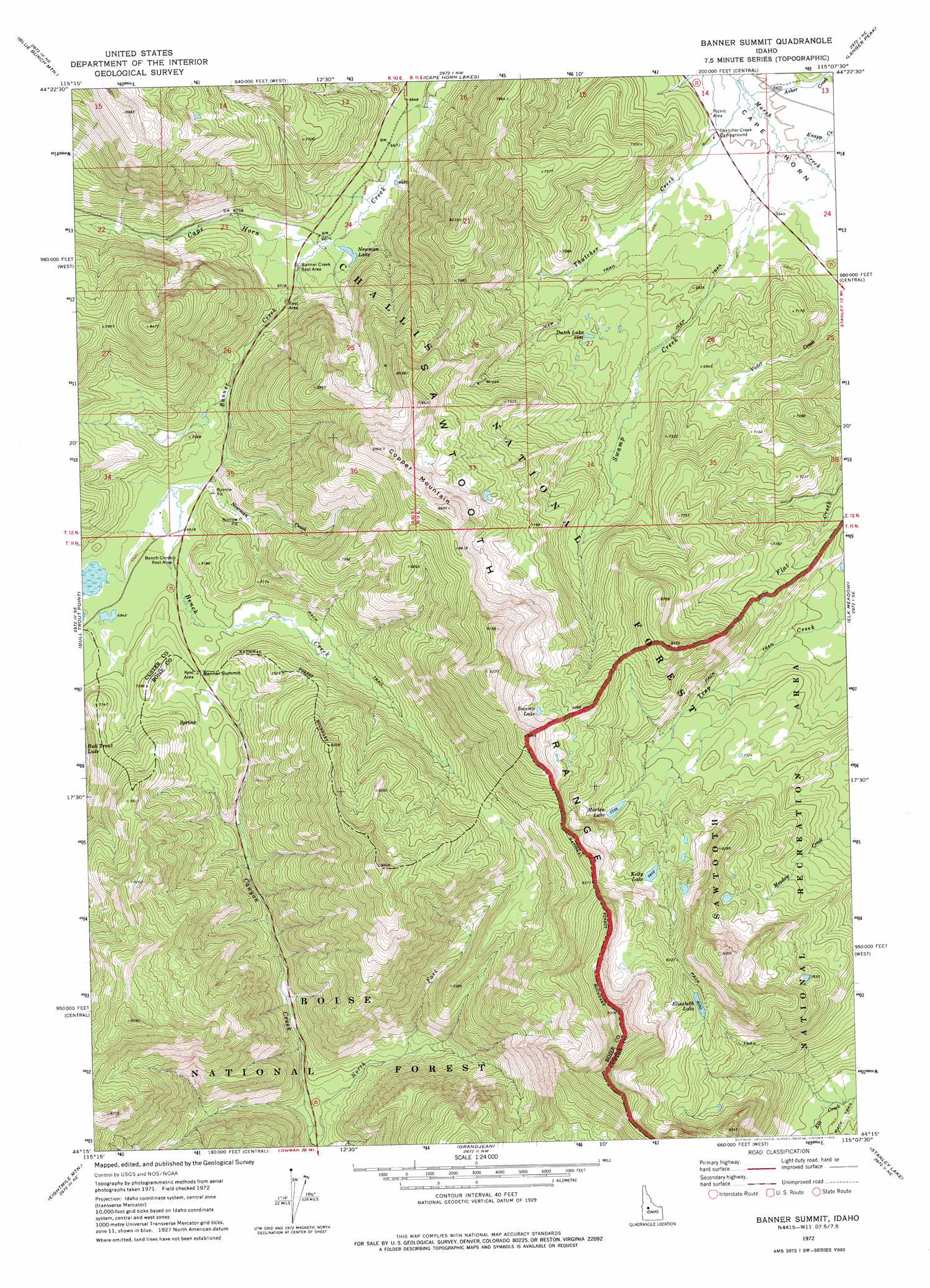
USGS Topo Quad 44115c2 - 1:24,000 scale
| Topo Map Name: | Banner Summit |
| USGS Topo Quad ID: | 44115c2 |
| Print Size: | ca. 21 1/4" wide x 27" high |
| Southeast Coordinates: | 44.25° N latitude / 115.125° W longitude |
| Map Center Coordinates: | 44.3125° N latitude / 115.1875° W longitude |
| U.S. State: | ID |
| Filename: | o44115c2.jpg |
| Download Map JPG Image: | Banner Summit topo map 1:24,000 scale |
| Map Type: | Topographic |
| Topo Series: | 7.5´ |
| Map Scale: | 1:24,000 |
| Source of Map Images: | United States Geological Survey (USGS) |
| Alternate Map Versions: |
Banner Summit ID 1972, updated 1975 Download PDF Buy paper map Banner Summit ID 2011 Download PDF Buy paper map Banner Summit ID 2013 Download PDF Buy paper map |
| FStopo: | US Forest Service topo Banner Summit is available: Download FStopo PDF Download FStopo TIF |
1:24,000 Topo Quads surrounding Banner Summit
Honeymoon Lake |
Big Soldier Mountain |
Soldier Creek |
Greyhound Mountain |
Pinyon Peak |
Bear Valley Mountain |
Blue Bunch Mountain |
Cape Horn Lakes |
Langer Peak |
Knapp Lakes |
Cache Creek |
Bull Trout Point |
Banner Summit |
Elk Meadow |
Basin Butte |
Miller Mountain East |
Eightmile Mountain |
Grandjean |
Stanley Lake |
Stanley |
Jackson Peak |
Tyee Mountain |
Edaho Mountain |
Warbonnet Peak |
Mount Cramer |
> Back to 44115a1 at 1:100,000 scale
> Back to 44114a1 at 1:250,000 scale
> Back to U.S. Topo Maps home
Banner Summit topo map: Gazetteer
Banner Summit: Areas
Cape Horn elevation 2013m 6604′Banner Summit: Gaps
Banner Summit elevation 2144m 7034′Banner Summit: Lakes
Dutch Lake elevation 2128m 6981′Elizabeth Lake elevation 2471m 8106′
Kelly Lake elevation 2398m 7867′
Marten Lake elevation 2301m 7549′
Newman Lake elevation 2034m 6673′
Swamp Lake elevation 2535m 8316′
Banner Summit: Streams
Asher Creek elevation 2007m 6584′Banner Creek elevation 2027m 6650′
Bench Creek elevation 2106m 6909′
Kelly Creek elevation 2017m 6617′
Knapp Creek elevation 2013m 6604′
Newman Creek elevation 2101m 6893′
Swamp Creek elevation 2016m 6614′
Thatcher Creek elevation 2005m 6578′
Banner Summit: Summits
Copper Mountain elevation 2709m 8887′Banner Summit digital topo map on disk
Buy this Banner Summit topo map showing relief, roads, GPS coordinates and other geographical features, as a high-resolution digital map file on DVD: