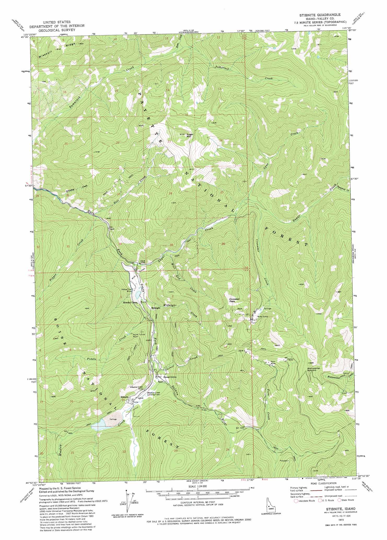
Stibnite Topo Map Idaho
To zoom in, hover over the map of Stibnite
USGS Topo Quad 44115h3 - 1:24,000 scale
| Topo Map Name: | Stibnite |
| USGS Topo Quad ID: | 44115h3 |
| Print Size: | ca. 21 1/4" wide x 27" high |
| Southeast Coordinates: | 44.875° N latitude / 115.25° W longitude |
| Map Center Coordinates: | 44.9375° N latitude / 115.3125° W longitude |
| U.S. State: | ID |
| Filename: | o44115h3.jpg |
| Download Map JPG Image: | Stibnite topo map 1:24,000 scale |
| Map Type: | Topographic |
| Topo Series: | 7.5´ |
| Map Scale: | 1:24,000 |
| Source of Map Images: | United States Geological Survey (USGS) |
| Alternate Map Versions: |
Stibnite ID 1973, updated 1976 Download PDF Buy paper map Stibnite ID 1973, updated 1986 Download PDF Buy paper map Stibnite ID 2004, updated 2007 Download PDF Buy paper map Stibnite ID 2011 Download PDF Buy paper map Stibnite ID 2013 Download PDF Buy paper map |
| FStopo: | US Forest Service topo Stibnite is available: Download FStopo PDF Download FStopo TIF |
1:24,000 Topo Quads surrounding Stibnite
Pilot Peak |
Wolf Fang Peak |
Big Creek |
Bismark Mountain |
Acorn Butte |
Parks Peak |
Profile Gap |
Edwardsburg |
Center Mountain |
Monument |
Caton Lake |
Yellow Pine |
Stibnite |
Rainbow Peak |
Safety Creek |
Log Mountain |
Chilcoot Peak |
Big Chief Creek |
Big Baldy |
Pungo Mountain |
Landmark |
Pistol Lake |
Chinook Mountain |
Artillery Dome |
Little Soldier Mountain |
> Back to 44115e1 at 1:100,000 scale
> Back to 44114a1 at 1:250,000 scale
> Back to U.S. Topo Maps home
Stibnite topo map: Gazetteer
Stibnite: Airports
Stibnite Airport elevation 1998m 6555′Stibnite: Mines
Fern Mine elevation 2439m 8001′Meadow Creek Mine elevation 2000m 6561′
North Tunnel Mine elevation 1993m 6538′
Yellow Pine Mine elevation 1906m 6253′
Stibnite: Populated Places
Midnight elevation 1917m 6289′Stibnite elevation 2020m 6627′
Stibnite: Ridges
Missouri Ridge elevation 2560m 8398′Stibnite: Streams
Bum Creek elevation 1918m 6292′Cane Creek elevation 1926m 6318′
Cinnabar Creek elevation 1925m 6315′
Fern Creek elevation 2164m 7099′
Fiddle Creek elevation 1907m 6256′
Garnet Creek elevation 1960m 6430′
Meadow Creek elevation 1989m 6525′
Midnight Creek elevation 1865m 6118′
Pepper Creek elevation 1759m 5770′
Pyramid Creek elevation 2067m 6781′
Salt Creek elevation 1759m 5770′
Sugar Creek elevation 1801m 5908′
West End Creek elevation 1843m 6046′
Whiskey Creek elevation 1720m 5643′
Stibnite: Summits
Cinnabar Peak elevation 2641m 8664′Sugar Mountain elevation 2661m 8730′
Stibnite digital topo map on disk
Buy this Stibnite topo map showing relief, roads, GPS coordinates and other geographical features, as a high-resolution digital map file on DVD: