Caton Lake Topo Map Idaho
To zoom in, hover over the map of Caton Lake
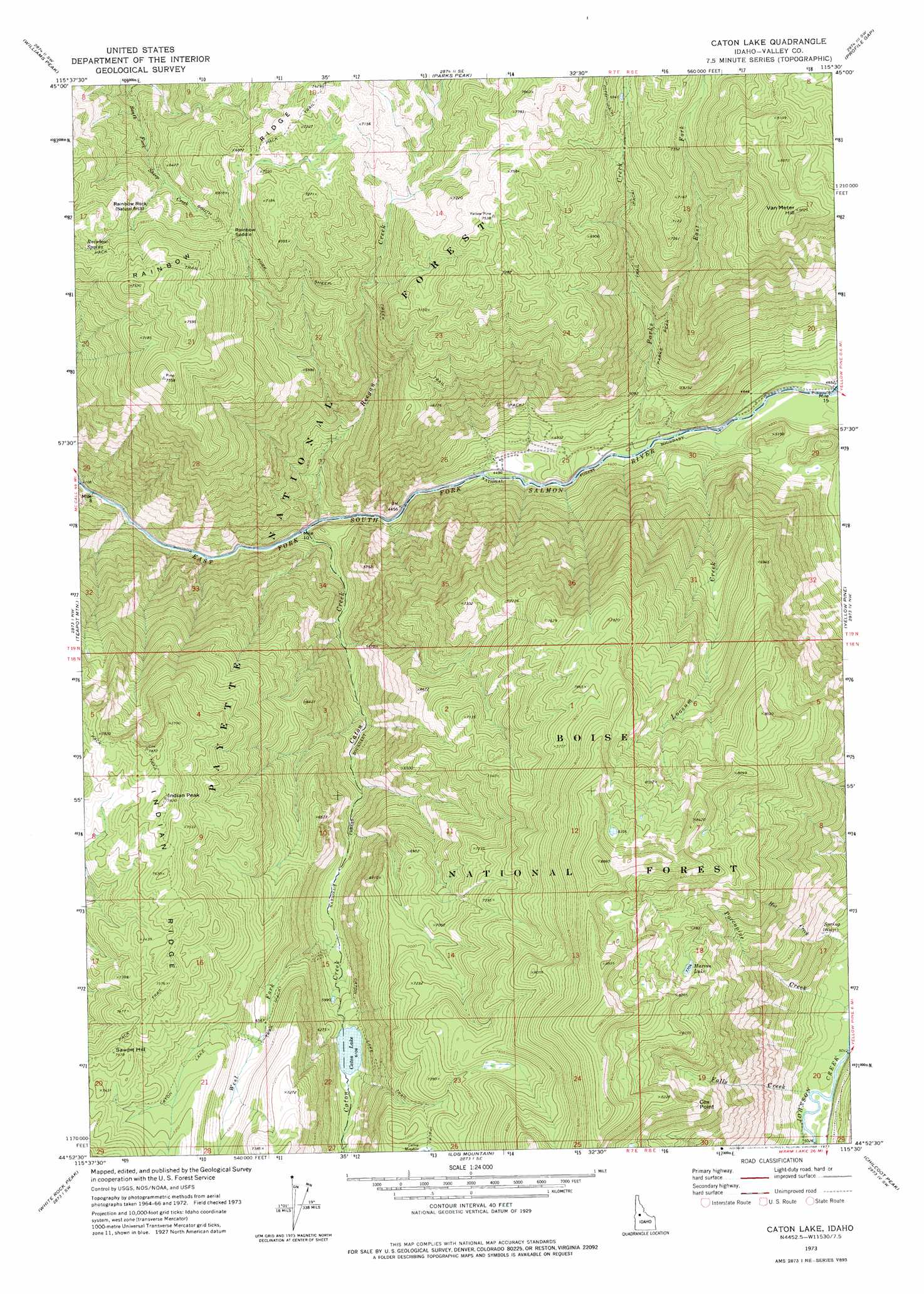
USGS Topo Quad 44115h5 - 1:24,000 scale
| Topo Map Name: | Caton Lake |
| USGS Topo Quad ID: | 44115h5 |
| Print Size: | ca. 21 1/4" wide x 27" high |
| Southeast Coordinates: | 44.875° N latitude / 115.5° W longitude |
| Map Center Coordinates: | 44.9375° N latitude / 115.5625° W longitude |
| U.S. State: | ID |
| Filename: | o44115h5.jpg |
| Download Map JPG Image: | Caton Lake topo map 1:24,000 scale |
| Map Type: | Topographic |
| Topo Series: | 7.5´ |
| Map Scale: | 1:24,000 |
| Source of Map Images: | United States Geological Survey (USGS) |
| Alternate Map Versions: |
Caton Lake ID 1973, updated 1977 Download PDF Buy paper map Caton Lake ID 2004, updated 2007 Download PDF Buy paper map Caton Lake ID 2011 Download PDF Buy paper map Caton Lake ID 2013 Download PDF Buy paper map |
| FStopo: | US Forest Service topo Caton Lake is available: Download FStopo PDF Download FStopo TIF |
1:24,000 Topo Quads surrounding Caton Lake
Loon Lake |
Pony Meadows |
Pilot Peak |
Wolf Fang Peak |
Big Creek |
Enos Lake |
Williams Peak |
Parks Peak |
Profile Gap |
Edwardsburg |
Fitsum Peak |
Teapot Mountain |
Caton Lake |
Yellow Pine |
Stibnite |
Blackmare |
White Rock Peak |
Log Mountain |
Chilcoot Peak |
Big Chief Creek |
Gold Fork Rock |
Warm Lake |
Landmark |
Pistol Lake |
Chinook Mountain |
> Back to 44115e1 at 1:100,000 scale
> Back to 44114a1 at 1:250,000 scale
> Back to U.S. Topo Maps home
Caton Lake topo map: Gazetteer
Caton Lake: Arches
Rainbow Rock elevation 2056m 6745′Caton Lake: Gaps
Rainbow Saddle elevation 2411m 7910′Caton Lake: Lakes
Marion Lake elevation 2354m 7723′Caton Lake: Ridges
Indian Ridge elevation 1704m 5590′Rainbow Ridge elevation 2381m 7811′
Caton Lake: Springs
Rainbow Spring elevation 2161m 7089′Caton Lake: Streams
Caton Creek elevation 1304m 4278′East Fork Parks Creek elevation 1619m 5311′
Johnson Creek elevation 1424m 4671′
Loosum Creek elevation 1404m 4606′
Parks Creek elevation 1397m 4583′
Porcupine Creek elevation 1537m 5042′
Reegan Creek elevation 1310m 4297′
West Fork Caton Creek elevation 1787m 5862′
Caton Lake: Summits
Indian Peak elevation 2041m 6696′Sawpit Hill elevation 2144m 7034′
Van Meter Hill elevation 2442m 8011′
Caton Lake digital topo map on disk
Buy this Caton Lake topo map showing relief, roads, GPS coordinates and other geographical features, as a high-resolution digital map file on DVD: