Webb Creek Topo Map Idaho
To zoom in, hover over the map of Webb Creek
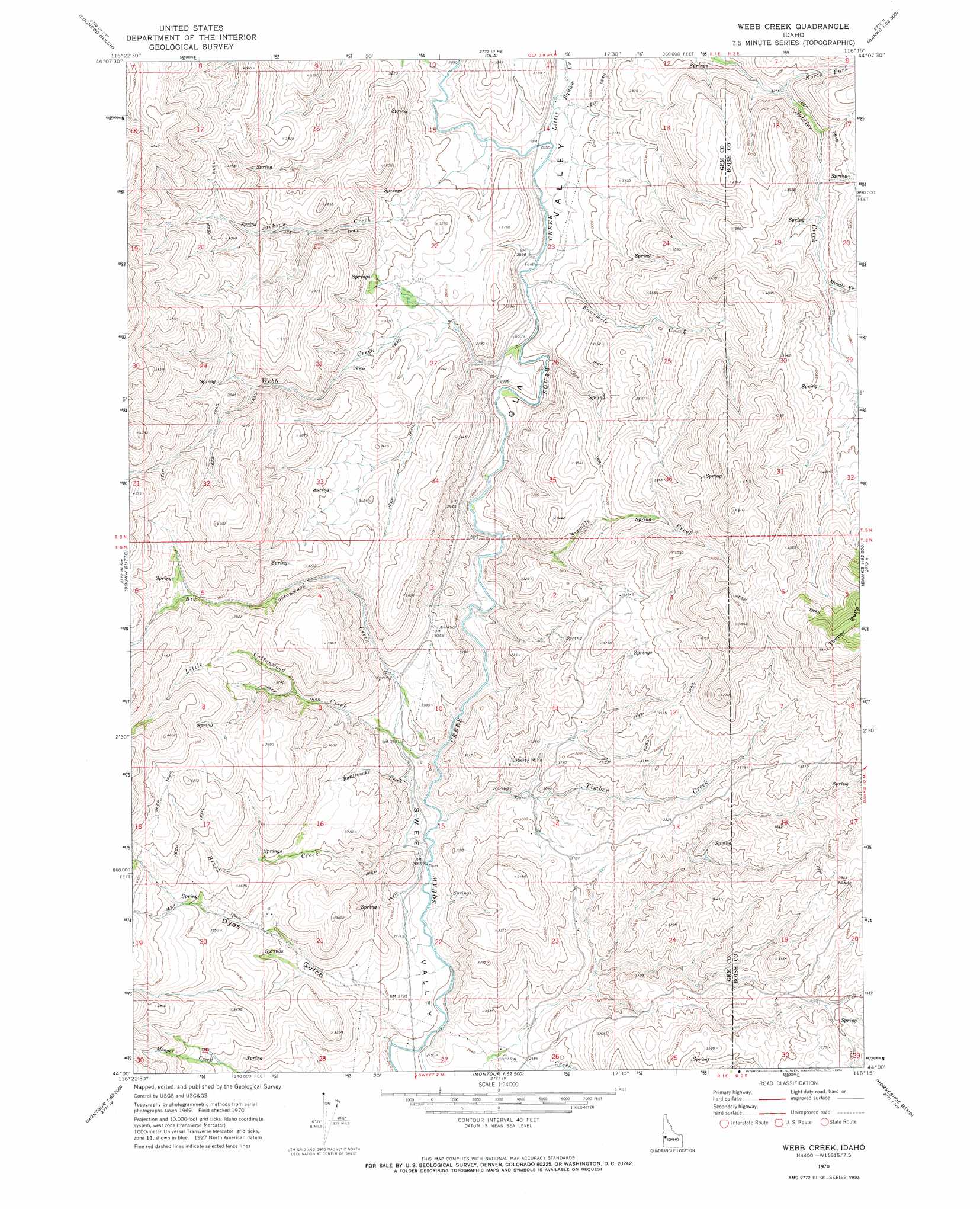
USGS Topo Quad 44116a3 - 1:24,000 scale
| Topo Map Name: | Webb Creek |
| USGS Topo Quad ID: | 44116a3 |
| Print Size: | ca. 21 1/4" wide x 27" high |
| Southeast Coordinates: | 44° N latitude / 116.25° W longitude |
| Map Center Coordinates: | 44.0625° N latitude / 116.3125° W longitude |
| U.S. State: | ID |
| Filename: | o44116a3.jpg |
| Download Map JPG Image: | Webb Creek topo map 1:24,000 scale |
| Map Type: | Topographic |
| Topo Series: | 7.5´ |
| Map Scale: | 1:24,000 |
| Source of Map Images: | United States Geological Survey (USGS) |
| Alternate Map Versions: |
Webb Creek ID 1970, updated 1974 Download PDF Buy paper map Webb Creek ID 2010 Download PDF Buy paper map Webb Creek ID 2013 Download PDF Buy paper map |
1:24,000 Topo Quads surrounding Webb Creek
Crane Creek Reservoir |
Riley Butte |
Dodson Pass |
Sage Hen Reservoir |
Smiths Ferry |
Paddock Valley Reservoir |
Coonrod Gulch |
Ola |
High Valley |
Packer John Mountain |
Hog Cove Butte |
Squaw Butte |
Webb Creek |
Dry Buck Valley |
Banks |
Northwest Emmett |
Northeast Emmett |
Montour |
Horseshoe Bend |
Harris Creek Summit |
Southwest Emmett |
Southeast Emmett |
Pearl |
Cartwright Canyon |
Shafer Butte |
> Back to 44116a1 at 1:100,000 scale
> Back to 44116a1 at 1:250,000 scale
> Back to U.S. Topo Maps home
Webb Creek topo map: Gazetteer
Webb Creek: Mines
Liberty Mine elevation 932m 3057′Webb Creek: Springs
Box Spring elevation 901m 2956′Webb Creek: Streams
Big Cottonwood Creek elevation 807m 2647′Brush Creek elevation 804m 2637′
Fourmile Creek elevation 878m 2880′
Jackson Creek elevation 878m 2880′
Little Cottonwood Creek elevation 806m 2644′
Little Squaw Creek elevation 874m 2867′
Middle Fork Soldier Creek elevation 1085m 3559′
North Fork Soldier Creek elevation 1001m 3284′
Rattlesnake Creek elevation 804m 2637′
Sixmile Creek elevation 835m 2739′
Timber Creek elevation 803m 2634′
Webb Creek elevation 854m 2801′
Webb Creek: Valleys
Dyes Gulch elevation 842m 2762′Ola Valley elevation 840m 2755′
Webb Creek digital topo map on disk
Buy this Webb Creek topo map showing relief, roads, GPS coordinates and other geographical features, as a high-resolution digital map file on DVD: