Packer John Mountain Topo Map Idaho
To zoom in, hover over the map of Packer John Mountain
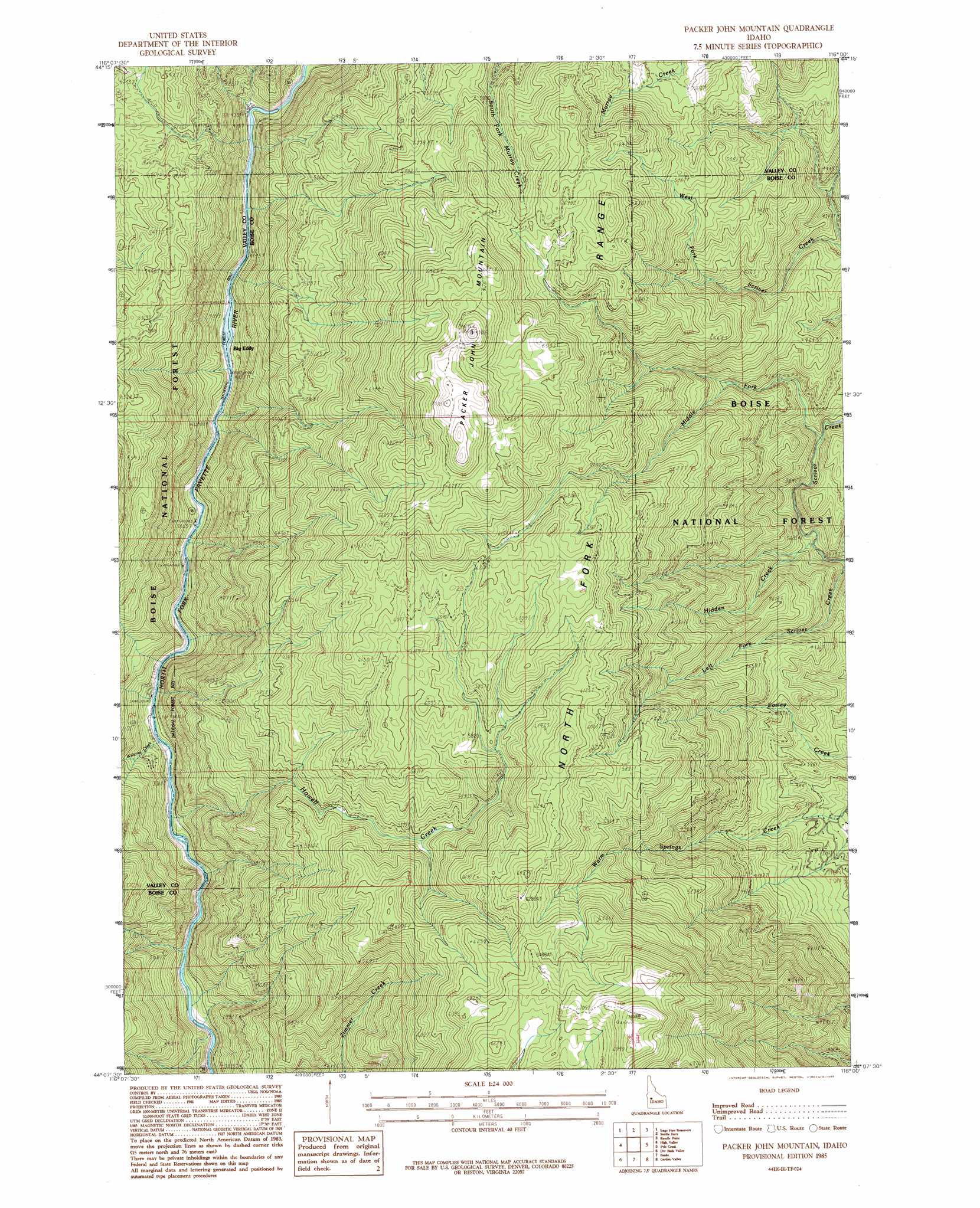
USGS Topo Quad 44116b1 - 1:24,000 scale
| Topo Map Name: | Packer John Mountain |
| USGS Topo Quad ID: | 44116b1 |
| Print Size: | ca. 21 1/4" wide x 27" high |
| Southeast Coordinates: | 44.125° N latitude / 116° W longitude |
| Map Center Coordinates: | 44.1875° N latitude / 116.0625° W longitude |
| U.S. State: | ID |
| Filename: | o44116b1.jpg |
| Download Map JPG Image: | Packer John Mountain topo map 1:24,000 scale |
| Map Type: | Topographic |
| Topo Series: | 7.5´ |
| Map Scale: | 1:24,000 |
| Source of Map Images: | United States Geological Survey (USGS) |
| Alternate Map Versions: |
Packer John Mountain ID 1985, updated 1986 Download PDF Buy paper map Packer John Mountain ID 2011 Download PDF Buy paper map Packer John Mountain ID 2013 Download PDF Buy paper map |
| FStopo: | US Forest Service topo Packer John Mountain is available: Download FStopo PDF Download FStopo TIF |
1:24,000 Topo Quads surrounding Packer John Mountain
Twin Sisters |
Tripod Peak |
Alpha |
Skunk Creek Summit |
Bull Creek Hot Springs |
Dodson Pass |
Sage Hen Reservoir |
Smiths Ferry |
Sixmile Point |
Boiling Springs |
Ola |
High Valley |
Packer John Mountain |
Pyle Creek |
Lightning Ridge |
Webb Creek |
Dry Buck Valley |
Banks |
Garden Valley |
Grimes Pass |
Montour |
Horseshoe Bend |
Harris Creek Summit |
Placerville |
Pioneerville |
> Back to 44116a1 at 1:100,000 scale
> Back to 44116a1 at 1:250,000 scale
> Back to U.S. Topo Maps home
Packer John Mountain topo map: Gazetteer
Packer John Mountain: Populated Places
Big Eddy elevation 1240m 4068′Williams Creek Summit Home Area elevation 1158m 3799′
Packer John Mountain: Ranges
North Fork Range elevation 1903m 6243′Packer John Mountain: Streams
Dead Horse Creek elevation 1694m 5557′Hidden Creek elevation 1160m 3805′
Howell Creek elevation 1058m 3471′
Left Fork Scriver Creek elevation 1082m 3549′
Middle Fork Scriver Creek elevation 1203m 3946′
Williams Creek elevation 1096m 3595′
Packer John Mountain: Summits
Packer John Mountain elevation 2134m 7001′Packer John Mountain digital topo map on disk
Buy this Packer John Mountain topo map showing relief, roads, GPS coordinates and other geographical features, as a high-resolution digital map file on DVD: