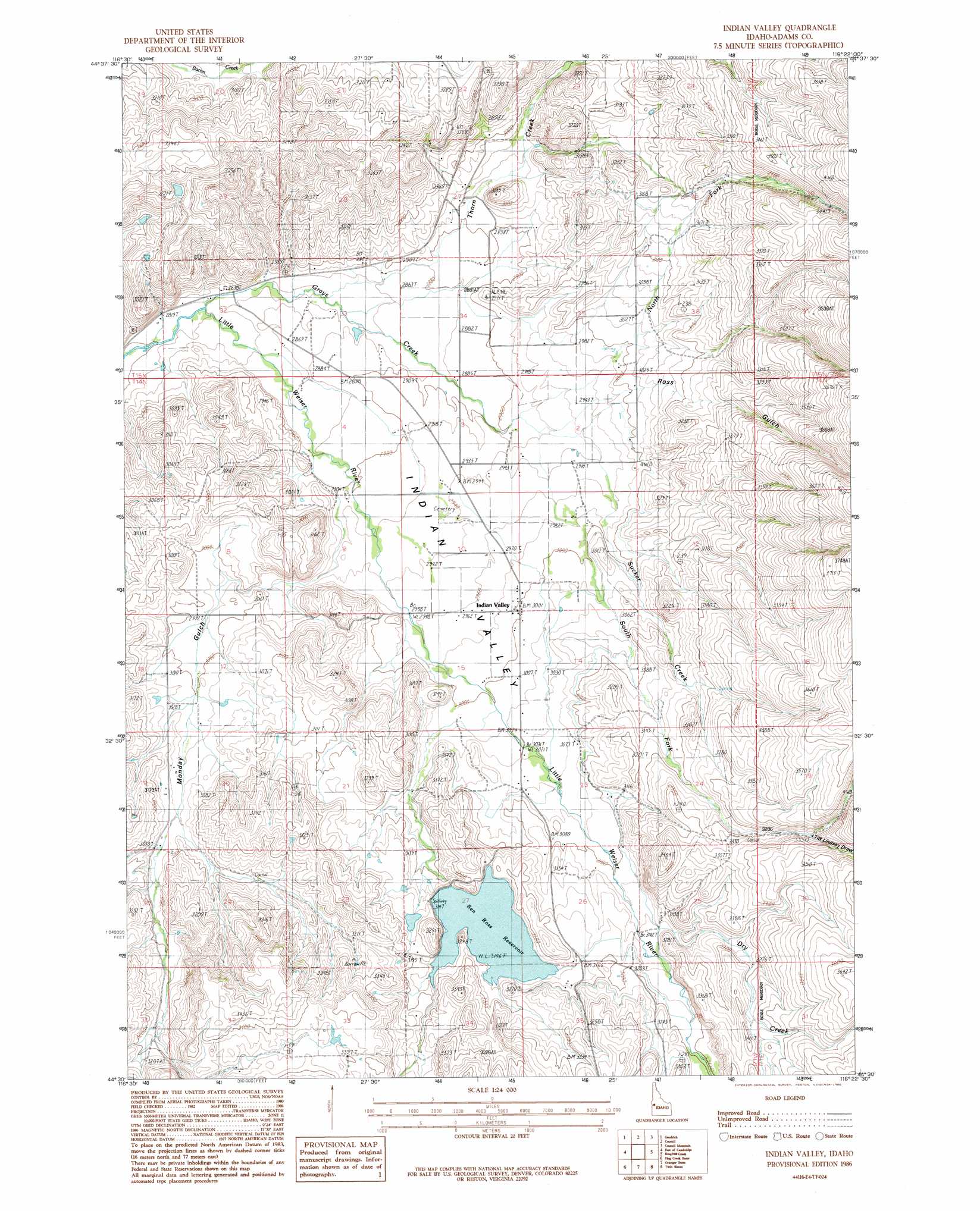
Indian Valley Topo Map Idaho
To zoom in, hover over the map of Indian Valley
USGS Topo Quad 44116e4 - 1:24,000 scale
| Topo Map Name: | Indian Valley |
| USGS Topo Quad ID: | 44116e4 |
| Print Size: | ca. 21 1/4" wide x 27" high |
| Southeast Coordinates: | 44.5° N latitude / 116.375° W longitude |
| Map Center Coordinates: | 44.5625° N latitude / 116.4375° W longitude |
| U.S. State: | ID |
| Filename: | o44116e4.jpg |
| Download Map JPG Image: | Indian Valley topo map 1:24,000 scale |
| Map Type: | Topographic |
| Topo Series: | 7.5´ |
| Map Scale: | 1:24,000 |
| Source of Map Images: | United States Geological Survey (USGS) |
| Alternate Map Versions: |
Indian Valley ID 1986, updated 1986 Download PDF Buy paper map Indian Valley ID 2010 Download PDF Buy paper map Indian Valley ID 2013 Download PDF Buy paper map |
1:24,000 Topo Quads surrounding Indian Valley
Crooked River Point |
Peck Mountain |
Fruitvale |
Cold Spring Summit |
No Business Mountain |
Rush Peak |
Goodrich |
Council |
Council Mountain |
Lone Tree |
Cambridge |
East Of Cambridge |
Indian Valley |
King Hill Creek |
Cold Spring Ridge |
Midvale |
Hog Creek Butte |
Granger Butte |
Twin Sisters |
Tripod Peak |
Nutmeg Flat |
Crane Creek Reservoir |
Riley Butte |
Dodson Pass |
Sage Hen Reservoir |
> Back to 44116e1 at 1:100,000 scale
> Back to 44116a1 at 1:250,000 scale
> Back to U.S. Topo Maps home
Indian Valley topo map: Gazetteer
Indian Valley: Dams
C Ben Ross Dam elevation 964m 3162′Indian Valley: Populated Places
Alpine elevation 860m 2821′Hillsdale (historical) elevation 975m 3198′
Indian Valley elevation 915m 3001′
Indian Valley: Reservoirs
Ben Ross Reservoir elevation 964m 3162′Indian Valley: Streams
Dry Creek elevation 996m 3267′Grays Creek elevation 860m 2821′
North Fork Grays Creek elevation 889m 2916′
South Fork Grays Creek elevation 1018m 3339′
Sucker Creek elevation 887m 2910′
Thorn Creek elevation 866m 2841′
Indian Valley: Valleys
Indian Valley elevation 896m 2939′Monday Gulch elevation 994m 3261′
Ross Gulch elevation 892m 2926′
Tiff Lindsay Draw elevation 1017m 3336′
Indian Valley digital topo map on disk
Buy this Indian Valley topo map showing relief, roads, GPS coordinates and other geographical features, as a high-resolution digital map file on DVD: