Cold Spring Summit Topo Map Idaho
To zoom in, hover over the map of Cold Spring Summit
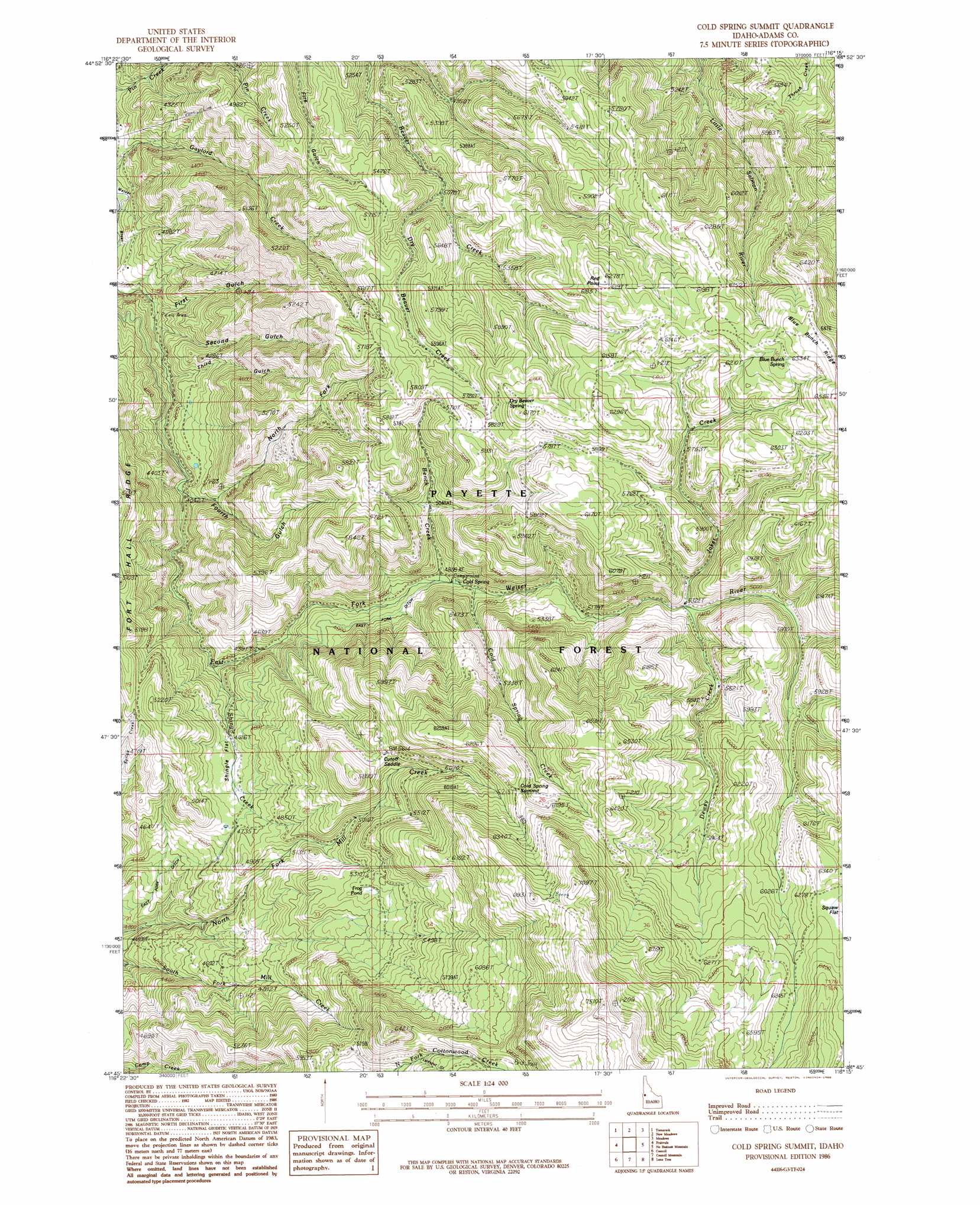
USGS Topo Quad 44116g3 - 1:24,000 scale
| Topo Map Name: | Cold Spring Summit |
| USGS Topo Quad ID: | 44116g3 |
| Print Size: | ca. 21 1/4" wide x 27" high |
| Southeast Coordinates: | 44.75° N latitude / 116.25° W longitude |
| Map Center Coordinates: | 44.8125° N latitude / 116.3125° W longitude |
| U.S. State: | ID |
| Filename: | o44116g3.jpg |
| Download Map JPG Image: | Cold Spring Summit topo map 1:24,000 scale |
| Map Type: | Topographic |
| Topo Series: | 7.5´ |
| Map Scale: | 1:24,000 |
| Source of Map Images: | United States Geological Survey (USGS) |
| Alternate Map Versions: |
Cold Spring Summit ID 1986, updated 1986 Download PDF Buy paper map Cold Spring Summit ID 2004, updated 2007 Download PDF Buy paper map Cold Spring Summit ID 2011 Download PDF Buy paper map Cold Spring Summit ID 2013 Download PDF Buy paper map |
| FStopo: | US Forest Service topo Cold Spring Summit is available: Download FStopo PDF Download FStopo TIF |
1:24,000 Topo Quads surrounding Cold Spring Summit
Butterfield Gulch |
Railroad Saddle |
Bally Mountain |
Brundage Mountain |
Granite Lake |
Weasel Gulch |
Tamarack |
New Meadows |
Meadows |
Mccall |
Peck Mountain |
Fruitvale |
Cold Spring Summit |
No Business Mountain |
Lake Fork |
Goodrich |
Council |
Council Mountain |
Lone Tree |
Donnelly |
East Of Cambridge |
Indian Valley |
King Hill Creek |
Cold Spring Ridge |
Cascade |
> Back to 44116e1 at 1:100,000 scale
> Back to 44116a1 at 1:250,000 scale
> Back to U.S. Topo Maps home
Cold Spring Summit topo map: Gazetteer
Cold Spring Summit: Canals
East Fork Ditch elevation 1452m 4763′Cold Spring Summit: Cliffs
Red Point elevation 1908m 6259′Cold Spring Summit: Flats
Shingle Flat elevation 1521m 4990′Squaw Flat elevation 1911m 6269′
Cold Spring Summit: Gaps
Cold Spring Summit elevation 1890m 6200′Cutoff Saddle elevation 1700m 5577′
Cold Spring Summit: Ridges
Fort Hall Ridge elevation 1462m 4796′Cold Spring Summit: Springs
Blue Bunch Spring elevation 1935m 6348′Cold Spring Summit: Streams
Bench Creek elevation 1457m 4780′Cold Spring Creek elevation 1483m 4865′
Dewey Creek elevation 1621m 5318′
Dry Beaver Creek elevation 1565m 5134′
Shingle Creek elevation 1318m 4324′
Cold Spring Summit: Swamps
Frog Pond elevation 1622m 5321′Cold Spring Summit: Valleys
First Gulch elevation 1102m 3615′Fourth Gulch elevation 1218m 3996′
Larkspur Gulch elevation 1783m 5849′
North Fork Fourth Gulch elevation 1281m 4202′
Second Gulch elevation 1136m 3727′
Third Gulch elevation 1171m 3841′
Cold Spring Summit digital topo map on disk
Buy this Cold Spring Summit topo map showing relief, roads, GPS coordinates and other geographical features, as a high-resolution digital map file on DVD: