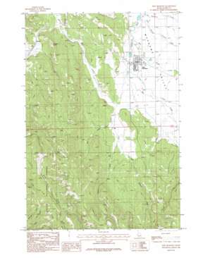
New Meadows Topo Map Idaho
To zoom in, hover over the map of New Meadows
USGS Topo Quad 44116h3 - 1:24,000 scale
| Topo Map Name: | New Meadows |
| USGS Topo Quad ID: | 44116h3 |
| Print Size: | ca. 21 1/4" wide x 27" high |
| Southeast Coordinates: | 44.875° N latitude / 116.25° W longitude |
| Map Center Coordinates: | 44.9375° N latitude / 116.3125° W longitude |
| U.S. State: | ID |
| Filename: | o44116h3.jpg |
| Download Map JPG Image: | New Meadows topo map 1:24,000 scale |
| Map Type: | Topographic |
| Topo Series: | 7.5´ |
| Map Scale: | 1:24,000 |
| Source of Map Images: | United States Geological Survey (USGS) |
| Alternate Map Versions: |
New Meadows ID 1986, updated 1986 Download PDF Buy paper map New Meadows ID 2004, updated 2007 Download PDF Buy paper map New Meadows ID 2011 Download PDF Buy paper map New Meadows ID 2013 Download PDF Buy paper map |
| FStopo: | US Forest Service topo New Meadows is available: Download FStopo PDF Download FStopo TIF |
1:24,000 Topo Quads surrounding New Meadows
> Back to 44116e1 at 1:100,000 scale
> Back to 44116a1 at 1:250,000 scale
> Back to U.S. Topo Maps home
New Meadows topo map: Gazetteer
New Meadows: Airports
New Meadows Airport elevation 1180m 3871′New Meadows: Populated Places
New Meadows elevation 1179m 3868′Rubicon elevation 1286m 4219′
New Meadows: Streams
Big Creek elevation 1178m 3864′East Branch Goose Creek elevation 1166m 3825′
Little Creek elevation 1177m 3861′
Little Mud Creek elevation 1220m 4002′
Mill Creek elevation 1197m 3927′
Mud Creek elevation 1188m 3897′
Vick Creek elevation 1214m 3982′
West Branch Goose Creek elevation 1172m 3845′
New Meadows: Valleys
Fire Gulch elevation 1419m 4655′New Meadows digital topo map on disk
Buy this New Meadows topo map showing relief, roads, GPS coordinates and other geographical features, as a high-resolution digital map file on DVD:


