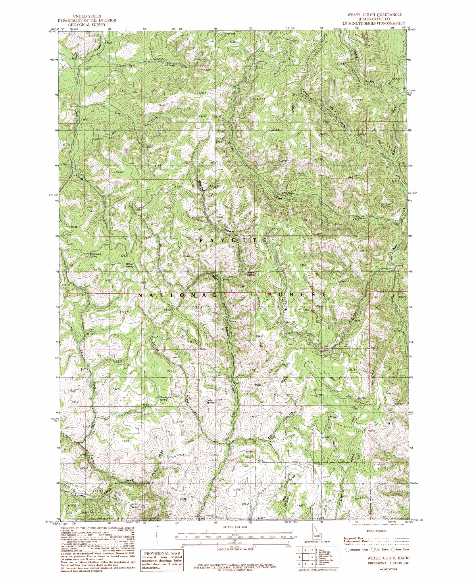
Weasel Gulch Topo Map Idaho
To zoom in, hover over the map of Weasel Gulch
USGS Topo Quad 44116h5 - 1:24,000 scale
| Topo Map Name: | Weasel Gulch |
| USGS Topo Quad ID: | 44116h5 |
| Print Size: | ca. 21 1/4" wide x 27" high |
| Southeast Coordinates: | 44.875° N latitude / 116.5° W longitude |
| Map Center Coordinates: | 44.9375° N latitude / 116.5625° W longitude |
| U.S. State: | ID |
| Filename: | o44116h5.jpg |
| Download Map JPG Image: | Weasel Gulch topo map 1:24,000 scale |
| Map Type: | Topographic |
| Topo Series: | 7.5´ |
| Map Scale: | 1:24,000 |
| Source of Map Images: | United States Geological Survey (USGS) |
| Alternate Map Versions: |
Weasel Gulch ID 1986, updated 1986 Download PDF Buy paper map Weasel Gulch ID 2004, updated 2007 Download PDF Buy paper map Weasel Gulch ID 2011 Download PDF Buy paper map Weasel Gulch ID 2013 Download PDF Buy paper map |
| FStopo: | US Forest Service topo Weasel Gulch is available: Download FStopo PDF Download FStopo TIF |
1:24,000 Topo Quads surrounding Weasel Gulch
Puderbaugh Ridge |
White Monument |
Purgatory Saddle |
Pollock Mountain |
Indian Mountain |
Homestead |
Cuprum |
Butterfield Gulch |
Railroad Saddle |
Bally Mountain |
Oxbow |
Rocky Comfort Flat |
Weasel Gulch |
Tamarack |
New Meadows |
Cuddy Mountain |
Crooked River Point |
Peck Mountain |
Fruitvale |
Cold Spring Summit |
Advent Gulch |
Rush Peak |
Goodrich |
Council |
Council Mountain |
> Back to 44116e1 at 1:100,000 scale
> Back to 44116a1 at 1:250,000 scale
> Back to U.S. Topo Maps home
Weasel Gulch topo map: Gazetteer
Weasel Gulch: Springs
Chipmunk Spring elevation 1597m 5239′Dean Spring elevation 1365m 4478′
Harrington Spring elevation 1375m 4511′
Weasel Spring elevation 1466m 4809′
Willow Spring elevation 1600m 5249′
Weasel Gulch: Streams
Corral Creek elevation 1374m 4507′Cottonwood Creek elevation 1301m 4268′
Cow Creek elevation 1340m 4396′
Deer Creek elevation 1322m 4337′
Derrick Creek elevation 1198m 3930′
Doe Creek elevation 1395m 4576′
Fourth of July Creek elevation 1193m 3914′
Grouse Creek elevation 1259m 4130′
Rock Creek elevation 1126m 3694′
Sheep Creek elevation 1522m 4993′
Summit Creek elevation 1237m 4058′
Weasel Gulch: Valleys
Alder Gulch elevation 1209m 3966′Bull Gulch elevation 1209m 3966′
Weasel Gulch elevation 1378m 4520′
Weasel Gulch digital topo map on disk
Buy this Weasel Gulch topo map showing relief, roads, GPS coordinates and other geographical features, as a high-resolution digital map file on DVD: