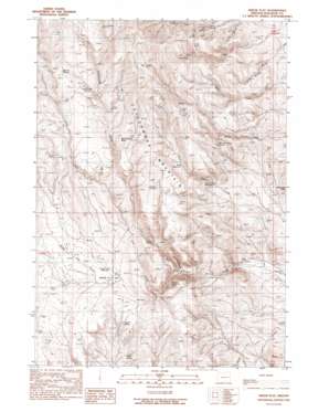
Swede Flat Topo Map Oregon
To zoom in, hover over the map of Swede Flat
USGS Topo Quad 44117a5 - 1:24,000 scale
| Topo Map Name: | Swede Flat |
| USGS Topo Quad ID: | 44117a5 |
| Print Size: | ca. 21 1/4" wide x 27" high |
| Southeast Coordinates: | 44° N latitude / 117.5° W longitude |
| Map Center Coordinates: | 44.0625° N latitude / 117.5625° W longitude |
| U.S. State: | OR |
| Filename: | o44117a5.jpg |
| Download Map JPG Image: | Swede Flat topo map 1:24,000 scale |
| Map Type: | Topographic |
| Topo Series: | 7.5´ |
| Map Scale: | 1:24,000 |
| Source of Map Images: | United States Geological Survey (USGS) |
| Alternate Map Versions: |
Swede Flat OR 1990, updated 1990 Download PDF Buy paper map Swede Flat OR 2011 Download PDF Buy paper map Swede Flat OR 2014 Download PDF Buy paper map |
1:24,000 Topo Quads surrounding Swede Flat
> Back to 44117a1 at 1:100,000 scale
> Back to 44116a1 at 1:250,000 scale
> Back to U.S. Topo Maps home
Swede Flat topo map: Gazetteer
Swede Flat: Flats
Swede Flat elevation 1039m 3408′Swede Flat: Reservoirs
Blue Reservoir elevation 1167m 3828′Kern Creek Reservoir elevation 1443m 4734′
Rattlesnake Reservoir elevation 1426m 4678′
Swede Flat Reservoir elevation 1050m 3444′
Swede Flat: Springs
Alkali Spring elevation 1008m 3307′Alkali Spring 2 elevation 849m 2785′
Bannock Corral Spring elevation 1129m 3704′
Cherry Spring elevation 1044m 3425′
Clara Spring elevation 1115m 3658′
Corrigal Spring elevation 1315m 4314′
Grouse Springs elevation 1246m 4087′
Horse Camp Spring elevation 1479m 4852′
Kern Creek Spring elevation 1484m 4868′
Little Willow Creek Spring elevation 1103m 3618′
O'Neil Spring elevation 952m 3123′
Rattlesnake Spring elevation 1352m 4435′
Rock Cabin Spring Number 1 elevation 1127m 3697′
Rock Cabin Spring Number 2 elevation 1069m 3507′
Solders Spring elevation 1305m 4281′
Turner Spring elevation 1208m 3963′
Upper Kern Creek Spring elevation 1482m 4862′
Walters Spring elevation 1403m 4603′
Swede Flat: Streams
N G Creek elevation 961m 3152′Swede Flat Creek elevation 1001m 3284′
Swede Flat: Summits
Burnt Stump Butte elevation 1355m 4445′Swede Flat digital topo map on disk
Buy this Swede Flat topo map showing relief, roads, GPS coordinates and other geographical features, as a high-resolution digital map file on DVD:


