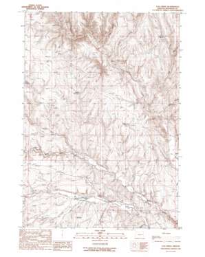
Log Creek Topo Map Oregon
To zoom in, hover over the map of Log Creek
USGS Topo Quad 44117a7 - 1:24,000 scale
| Topo Map Name: | Log Creek |
| USGS Topo Quad ID: | 44117a7 |
| Print Size: | ca. 21 1/4" wide x 27" high |
| Southeast Coordinates: | 44° N latitude / 117.75° W longitude |
| Map Center Coordinates: | 44.0625° N latitude / 117.8125° W longitude |
| U.S. State: | OR |
| Filename: | o44117a7.jpg |
| Download Map JPG Image: | Log Creek topo map 1:24,000 scale |
| Map Type: | Topographic |
| Topo Series: | 7.5´ |
| Map Scale: | 1:24,000 |
| Source of Map Images: | United States Geological Survey (USGS) |
| Alternate Map Versions: |
Log Creek OR 1990, updated 1990 Download PDF Buy paper map Log Creek OR 2011 Download PDF Buy paper map Log Creek OR 2014 Download PDF Buy paper map |
1:24,000 Topo Quads surrounding Log Creek
> Back to 44117a1 at 1:100,000 scale
> Back to 44116a1 at 1:250,000 scale
> Back to U.S. Topo Maps home
Log Creek topo map: Gazetteer
Log Creek: Basins
Log Creek Basin elevation 1291m 4235′Log Creek: Dams
Becker Dam elevation 1044m 3425′Log Creek: Reservoirs
Becker Reservoir elevation 1044m 3425′Log Creek Basin Reservoir elevation 1212m 3976′
Ridge Road Reservoir elevation 1138m 3733′
Saddle Reservoir elevation 1135m 3723′
Log Creek: Streams
Birch Creek elevation 1146m 3759′Deep Creek elevation 1043m 3421′
Gregory Creek elevation 986m 3234′
Log Creek elevation 996m 3267′
North Fork Bully Creek elevation 1002m 3287′
North Fork Indian Creek elevation 996m 3267′
Reds Creek elevation 961m 3152′
South Fork Indian Creek elevation 996m 3267′
Swamp Creek elevation 972m 3188′
Log Creek: Valleys
Hay Canyon elevation 1057m 3467′Stoney Gulch elevation 1143m 3750′
Timber Canyon elevation 979m 3211′
Log Creek digital topo map on disk
Buy this Log Creek topo map showing relief, roads, GPS coordinates and other geographical features, as a high-resolution digital map file on DVD:


