Scratch Post Mountain Topo Map Oregon
To zoom in, hover over the map of Scratch Post Mountain
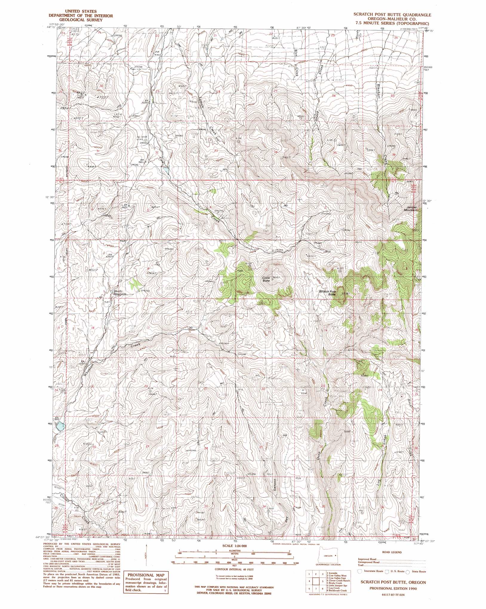
USGS Topo Quad 44117b7 - 1:24,000 scale
| Topo Map Name: | Scratch Post Mountain |
| USGS Topo Quad ID: | 44117b7 |
| Print Size: | ca. 21 1/4" wide x 27" high |
| Southeast Coordinates: | 44.125° N latitude / 117.75° W longitude |
| Map Center Coordinates: | 44.1875° N latitude / 117.8125° W longitude |
| U.S. State: | OR |
| Filename: | o44117b7.jpg |
| Download Map JPG Image: | Scratch Post Mountain topo map 1:24,000 scale |
| Map Type: | Topographic |
| Topo Series: | 7.5´ |
| Map Scale: | 1:24,000 |
| Source of Map Images: | United States Geological Survey (USGS) |
| Alternate Map Versions: |
Scratch Post Butte OR 1990, updated 1990 Download PDF Buy paper map Scratch Post Butte OR 2011 Download PDF Buy paper map Scratch Post Butte OR 2014 Download PDF Buy paper map |
1:24,000 Topo Quads surrounding Scratch Post Mountain
Hereford |
Devils Heel |
Wendt Butte |
Bridgeport |
Mormon Basin |
Eldorado Pass |
Ironside |
Cow Valley West |
Cow Valley East |
Becker Creek |
De Bord Peaks |
Clover Creek Ranch |
Scratch Post Mountain |
Juniper Mountain |
Brogan |
Hunter Mtn |
Little Juniper Spring |
Log Creek |
Buckbrush Creek |
Swede Flat |
De Armond Mountain |
Westfall Butte |
Little Black Canyon |
Westfall |
Little Valley |
> Back to 44117a1 at 1:100,000 scale
> Back to 44116a1 at 1:250,000 scale
> Back to U.S. Topo Maps home
Scratch Post Mountain topo map: Gazetteer
Scratch Post Mountain: Dams
Smith Dam elevation 1273m 4176′Wheaton Creek Dam elevation 1171m 3841′
Scratch Post Mountain: Populated Places
Caviness (historical) elevation 1370m 4494′Scratch Post Mountain: Post Offices
Caviness Post Office (historical) elevation 1370m 4494′Scratch Post Mountain: Reservoirs
Hay Canyon Reservoir elevation 1261m 4137′Smith Reservoir elevation 1271m 4169′
Wheaton Creek Reservoir elevation 1165m 3822′
Scratch Post Mountain: Springs
Kink Spring elevation 1286m 4219′Scratch Post Mountain: Summits
Circle Butte elevation 1701m 5580′Scratch Post Butte elevation 1681m 5515′
Scratch Post Mountain digital topo map on disk
Buy this Scratch Post Mountain topo map showing relief, roads, GPS coordinates and other geographical features, as a high-resolution digital map file on DVD: