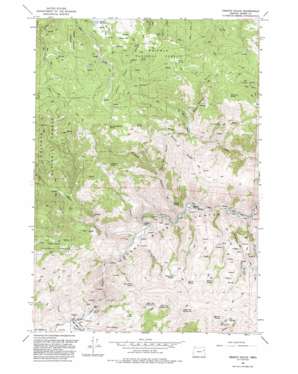
French Gulch Topo Map Oregon
To zoom in, hover over the map of French Gulch
USGS Topo Quad 44117e6 - 1:24,000 scale
| Topo Map Name: | French Gulch |
| USGS Topo Quad ID: | 44117e6 |
| Print Size: | ca. 21 1/4" wide x 27" high |
| Southeast Coordinates: | 44.5° N latitude / 117.625° W longitude |
| Map Center Coordinates: | 44.5625° N latitude / 117.6875° W longitude |
| U.S. State: | OR |
| Filename: | o44117e6.jpg |
| Download Map JPG Image: | French Gulch topo map 1:24,000 scale |
| Map Type: | Topographic |
| Topo Series: | 7.5´ |
| Map Scale: | 1:24,000 |
| Source of Map Images: | United States Geological Survey (USGS) |
| Alternate Map Versions: |
French Gulch OR 1967, updated 1971 Download PDF Buy paper map French Gulch OR 1967, updated 1972 Download PDF Buy paper map French Gulch OR 1967, updated 1985 Download PDF Buy paper map French Gulch OR 1992, updated 1993 Download PDF Buy paper map French Gulch OR 2011 Download PDF Buy paper map French Gulch OR 2014 Download PDF Buy paper map |
| FStopo: | US Forest Service topo French Gulch is available: Download FStopo PDF Download FStopo TIF |
1:24,000 Topo Quads surrounding French Gulch
> Back to 44117e1 at 1:100,000 scale
> Back to 44116a1 at 1:250,000 scale
> Back to U.S. Topo Maps home
French Gulch topo map: Gazetteer
French Gulch: Dams
Bennett Dam elevation 1509m 4950′French Gulch: Flats
Sheep Flat elevation 1602m 5255′French Gulch: Reservoirs
Bennett Reservoir elevation 1509m 4950′French Gulch: Ridges
Ebell Creek Divide elevation 1711m 5613′Windy Ridge elevation 1522m 4993′
French Gulch: Springs
Big Fir Spring elevation 1532m 5026′Birch Spring elevation 1161m 3809′
Blue Spring elevation 1697m 5567′
Burnt River Spring elevation 1409m 4622′
Cottonwood Spring elevation 1527m 5009′
Fawn Spring elevation 1685m 5528′
French Spring elevation 1021m 3349′
High Up Spring elevation 1548m 5078′
Mahogany Spring elevation 1663m 5456′
Mullen Spring elevation 1498m 4914′
Ridge Top Spring Number Four elevation 1459m 4786′
Ridge Top Spring Number Three elevation 1446m 4744′
Ridge Top Spring Number Two elevation 1538m 5045′
Salt Spring elevation 1560m 5118′
Salt Spring Number One elevation 1488m 4881′
Stump Spring elevation 1567m 5141′
Tule Spring elevation 1295m 4248′
French Gulch: Streams
Clarks Creek elevation 1023m 3356′Marble Creek elevation 1029m 3375′
French Gulch: Summits
Chicken Peak elevation 1602m 5255′Stump Spring Butte elevation 1773m 5816′
French Gulch: Valleys
Blue Spring Gulch elevation 1286m 4219′Bridgeport Valley elevation 1025m 3362′
Campbell Gulch elevation 957m 3139′
Dark Canyon elevation 984m 3228′
Dead Horse Canyon elevation 1132m 3713′
French Gulch elevation 971m 3185′
Grouse Gulch elevation 1264m 4146′
Miller Gulch elevation 1285m 4215′
Snowshoe Gulch elevation 1028m 3372′
White Rock Gulch elevation 986m 3234′
French Gulch digital topo map on disk
Buy this French Gulch topo map showing relief, roads, GPS coordinates and other geographical features, as a high-resolution digital map file on DVD:


