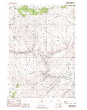
Sparta Topo Map Oregon
To zoom in, hover over the map of Sparta
USGS Topo Quad 44117g3 - 1:24,000 scale
| Topo Map Name: | Sparta |
| USGS Topo Quad ID: | 44117g3 |
| Print Size: | ca. 21 1/4" wide x 27" high |
| Southeast Coordinates: | 44.75° N latitude / 117.25° W longitude |
| Map Center Coordinates: | 44.8125° N latitude / 117.3125° W longitude |
| U.S. State: | OR |
| Filename: | o44117g3.jpg |
| Download Map JPG Image: | Sparta topo map 1:24,000 scale |
| Map Type: | Topographic |
| Topo Series: | 7.5´ |
| Map Scale: | 1:24,000 |
| Source of Map Images: | United States Geological Survey (USGS) |
| Alternate Map Versions: |
Sparta OR 1988, updated 1988 Download PDF Buy paper map Sparta OR 2011 Download PDF Buy paper map Sparta OR 2014 Download PDF Buy paper map |
| FStopo: | US Forest Service topo Sparta is available: Download FStopo PDF Download FStopo TIF |
1:24,000 Topo Quads surrounding Sparta
> Back to 44117e1 at 1:100,000 scale
> Back to 44116a1 at 1:250,000 scale
> Back to U.S. Topo Maps home
Sparta topo map: Gazetteer
Sparta: Flats
Deer Flats elevation 1136m 3727′Sparta: Mines
Crystal Palace Mine elevation 1231m 4038′Del Monte Mine elevation 1234m 4048′
Gem Mine (historical) elevation 1271m 4169′
Keystone Mine elevation 743m 2437′
Lone Star Mine (historical) elevation 892m 2926′
Macy Mine elevation 779m 2555′
Minnie May Mine elevation 736m 2414′
Rosebud Mine elevation 1281m 4202′
Sparta: Populated Places
Sparta elevation 1253m 4110′Sparta: Post Offices
Gem Post Office (historical) elevation 1236m 4055′Sparta Post Office (historical) elevation 1253m 4110′
Sparta: Reservoirs
Wyatt Reservoir elevation 1405m 4609′Sparta: Springs
Boyce spring elevation 1039m 3408′Sparta: Streams
Canyon Creek elevation 708m 2322′Rich Creek elevation 752m 2467′
Sparta: Valleys
Baldy Gulch elevation 1174m 3851′Blue Gulch elevation 798m 2618′
Dry Gulch elevation 754m 2473′
Eagle Creek Canyon elevation 1257m 4124′
Goodwin Gulch elevation 683m 2240′
Hole in the Wall Gulch elevation 737m 2417′
Hyall Gulch elevation 687m 2253′
Kuykendahl Gulch elevation 689m 2260′
Long Gulch elevation 709m 2326′
Lost Gulch elevation 801m 2627′
Lower Timber Canyon elevation 672m 2204′
Maiden Gulch elevation 724m 2375′
Murray Gulch elevation 834m 2736′
Pittsburg Gulch elevation 770m 2526′
Rattlesnake Gulch elevation 722m 2368′
Skin-it Gulch elevation 1296m 4251′
Tackle Gulch elevation 1238m 4061′
Thorn Gulch elevation 968m 3175′
Upper Timber Canyon elevation 698m 2290′
Wyatt Gulch elevation 714m 2342′
Sparta digital topo map on disk
Buy this Sparta topo map showing relief, roads, GPS coordinates and other geographical features, as a high-resolution digital map file on DVD:


