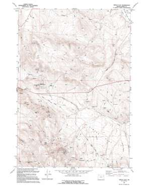
Virtue Flat Topo Map Oregon
To zoom in, hover over the map of Virtue Flat
USGS Topo Quad 44117g6 - 1:24,000 scale
| Topo Map Name: | Virtue Flat |
| USGS Topo Quad ID: | 44117g6 |
| Print Size: | ca. 21 1/4" wide x 27" high |
| Southeast Coordinates: | 44.75° N latitude / 117.625° W longitude |
| Map Center Coordinates: | 44.8125° N latitude / 117.6875° W longitude |
| U.S. State: | OR |
| Filename: | o44117g6.jpg |
| Download Map JPG Image: | Virtue Flat topo map 1:24,000 scale |
| Map Type: | Topographic |
| Topo Series: | 7.5´ |
| Map Scale: | 1:24,000 |
| Source of Map Images: | United States Geological Survey (USGS) |
| Alternate Map Versions: |
Virtue Flat OR 1967, updated 1971 Download PDF Buy paper map Virtue Flat OR 1967, updated 1991 Download PDF Buy paper map Virtue Flat OR 1994, updated 1994 Download PDF Buy paper map Virtue Flat OR 2011 Download PDF Buy paper map Virtue Flat OR 2014 Download PDF Buy paper map |
| FStopo: | US Forest Service topo Virtue Flat is available: Download FStopo PDF Download FStopo TIF |
1:24,000 Topo Quads surrounding Virtue Flat
> Back to 44117e1 at 1:100,000 scale
> Back to 44116a1 at 1:250,000 scale
> Back to U.S. Topo Maps home
Virtue Flat topo map: Gazetteer
Virtue Flat: Flats
Virtue Flat elevation 1046m 3431′Virtue Flat: Mines
Cliff Mine elevation 1130m 3707′Columbia Mine elevation 1032m 3385′
Con-Virginia Mine elevation 1262m 4140′
Emma Mine elevation 1329m 4360′
Flagstaff Mine elevation 1187m 3894′
Friday Mine elevation 1027m 3369′
Gray Eagle Mine elevation 1162m 3812′
Hidden Treasure Mine elevation 1016m 3333′
Rachel Mine elevation 1225m 4019′
Saint Paul Mine elevation 1162m 3812′
Virtue Mine elevation 1208m 3963′
Virtue Flat: Parks
Oregon Trail Historical Monument elevation 1127m 3697′Virtue Flat: Streams
First Creek elevation 983m 3225′North Fork Ruckles Creek elevation 1037m 3402′
Virtue Flat: Summits
Flagstaff Hill elevation 1203m 3946′Lone Pine Mountain elevation 1543m 5062′
Virtue Flat: Valleys
Flagstaff Gulch elevation 1043m 3421′Quartz Gulch elevation 1004m 3293′
White Swan Gulch elevation 993m 3257′
Virtue Flat digital topo map on disk
Buy this Virtue Flat topo map showing relief, roads, GPS coordinates and other geographical features, as a high-resolution digital map file on DVD:


