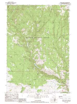
Sparta Butte Topo Map Oregon
To zoom in, hover over the map of Sparta Butte
USGS Topo Quad 44117h3 - 1:24,000 scale
| Topo Map Name: | Sparta Butte |
| USGS Topo Quad ID: | 44117h3 |
| Print Size: | ca. 21 1/4" wide x 27" high |
| Southeast Coordinates: | 44.875° N latitude / 117.25° W longitude |
| Map Center Coordinates: | 44.9375° N latitude / 117.3125° W longitude |
| U.S. State: | OR |
| Filename: | o44117h3.jpg |
| Download Map JPG Image: | Sparta Butte topo map 1:24,000 scale |
| Map Type: | Topographic |
| Topo Series: | 7.5´ |
| Map Scale: | 1:24,000 |
| Source of Map Images: | United States Geological Survey (USGS) |
| Alternate Map Versions: |
Sparta Butte OR 1988, updated 1988 Download PDF Buy paper map Sparta Butte OR 2011 Download PDF Buy paper map Sparta Butte OR 2014 Download PDF Buy paper map |
| FStopo: | US Forest Service topo Sparta Butte is available: Download FStopo PDF Download FStopo TIF |
1:24,000 Topo Quads surrounding Sparta Butte
> Back to 44117e1 at 1:100,000 scale
> Back to 44116a1 at 1:250,000 scale
> Back to U.S. Topo Maps home
Sparta Butte topo map: Gazetteer
Sparta Butte: Mines
Amalgamated Mine elevation 1770m 5807′Union Mine (historical) elevation 1358m 4455′
Sparta Butte: Post Offices
Anthony Post Office (historical) elevation 1129m 3704′Augusta Post Office (historical) elevation 1127m 3697′
Sparta Butte: Reservoirs
Stoddard Reservoir elevation 973m 3192′Sparta Butte: Springs
Cup Spring elevation 1302m 4271′Fizz Spring elevation 1139m 3736′
Holcomb Spring elevation 1435m 4708′
Torchlight Spring elevation 1288m 4225′
Sparta Butte: Streams
Basin Creek elevation 1024m 3359′Conundrum Creek elevation 1357m 4452′
Dempsey Creek elevation 1000m 3280′
East Fork Eagle Creek elevation 1224m 4015′
Ethel Creek elevation 1293m 4242′
Gold Creek elevation 1280m 4199′
Holcomb Creek elevation 905m 2969′
Little Eagle Creek elevation 892m 2926′
Long Creek elevation 1363m 4471′
Lost Cabin Creek elevation 1383m 4537′
Packsaddle Creek elevation 1315m 4314′
Paddy Creek elevation 1080m 3543′
Puzzle Creek elevation 1018m 3339′
Shanghai Creek elevation 1000m 3280′
Snow Fork Creek elevation 1184m 3884′
South Fork Spring Creek elevation 1394m 4573′
Spring Creek elevation 1266m 4153′
Spring Creek elevation 1818m 5964′
Trouble Creek elevation 876m 2874′
Twin Bridge Creek elevation 1526m 5006′
Sparta Butte: Summits
Sparta Butte elevation 1465m 4806′Sparta Butte: Trails
Martin Bridge Trail elevation 1005m 3297′Sparta Butte: Valleys
Blue Canyon elevation 1146m 3759′Empire Gulch elevation 1072m 3517′
Six Dollar Gulch elevation 911m 2988′
Torchlight Gulch elevation 1080m 3543′
Sparta Butte digital topo map on disk
Buy this Sparta Butte topo map showing relief, roads, GPS coordinates and other geographical features, as a high-resolution digital map file on DVD:


