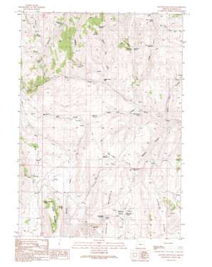
Hunter Mtn Topo Map Oregon
To zoom in, hover over the map of Hunter Mtn
USGS Topo Quad 44118a1 - 1:24,000 scale
| Topo Map Name: | Hunter Mtn |
| USGS Topo Quad ID: | 44118a1 |
| Print Size: | ca. 21 1/4" wide x 27" high |
| Southeast Coordinates: | 44° N latitude / 118° W longitude |
| Map Center Coordinates: | 44.0625° N latitude / 118.0625° W longitude |
| U.S. State: | OR |
| Filename: | o44118a1.jpg |
| Download Map JPG Image: | Hunter Mtn topo map 1:24,000 scale |
| Map Type: | Topographic |
| Topo Series: | 7.5´ |
| Map Scale: | 1:24,000 |
| Source of Map Images: | United States Geological Survey (USGS) |
| Alternate Map Versions: |
Hunter Mountain OR 1990, updated 1991 Download PDF Buy paper map Hunter Mountain OR 2011 Download PDF Buy paper map Hunter Mountain OR 2014 Download PDF Buy paper map |
1:24,000 Topo Quads surrounding Hunter Mtn
> Back to 44118a1 at 1:100,000 scale
> Back to 44118a1 at 1:250,000 scale
> Back to U.S. Topo Maps home
Hunter Mtn topo map: Gazetteer
Hunter Mtn: Basins
Willow Basin elevation 1310m 4297′Hunter Mtn: Canals
Hunter Ditch elevation 1289m 4229′Hunter Mtn: Cliffs
Steamboat Rock elevation 1303m 4274′Hunter Mtn: Flats
Beaver Dam Flat elevation 1246m 4087′Big Flat elevation 1344m 4409′
Hunter Mtn: Reservoirs
Big Flat Reservoir elevation 1342m 4402′Kitten Canyon Reservoir elevation 1364m 4475′
Mailbox Canyon Reservoir elevation 1294m 4245′
Willow Basin Reservoir elevation 1282m 4206′
Hunter Mtn: Springs
Baker City Springs elevation 1319m 4327′Buckskin Spring elevation 1492m 4895′
Cold Spring elevation 1396m 4580′
Earp Spring elevation 1364m 4475′
Hunter Mountain Spring elevation 1291m 4235′
Juniper Spring elevation 1286m 4219′
Kitten Canyon Spring elevation 1476m 4842′
McArthur Spring elevation 1519m 4983′
Pinto Springs elevation 1438m 4717′
Schoolmarm Spring elevation 1208m 3963′
Steamboat Spring elevation 1334m 4376′
Willow Basin Spring elevation 1322m 4337′
Wilson Spring elevation 1343m 4406′
Hunter Mtn: Streams
Beaver Dam Creek elevation 1233m 4045′Godding Creek elevation 1260m 4133′
Hunter Creek elevation 1223m 4012′
McArthur Creek elevation 1393m 4570′
North Bully Creek elevation 1300m 4265′
Puckett Creek elevation 1407m 4616′
South Bully Creek elevation 1303m 4274′
Steamboat Creek elevation 1197m 3927′
West Fork Bendire Creek elevation 1247m 4091′
Willow Basin Creek elevation 1209m 3966′
Hunter Mtn: Summits
Hunter Mountain elevation 1466m 4809′Hunter Mtn: Valleys
Baker City Canyon elevation 1177m 3861′Baker City Draw elevation 1187m 3894′
Kitten Canyon elevation 1231m 4038′
Mailbox Canyon elevation 1168m 3832′
Hunter Mtn digital topo map on disk
Buy this Hunter Mtn topo map showing relief, roads, GPS coordinates and other geographical features, as a high-resolution digital map file on DVD:


