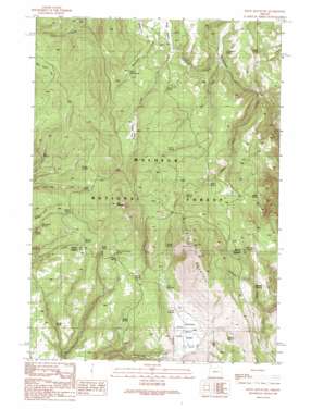
Knox Mountain Topo Map Oregon
To zoom in, hover over the map of Knox Mountain
USGS Topo Quad 44118a4 - 1:24,000 scale
| Topo Map Name: | Knox Mountain |
| USGS Topo Quad ID: | 44118a4 |
| Print Size: | ca. 21 1/4" wide x 27" high |
| Southeast Coordinates: | 44° N latitude / 118.375° W longitude |
| Map Center Coordinates: | 44.0625° N latitude / 118.4375° W longitude |
| U.S. State: | OR |
| Filename: | o44118a4.jpg |
| Download Map JPG Image: | Knox Mountain topo map 1:24,000 scale |
| Map Type: | Topographic |
| Topo Series: | 7.5´ |
| Map Scale: | 1:24,000 |
| Source of Map Images: | United States Geological Survey (USGS) |
| Alternate Map Versions: |
Knox Mountain OR 1999, updated 2002 Download PDF Buy paper map Knox Mountain OR 2011 Download PDF Buy paper map Knox Mountain OR 2014 Download PDF Buy paper map |
| FStopo: | US Forest Service topo Knox Mountain is available: Download FStopo PDF Download FStopo TIF |
1:24,000 Topo Quads surrounding Knox Mountain
> Back to 44118a1 at 1:100,000 scale
> Back to 44118a1 at 1:250,000 scale
> Back to U.S. Topo Maps home
Knox Mountain topo map: Gazetteer
Knox Mountain: Basins
Antelope Swale elevation 1605m 5265′Knox Mountain: Flats
Buttermilk Flat elevation 1621m 5318′Cougar Meadow elevation 1628m 5341′
Knox Meadow elevation 1689m 5541′
Knox Mountain: Reservoirs
Shorty Reservoir elevation 1660m 5446′Tamarack Reservoir elevation 1639m 5377′
Tuck Reservoir elevation 1627m 5337′
Knox Mountain: Springs
Alder Spring elevation 1669m 5475′Alder Spring elevation 1703m 5587′
Anderson Spring elevation 1617m 5305′
Bear Spring elevation 1742m 5715′
Bingham Spring elevation 1603m 5259′
Cabin Spring elevation 1665m 5462′
Cottonwood Spring elevation 1597m 5239′
Cougar Spring elevation 1590m 5216′
Fir Tree Spring elevation 1741m 5711′
Hoffman Spring elevation 1790m 5872′
Hogan Spring elevation 1681m 5515′
Jones Spring elevation 1765m 5790′
Juniper Spring elevation 1799m 5902′
Leacy Spring elevation 1685m 5528′
Lost Spring elevation 1820m 5971′
Marksbury Spring elevation 1696m 5564′
Miller and Jackson Spring elevation 1764m 5787′
Moffitt Spring elevation 1744m 5721′
Palmer Spring elevation 1698m 5570′
Swale Springs elevation 1615m 5298′
Tamarack Spring elevation 1717m 5633′
Teepee Spring elevation 1633m 5357′
Two Dot Spring elevation 1684m 5524′
Westfall Spring elevation 1785m 5856′
Whitney Spring elevation 1737m 5698′
Knox Mountain: Streams
Alder Creek elevation 1559m 5114′Cat Creek elevation 1578m 5177′
Cougar Creek elevation 1624m 5328′
Knox Mountain: Summits
Antelope Mountain elevation 1957m 6420′Knox Mountain elevation 1980m 6496′
Knox Mountain digital topo map on disk
Buy this Knox Mountain topo map showing relief, roads, GPS coordinates and other geographical features, as a high-resolution digital map file on DVD:


