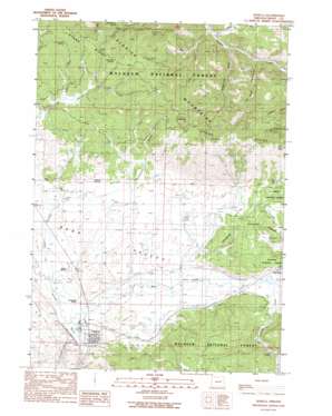
Seneca Topo Map Oregon
To zoom in, hover over the map of Seneca
USGS Topo Quad 44118b8 - 1:24,000 scale
| Topo Map Name: | Seneca |
| USGS Topo Quad ID: | 44118b8 |
| Print Size: | ca. 21 1/4" wide x 27" high |
| Southeast Coordinates: | 44.125° N latitude / 118.875° W longitude |
| Map Center Coordinates: | 44.1875° N latitude / 118.9375° W longitude |
| U.S. State: | OR |
| Filename: | o44118b8.jpg |
| Download Map JPG Image: | Seneca topo map 1:24,000 scale |
| Map Type: | Topographic |
| Topo Series: | 7.5´ |
| Map Scale: | 1:24,000 |
| Source of Map Images: | United States Geological Survey (USGS) |
| Alternate Map Versions: |
Seneca OR 1990, updated 1990 Download PDF Buy paper map Seneca OR 1998, updated 2000 Download PDF Buy paper map Seneca OR 2011 Download PDF Buy paper map Seneca OR 2014 Download PDF Buy paper map |
| FStopo: | US Forest Service topo Seneca is available: Download FStopo PDF Download FStopo TIF |
1:24,000 Topo Quads surrounding Seneca
> Back to 44118a1 at 1:100,000 scale
> Back to 44118a1 at 1:250,000 scale
> Back to U.S. Topo Maps home
Seneca topo map: Gazetteer
Seneca: Canals
Southworth Ditch elevation 1431m 4694′Seneca: Dams
H S Johnson Dam elevation 1483m 4865′Seneca: Populated Places
Seneca elevation 1425m 4675′Seneca: Post Offices
Seneca Post Office elevation 1425m 4675′Yeoville Post Office (historical) elevation 1454m 4770′
Seneca: Reservoirs
Bull Run Reservoir elevation 1441m 4727′H S Johnson Reservoir elevation 1483m 4865′
Johnson Reservoir elevation 1496m 4908′
Rex Reservoir elevation 1451m 4760′
Seneca: Springs
Big Glade Spring elevation 1441m 4727′Bull Run Spring elevation 1443m 4734′
Frys Camp Spring elevation 1526m 5006′
Hagney Spring elevation 1473m 4832′
Herberger Spring elevation 1588m 5209′
Hunters Cabin Spring elevation 1609m 5278′
Moonshine Spring elevation 1473m 4832′
Shields Spring elevation 1434m 4704′
Sugarloaf Spring elevation 1597m 5239′
Van Aspen Spring elevation 1583m 5193′
Seneca: Streams
Antelope Creek elevation 1444m 4737′Bear Creek elevation 1425m 4675′
East Fork Canyon Creek elevation 1244m 4081′
Honeymoon Creek elevation 1425m 4675′
Jimmy Creek elevation 1425m 4675′
Pearson Creek elevation 1473m 4832′
Shirttail Creek elevation 1425m 4675′
South Fork Antelope Creek elevation 1476m 4842′
Seneca: Summits
Sugarloaf elevation 1701m 5580′Seneca: Valleys
Dry Soda Gulch elevation 1271m 4169′Sloan Gulch elevation 1240m 4068′
Sugarloaf Gulch elevation 1282m 4206′
Thompson Gulch elevation 1452m 4763′
Seneca: Wells
Seneca Well elevation 1425m 4675′Seneca digital topo map on disk
Buy this Seneca topo map showing relief, roads, GPS coordinates and other geographical features, as a high-resolution digital map file on DVD:


