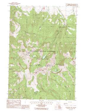
Strawberry Mountain Topo Map Oregon
To zoom in, hover over the map of Strawberry Mountain
USGS Topo Quad 44118c6 - 1:24,000 scale
| Topo Map Name: | Strawberry Mountain |
| USGS Topo Quad ID: | 44118c6 |
| Print Size: | ca. 21 1/4" wide x 27" high |
| Southeast Coordinates: | 44.25° N latitude / 118.625° W longitude |
| Map Center Coordinates: | 44.3125° N latitude / 118.6875° W longitude |
| U.S. State: | OR |
| Filename: | o44118c6.jpg |
| Download Map JPG Image: | Strawberry Mountain topo map 1:24,000 scale |
| Map Type: | Topographic |
| Topo Series: | 7.5´ |
| Map Scale: | 1:24,000 |
| Source of Map Images: | United States Geological Survey (USGS) |
| Alternate Map Versions: |
Strawberry Mtn OR 1988, updated 1988 Download PDF Buy paper map Strawberry Mountain OR 1996, updated 1998 Download PDF Buy paper map Strawberry Mountain OR 2011 Download PDF Buy paper map Strawberry Mountain OR 2014 Download PDF Buy paper map |
| FStopo: | US Forest Service topo Strawberry Mountain is available: Download FStopo PDF Download FStopo TIF |
1:24,000 Topo Quads surrounding Strawberry Mountain
> Back to 44118a1 at 1:100,000 scale
> Back to 44118a1 at 1:250,000 scale
> Back to U.S. Topo Maps home
Strawberry Mountain topo map: Gazetteer
Strawberry Mountain: Basins
Big Riner Basin elevation 2270m 7447′Little Riner Basin elevation 2248m 7375′
Wildcat Basin elevation 2160m 7086′
Strawberry Mountain: Falls
Slide Falls elevation 2126m 6975′Strawberry Falls elevation 2066m 6778′
Strawberry Mountain: Flats
Buckhorn Meadow elevation 1987m 6519′Strawberry Mountain: Lakes
High Lake elevation 2277m 7470′Little Mud Lake elevation 2263m 7424′
Little Slide Lake elevation 2218m 7276′
Little Strawberry Lake elevation 2107m 6912′
Mud Lake elevation 2229m 7312′
Slide Lake elevation 2203m 7227′
Strawberry Lake elevation 1910m 6266′
Strawberry Mountain: Mines
Marks-Thompson Mine elevation 1422m 4665′Strawberry Mountain: Springs
Dalton Springs elevation 1422m 4665′Hot Spring elevation 1292m 4238′
Indian Springs elevation 2075m 6807′
McNaughton Spring elevation 1478m 4849′
Strawberry Spring elevation 2457m 8061′
Wildcat Spring elevation 2119m 6952′
Strawberry Mountain: Streams
East Fork Indian Creek elevation 1775m 5823′Onion Creek elevation 1584m 5196′
Overholt Creek elevation 1268m 4160′
Sheep Creek elevation 1337m 4386′
Slide Creek elevation 1499m 4917′
Strawberry Mountain: Summits
Graham Mountain elevation 2591m 8500′Indian Spring Butte elevation 2577m 8454′
Rabbit Ears elevation 2530m 8300′
Sheep Rock elevation 1938m 6358′
Slide Mountain elevation 2585m 8480′
Strawberry Mountain elevation 2750m 9022′
Strawberry Mountain: Trails
Buckhorn Meadows Trail elevation 1886m 6187′Canyon Creek Trail elevation 1974m 6476′
Indian Creek Trail elevation 1919m 6295′
Meadow Fork Trail elevation 2245m 7365′
Mud Lake Trail elevation 1964m 6443′
Onion Creek Trail elevation 1953m 6407′
Pine Creek Trail elevation 2180m 7152′
Slide Basin Trail elevation 2357m 7732′
Strawberry Basin Trail elevation 2035m 6676′
Twin Springs Trail elevation 2503m 8211′
Strawberry Mountain digital topo map on disk
Buy this Strawberry Mountain topo map showing relief, roads, GPS coordinates and other geographical features, as a high-resolution digital map file on DVD:


