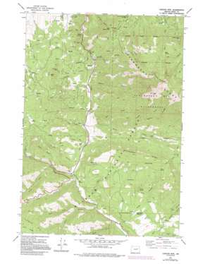
Canyon Mountain Topo Map Oregon
To zoom in, hover over the map of Canyon Mountain
USGS Topo Quad 44118c8 - 1:24,000 scale
| Topo Map Name: | Canyon Mountain |
| USGS Topo Quad ID: | 44118c8 |
| Print Size: | ca. 21 1/4" wide x 27" high |
| Southeast Coordinates: | 44.25° N latitude / 118.875° W longitude |
| Map Center Coordinates: | 44.3125° N latitude / 118.9375° W longitude |
| U.S. State: | OR |
| Filename: | o44118c8.jpg |
| Download Map JPG Image: | Canyon Mountain topo map 1:24,000 scale |
| Map Type: | Topographic |
| Topo Series: | 7.5´ |
| Map Scale: | 1:24,000 |
| Source of Map Images: | United States Geological Survey (USGS) |
| Alternate Map Versions: |
Canyon Mtn OR 1972, updated 1976 Download PDF Buy paper map Canyon Mtn OR 1972, updated 1984 Download PDF Buy paper map Canyon Mtn OR 1972, updated 1995 Download PDF Buy paper map Canyon Mountain OR 1998, updated 2000 Download PDF Buy paper map Canyon Mountain OR 2011 Download PDF Buy paper map Canyon Mountain OR 2014 Download PDF Buy paper map |
| FStopo: | US Forest Service topo Canyon Mountain is available: Download FStopo PDF Download FStopo TIF |
1:24,000 Topo Quads surrounding Canyon Mountain
> Back to 44118a1 at 1:100,000 scale
> Back to 44118a1 at 1:250,000 scale
> Back to U.S. Topo Maps home
Canyon Mountain topo map: Gazetteer
Canyon Mountain: Bars
Horseshoe Bar elevation 1021m 3349′Canyon Mountain: Basins
Canyon City Municipal Watershed elevation 1622m 5321′Canyon Mountain: Flats
Jack Cabin Meadow elevation 1313m 4307′Canyon Mountain: Lakes
Mud Lake elevation 1196m 3923′Canyon Mountain: Mines
Golden West Mine elevation 1612m 5288′Great Northern Mine elevation 1490m 4888′
Haggard Mine elevation 1680m 5511′
Iron King Mine elevation 1697m 5567′
Miller Mountain Mine elevation 1436m 4711′
New Mine elevation 1812m 5944′
Canyon Mountain: Pillars
Big Rock elevation 1675m 5495′Canyon Mountain: Reservoirs
Guernsey Pond elevation 1166m 3825′Canyon Mountain: Ridges
Rabbit Ridge elevation 1868m 6128′Rattlesnake Ridge elevation 1913m 6276′
Canyon Mountain: Springs
Alder Spring elevation 1784m 5853′Fawn Spring elevation 1487m 4878′
Hot Springs elevation 1183m 3881′
Maiden Spring elevation 1771m 5810′
Mud Spring elevation 1853m 6079′
Rattlesnake Spring elevation 1415m 4642′
Willow Spring elevation 1468m 4816′
Canyon Mountain: Streams
Berry Creek elevation 1146m 3759′Cougar Creek elevation 1299m 4261′
Deer Creek elevation 1148m 3766′
Fawn Creek elevation 1194m 3917′
Gold Creek elevation 1041m 3415′
Grouse Creek elevation 1146m 3759′
Overholt Creek elevation 1100m 3608′
Rhodabush Creek elevation 1069m 3507′
South Fork Vance Creek elevation 1221m 4005′
Vance Creek elevation 1184m 3884′
Wall Creek elevation 1275m 4183′
Canyon Mountain: Summits
Canyon Mountain elevation 2432m 7979′Eagle Peak elevation 1326m 4350′
Little Canyon Mountain elevation 1729m 5672′
Miller Mountain elevation 1675m 5495′
Sheep Rock elevation 2251m 7385′
Canyon Mountain: Trails
Fawn Spring Trail elevation 1499m 4917′Joaquin Miller Trail elevation 1708m 5603′
Canyon Mountain: Valleys
Alder Gulch elevation 1223m 4012′Bear Gulch elevation 1181m 3874′
Byram Gulch elevation 1084m 3556′
Cherry Gulch elevation 1023m 3356′
Corral Gulch elevation 1182m 3877′
Dry Gulch elevation 1056m 3464′
East Gulch elevation 1203m 3946′
Painters Gulch elevation 1345m 4412′
Road Gulch elevation 1217m 3992′
Sheep Gulch elevation 1107m 3631′
Soda Gulch elevation 1224m 4015′
Watson Gulch elevation 1139m 3736′
West Fork East Gulch elevation 1263m 4143′
Canyon Mountain digital topo map on disk
Buy this Canyon Mountain topo map showing relief, roads, GPS coordinates and other geographical features, as a high-resolution digital map file on DVD:


