Isham Creek Topo Map Oregon
To zoom in, hover over the map of Isham Creek
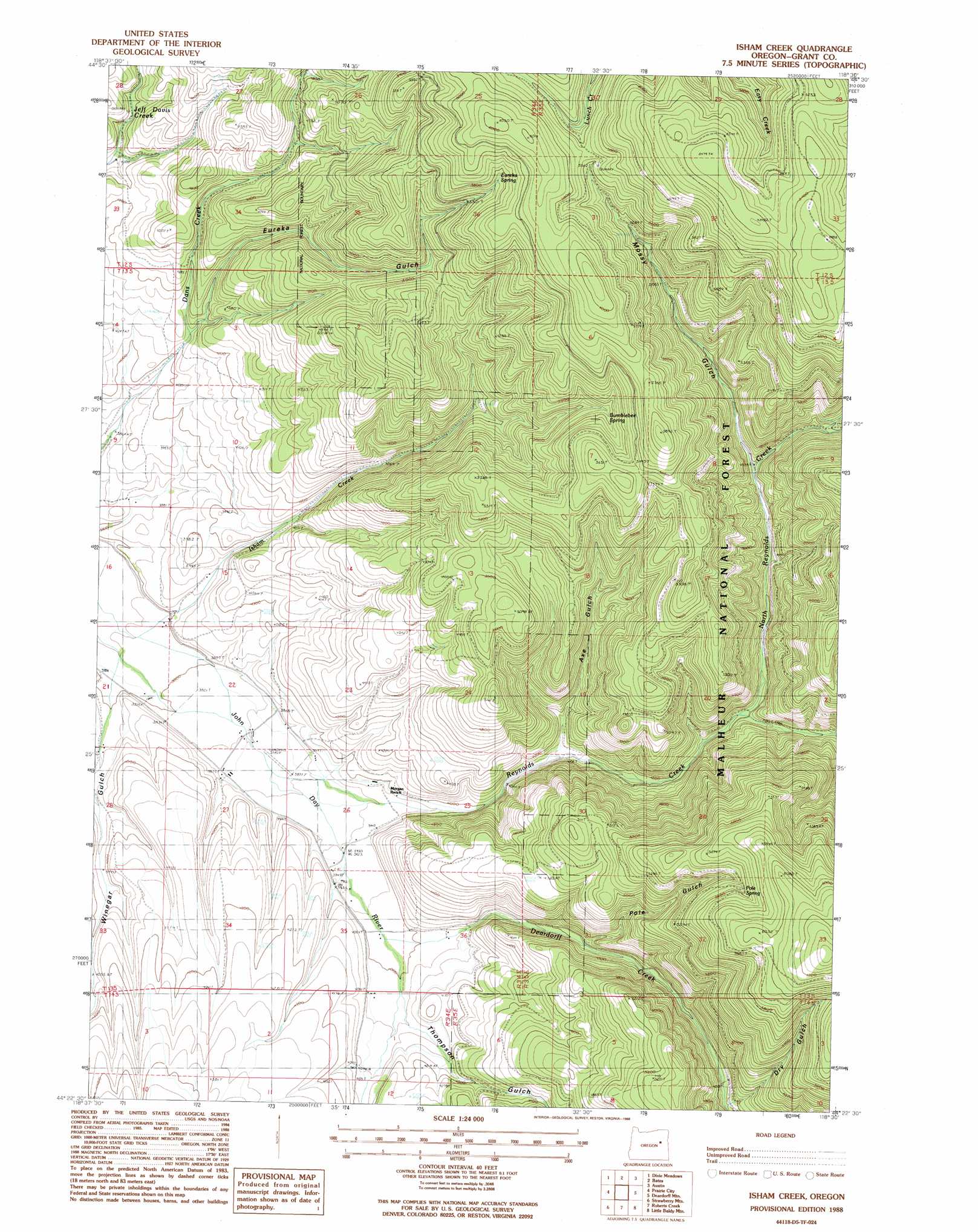
USGS Topo Quad 44118d5 - 1:24,000 scale
| Topo Map Name: | Isham Creek |
| USGS Topo Quad ID: | 44118d5 |
| Print Size: | ca. 21 1/4" wide x 27" high |
| Southeast Coordinates: | 44.375° N latitude / 118.5° W longitude |
| Map Center Coordinates: | 44.4375° N latitude / 118.5625° W longitude |
| U.S. State: | OR |
| Filename: | o44118d5.jpg |
| Download Map JPG Image: | Isham Creek topo map 1:24,000 scale |
| Map Type: | Topographic |
| Topo Series: | 7.5´ |
| Map Scale: | 1:24,000 |
| Source of Map Images: | United States Geological Survey (USGS) |
| Alternate Map Versions: |
Isham Creek OR 1988, updated 1988 Download PDF Buy paper map Isham Creek OR 1996, updated 1998 Download PDF Buy paper map Isham Creek OR 2011 Download PDF Buy paper map Isham Creek OR 2014 Download PDF Buy paper map |
| FStopo: | US Forest Service topo Isham Creek is available: Download FStopo PDF Download FStopo TIF |
1:24,000 Topo Quads surrounding Isham Creek
Susanville |
Boulder Butte |
Vinegar Hill |
Greenhorn |
Whitney |
Cougar Rock |
Dixie Meadows |
Bates |
Austin |
Pogue Point |
Castle Creek |
Prairie City |
Isham Creek |
Deardorff Mountain |
Rail Gulch |
Pine Creek Mountain |
Strawberry Mountain |
Roberts Creek |
Little Baldy Mountain |
Bullrun Rock |
Big Canyon |
Logan Valley West |
Logan Valley East |
Crane Prairie |
Flag Prairie |
> Back to 44118a1 at 1:100,000 scale
> Back to 44118a1 at 1:250,000 scale
> Back to U.S. Topo Maps home
Isham Creek topo map: Gazetteer
Isham Creek: Springs
Bumblebee Spring elevation 1583m 5193′Eureka Spring elevation 1671m 5482′
Horse Spring elevation 1700m 5577′
Pole Spring elevation 1689m 5541′
Isham Creek: Streams
Davis Creek elevation 1285m 4215′Deardorff Creek elevation 1213m 3979′
Isham Creek elevation 1154m 3786′
North Reynolds Creek elevation 1311m 4301′
Reynolds Creek elevation 1177m 3861′
Wildcat Creek elevation 1357m 4452′
Isham Creek: Valleys
Axe Gulch elevation 1246m 4087′Dry Gulch elevation 1392m 4566′
Eureka Gulch elevation 1232m 4041′
Mossy Gulch elevation 1401m 4596′
Pole Gulch elevation 1293m 4242′
Thompson Gulch elevation 1232m 4041′
Winegar Gulch elevation 1148m 3766′
Isham Creek digital topo map on disk
Buy this Isham Creek topo map showing relief, roads, GPS coordinates and other geographical features, as a high-resolution digital map file on DVD: