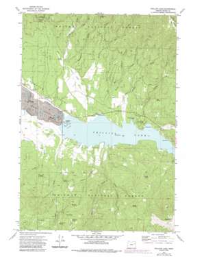
Phillips Lake Topo Map Oregon
To zoom in, hover over the map of Phillips Lake
USGS Topo Quad 44118f1 - 1:24,000 scale
| Topo Map Name: | Phillips Lake |
| USGS Topo Quad ID: | 44118f1 |
| Print Size: | ca. 21 1/4" wide x 27" high |
| Southeast Coordinates: | 44.625° N latitude / 118° W longitude |
| Map Center Coordinates: | 44.6875° N latitude / 118.0625° W longitude |
| U.S. State: | OR |
| Filename: | o44118f1.jpg |
| Download Map JPG Image: | Phillips Lake topo map 1:24,000 scale |
| Map Type: | Topographic |
| Topo Series: | 7.5´ |
| Map Scale: | 1:24,000 |
| Source of Map Images: | United States Geological Survey (USGS) |
| Alternate Map Versions: |
Phillips Lake OR 1972, updated 1976 Download PDF Buy paper map Phillips Lake OR 1972, updated 1985 Download PDF Buy paper map Phillips Lake OR 2011 Download PDF Buy paper map Phillips Lake OR 2014 Download PDF Buy paper map |
| FStopo: | US Forest Service topo Phillips Lake is available: Download FStopo PDF Download FStopo TIF |
1:24,000 Topo Quads surrounding Phillips Lake
> Back to 44118e1 at 1:100,000 scale
> Back to 44118a1 at 1:250,000 scale
> Back to U.S. Topo Maps home
Phillips Lake topo map: Gazetteer
Phillips Lake: Canals
Farmers Ditch elevation 1253m 4110′Phillips Lake: Flats
McHenry Flat elevation 1522m 4993′Phillips Lake: Populated Places
McEwen elevation 1265m 4150′Phillips Lake: Post Offices
Britten Post Office (historical) elevation 1244m 4081′Hershal Post Office (historical) elevation 1242m 4074′
McEwen Post Office (historical) elevation 1265m 4150′
Phillips Lake: Reservoirs
Mason Reservoir elevation 1242m 4074′Phillips Lake elevation 1246m 4087′
Phillips Lake: Springs
Adams Spring elevation 1344m 4409′Alder Loop Spring elevation 1621m 5318′
Camp Spring elevation 1476m 4842′
Jack Wilson Spring elevation 1518m 4980′
Jeep Ride Spring elevation 1475m 4839′
Log Cabin Spring elevation 1475m 4839′
McHenry Spring elevation 1513m 4963′
Moody Spring elevation 1379m 4524′
Picnic Spring elevation 1550m 5085′
Pothole Spring elevation 1692m 5551′
Tope Spring elevation 1423m 4668′
Phillips Lake: Streams
Alder Creek elevation 1299m 4261′Baboon Creek elevation 1352m 4435′
Birch Creek elevation 1278m 4192′
Bridge Creek elevation 1242m 4074′
Clear Creek elevation 1242m 4074′
Dean Creek elevation 1249m 4097′
Deer Creek elevation 1243m 4078′
East Fork Alder Creek elevation 1414m 4639′
East Fork Birch Creek elevation 1292m 4238′
East Fork Miners Creek elevation 1415m 4642′
Lake Creek elevation 1355m 4445′
Little Dean Creek elevation 1343m 4406′
Miners Creek elevation 1243m 4078′
Smith Creek elevation 1242m 4074′
Tibbs Creek elevation 1284m 4212′
Union Creek elevation 1242m 4074′
West Fork Birch Creek elevation 1288m 4225′
Phillips Lake: Summits
Black Mountain elevation 2021m 6630′Phillips Lake: Valleys
Cook Gulch elevation 1250m 4101′Rockne Gulch elevation 1358m 4455′
Stovepipe Gulch elevation 1284m 4212′
Sumpter Valley elevation 1242m 4074′
Phillips Lake digital topo map on disk
Buy this Phillips Lake topo map showing relief, roads, GPS coordinates and other geographical features, as a high-resolution digital map file on DVD:


