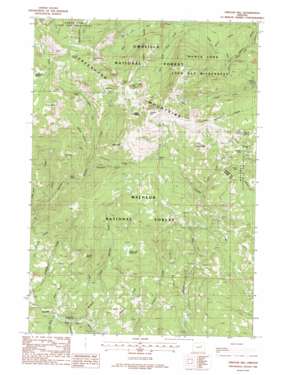
Vinegar Hill Topo Map Oregon
To zoom in, hover over the map of Vinegar Hill
USGS Topo Quad 44118f5 - 1:24,000 scale
| Topo Map Name: | Vinegar Hill |
| USGS Topo Quad ID: | 44118f5 |
| Print Size: | ca. 21 1/4" wide x 27" high |
| Southeast Coordinates: | 44.625° N latitude / 118.5° W longitude |
| Map Center Coordinates: | 44.6875° N latitude / 118.5625° W longitude |
| U.S. State: | OR |
| Filename: | o44118f5.jpg |
| Download Map JPG Image: | Vinegar Hill topo map 1:24,000 scale |
| Map Type: | Topographic |
| Topo Series: | 7.5´ |
| Map Scale: | 1:24,000 |
| Source of Map Images: | United States Geological Survey (USGS) |
| Alternate Map Versions: |
Vinegar Hill OR 1988, updated 1988 Download PDF Buy paper map Vinegar Hill OR 1995, updated 1998 Download PDF Buy paper map Vinegar Hill OR 2011 Download PDF Buy paper map Vinegar Hill OR 2014 Download PDF Buy paper map |
| FStopo: | US Forest Service topo Vinegar Hill is available: Download FStopo PDF Download FStopo TIF |
1:24,000 Topo Quads surrounding Vinegar Hill
> Back to 44118e1 at 1:100,000 scale
> Back to 44118a1 at 1:250,000 scale
> Back to U.S. Topo Maps home
Vinegar Hill topo map: Gazetteer
Vinegar Hill: Basins
Morris Basin elevation 2076m 6811′Vinegar Hill: Flats
Cow Camp Meadows elevation 1573m 5160′McCalpine Meadow elevation 2257m 7404′
Vinegar Hill: Mines
Banner Mine elevation 1880m 6167′Ben Harrison Mine elevation 1958m 6423′
Bimetallic Mine elevation 2111m 6925′
Butler Mine elevation 2069m 6788′
Fryes Mine elevation 1914m 6279′
Little Doe Mine elevation 1998m 6555′
Morning Mine elevation 1955m 6414′
Morris Mine elevation 2257m 7404′
Portland Mine elevation 2236m 7335′
Roberts Mine elevation 1812m 5944′
Tempest Mine elevation 1978m 6489′
Tiger Mine elevation 2170m 7119′
Vinegar Hill: Ranges
Greenhorn Mountains elevation 2469m 8100′Vinegar Hill: Springs
Duprat Spring elevation 2284m 7493′Sunrise Spring elevation 1614m 5295′
Vinegar Hill: Streams
Blackeye Creek elevation 1624m 5328′Ditch Creek elevation 1624m 5328′
East Fork Clear Creek elevation 1800m 5905′
East Fork Granite Boulder Creek elevation 1736m 5695′
Flat Creek elevation 1201m 3940′
Gorge Creek elevation 1197m 3927′
Ingram Creek elevation 1696m 5564′
Lemon Creek elevation 1406m 4612′
Little Boulder Creek elevation 1197m 3927′
Little Butte Creek elevation 1168m 3832′
Morning Creek elevation 1415m 4642′
Morris Creek elevation 1928m 6325′
Murdock Creek elevation 1190m 3904′
Poker Creek elevation 1405m 4609′
Porky Creek elevation 1395m 4576′
Salmon Creek elevation 1857m 6092′
Spring Creek elevation 1689m 5541′
West Fork Clear Creek elevation 1800m 5905′
West Fork Granite Boulder Creek elevation 1736m 5695′
Vinegar Hill: Summits
Ben Harrison Peak elevation 2371m 7778′Black Butte elevation 2203m 7227′
Psyche Butte elevation 2169m 7116′
Sunrise Butte elevation 2346m 7696′
Twin Buttes elevation 1647m 5403′
Vinegar Hill elevation 2472m 8110′
Vinegar Hill: Valleys
Blue Gulch elevation 1653m 5423′Hunt Gulch elevation 1165m 3822′
Vinegar Hill digital topo map on disk
Buy this Vinegar Hill topo map showing relief, roads, GPS coordinates and other geographical features, as a high-resolution digital map file on DVD:


