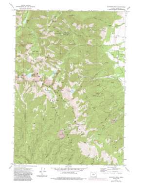
Elkhorn Peak Topo Map Oregon
To zoom in, hover over the map of Elkhorn Peak
USGS Topo Quad 44118g1 - 1:24,000 scale
| Topo Map Name: | Elkhorn Peak |
| USGS Topo Quad ID: | 44118g1 |
| Print Size: | ca. 21 1/4" wide x 27" high |
| Southeast Coordinates: | 44.75° N latitude / 118° W longitude |
| Map Center Coordinates: | 44.8125° N latitude / 118.0625° W longitude |
| U.S. State: | OR |
| Filename: | o44118g1.jpg |
| Download Map JPG Image: | Elkhorn Peak topo map 1:24,000 scale |
| Map Type: | Topographic |
| Topo Series: | 7.5´ |
| Map Scale: | 1:24,000 |
| Source of Map Images: | United States Geological Survey (USGS) |
| Alternate Map Versions: |
Elkhorn Peak OR 1972 Download PDF Buy paper map Elkhorn Peak OR 1972, updated 1976 Download PDF Buy paper map Elkhorn Peak OR 1972, updated 1984 Download PDF Buy paper map Elkhorn Peak OR 1972, updated 1985 Download PDF Buy paper map Elkhorn Peak OR 2011 Download PDF Buy paper map Elkhorn Peak OR 2014 Download PDF Buy paper map |
| FStopo: | US Forest Service topo Elkhorn Peak is available: Download FStopo PDF Download FStopo TIF |
1:24,000 Topo Quads surrounding Elkhorn Peak
> Back to 44118e1 at 1:100,000 scale
> Back to 44118a1 at 1:250,000 scale
> Back to U.S. Topo Maps home
Elkhorn Peak topo map: Gazetteer
Elkhorn Peak: Basins
Cougar Basin elevation 2379m 7805′Elkhorn Peak: Canals
Nelson Ditch elevation 1216m 3989′Williams Ditch elevation 1212m 3976′
Elkhorn Peak: Dams
Goodrich Dam elevation 2101m 6893′Pine Creek Dam elevation 1993m 6538′
Rock Lake Dam elevation 2378m 7801′
Elkhorn Peak: Flats
Eilertson Meadow elevation 1678m 5505′Elkhorn Peak: Lakes
Bucket Lake elevation 2387m 7831′Cougar Pond elevation 2422m 7946′
Goodrich Lake elevation 2101m 6893′
Rock Creek Lake elevation 2339m 7673′
Twin Lakes elevation 2337m 7667′
Willow Creek Lake elevation 2524m 8280′
Elkhorn Peak: Mines
Excuse Mine elevation 1734m 5688′Highland Mine elevation 1947m 6387′
Lower Baisley-Elkhorn Mine elevation 1613m 5291′
Maxwell Mine elevation 2159m 7083′
Middle Camp Baisley-Elkhorn Mine elevation 1832m 6010′
Upper Baisley-Elkhorn Mine elevation 2077m 6814′
Elkhorn Peak: Post Offices
Tracy Post Office (historical) elevation 1325m 4347′Elkhorn Peak: Reservoirs
Pine Creek Reservoir elevation 1993m 6538′Elkhorn Peak: Ridges
Elkhorn Ridge elevation 2611m 8566′Elkhorn Peak: Springs
Coyote Spring elevation 1657m 5436′Hawk Spring elevation 1656m 5433′
Elkhorn Peak: Streams
Bear Creek elevation 1406m 4612′Crevice Creek elevation 1403m 4603′
Gee Creek elevation 1218m 3996′
Little Marble Creek elevation 1424m 4671′
Little Mill Creek elevation 1359m 4458′
North Fork Pine Creek elevation 1484m 4868′
South Fork Rock Creek elevation 1687m 5534′
South Prong Pine Creek elevation 1855m 6085′
West Fork Lake Creek elevation 1568m 5144′
Elkhorn Peak: Summits
Elkhorn Peak elevation 2711m 8894′Hunt Mountain elevation 2506m 8221′
Marble Point elevation 2417m 7929′
Rock Creek Butte elevation 2763m 9064′
Elkhorn Peak: Swamps
Gee Creek Swamp elevation 1180m 3871′Elkhorn Peak: Trails
Elkhorn Crest Trail elevation 2228m 7309′Highland Trail elevation 2501m 8205′
Twin Lakes Trail elevation 2066m 6778′
Elkhorn Peak digital topo map on disk
Buy this Elkhorn Peak topo map showing relief, roads, GPS coordinates and other geographical features, as a high-resolution digital map file on DVD:


