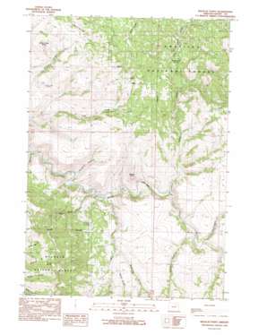
Wildcat Point Topo Map Oregon
To zoom in, hover over the map of Wildcat Point
USGS Topo Quad 44118g8 - 1:24,000 scale
| Topo Map Name: | Wildcat Point |
| USGS Topo Quad ID: | 44118g8 |
| Print Size: | ca. 21 1/4" wide x 27" high |
| Southeast Coordinates: | 44.75° N latitude / 118.875° W longitude |
| Map Center Coordinates: | 44.8125° N latitude / 118.9375° W longitude |
| U.S. State: | OR |
| Filename: | o44118g8.jpg |
| Download Map JPG Image: | Wildcat Point topo map 1:24,000 scale |
| Map Type: | Topographic |
| Topo Series: | 7.5´ |
| Map Scale: | 1:24,000 |
| Source of Map Images: | United States Geological Survey (USGS) |
| Alternate Map Versions: |
Wildcat Point OR 1990, updated 1990 Download PDF Buy paper map Wildcat Point OR 1995, updated 1998 Download PDF Buy paper map Wildcat Point OR 2011 Download PDF Buy paper map Wildcat Point OR 2014 Download PDF Buy paper map |
| FStopo: | US Forest Service topo Wildcat Point is available: Download FStopo PDF Download FStopo TIF |
1:24,000 Topo Quads surrounding Wildcat Point
> Back to 44118e1 at 1:100,000 scale
> Back to 44118a1 at 1:250,000 scale
> Back to U.S. Topo Maps home
Wildcat Point topo map: Gazetteer
Wildcat Point: Basins
Patterson Basin elevation 1258m 4127′Wildcat Point: Post Offices
Kilbride Post Office (historical) elevation 969m 3179′Wildcat Point: Springs
Crowley Spring elevation 1484m 4868′Lick Spring elevation 1384m 4540′
Wildcat Point: Streams
Bullrun Creek elevation 905m 2969′Huckleberry Creek elevation 982m 3221′
Indian Creek elevation 962m 3156′
Little Indian Creek elevation 1184m 3884′
Slide Creek elevation 952m 3123′
Wildcat Point: Summits
Wildcat Point elevation 1123m 3684′Willow Creek Butte elevation 1377m 4517′
Wildcat Point: Valleys
Bum Canyon elevation 928m 3044′Cross Hollow elevation 976m 3202′
Paradise Canyon elevation 920m 3018′
Rapp Gulch elevation 1041m 3415′
Waterlog Gulch elevation 1024m 3359′
Wildcat Point digital topo map on disk
Buy this Wildcat Point topo map showing relief, roads, GPS coordinates and other geographical features, as a high-resolution digital map file on DVD:


