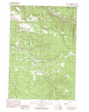
The Cockscomb Topo Map Oregon
To zoom in, hover over the map of The Cockscomb
USGS Topo Quad 44118h7 - 1:24,000 scale
| Topo Map Name: | The Cockscomb |
| USGS Topo Quad ID: | 44118h7 |
| Print Size: | ca. 21 1/4" wide x 27" high |
| Southeast Coordinates: | 44.875° N latitude / 118.75° W longitude |
| Map Center Coordinates: | 44.9375° N latitude / 118.8125° W longitude |
| U.S. State: | OR |
| Filename: | o44118h7.jpg |
| Download Map JPG Image: | The Cockscomb topo map 1:24,000 scale |
| Map Type: | Topographic |
| Topo Series: | 7.5´ |
| Map Scale: | 1:24,000 |
| Source of Map Images: | United States Geological Survey (USGS) |
| Alternate Map Versions: |
The Cockscomb OR 1990, updated 1990 Download PDF Buy paper map The Cockscomb OR 1995, updated 1998 Download PDF Buy paper map The Cockscomb OR 2011 Download PDF Buy paper map The Cockscomb OR 2014 Download PDF Buy paper map |
| FStopo: | US Forest Service topo The Cockscomb is available: Download FStopo PDF Download FStopo TIF |
1:24,000 Topo Quads surrounding The Cockscomb
> Back to 44118e1 at 1:100,000 scale
> Back to 44118a1 at 1:250,000 scale
> Back to U.S. Topo Maps home
The Cockscomb topo map: Gazetteer
The Cockscomb: Basins
Turner Basin elevation 1251m 4104′The Cockscomb: Flats
Onion Flats elevation 1568m 5144′Round Meadows elevation 1384m 4540′
Turner Meadow elevation 1251m 4104′
Wassen Meadows elevation 1224m 4015′
The Cockscomb: Mines
Blue Bucket Mine elevation 1463m 4799′The Cockscomb: Springs
Big Springs elevation 1402m 4599′Hunters Spring elevation 1494m 4901′
Mote Spring elevation 1212m 3976′
Mud Spring elevation 1410m 4625′
Snapp Spring elevation 1254m 4114′
The Cockscomb: Streams
Bruin Creek elevation 1295m 4248′Camp Creek elevation 954m 3129′
Junkens Creek elevation 1348m 4422′
Kelsay Creek elevation 1234m 4048′
Little Kelsay Creek elevation 1461m 4793′
Otter Creek elevation 972m 3188′
Park Creek elevation 1286m 4219′
Peep Creek elevation 1211m 3973′
Spring Creek elevation 1265m 4150′
Starveout Creek elevation 1268m 4160′
Sulphur Creek elevation 956m 3136′
Welch Creek elevation 1361m 4465′
The Cockscomb: Summits
The Cockscomb elevation 1253m 4110′The Cockscomb: Trails
Peep Creek Trail (historical) elevation 1564m 5131′Trough Creek Trail (historical) elevation 1484m 4868′
The Cockscomb digital topo map on disk
Buy this The Cockscomb topo map showing relief, roads, GPS coordinates and other geographical features, as a high-resolution digital map file on DVD:


