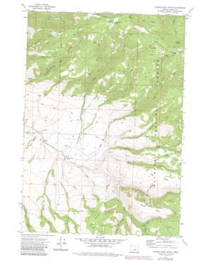
Aldrich Mountain South Topo Map Oregon
To zoom in, hover over the map of Aldrich Mountain South
USGS Topo Quad 44119c4 - 1:24,000 scale
| Topo Map Name: | Aldrich Mountain South |
| USGS Topo Quad ID: | 44119c4 |
| Print Size: | ca. 21 1/4" wide x 27" high |
| Southeast Coordinates: | 44.25° N latitude / 119.375° W longitude |
| Map Center Coordinates: | 44.3125° N latitude / 119.4375° W longitude |
| U.S. State: | OR |
| Filename: | o44119c4.jpg |
| Download Map JPG Image: | Aldrich Mountain South topo map 1:24,000 scale |
| Map Type: | Topographic |
| Topo Series: | 7.5´ |
| Map Scale: | 1:24,000 |
| Source of Map Images: | United States Geological Survey (USGS) |
| Alternate Map Versions: |
Aldrich Mountain South OR 1972, updated 1976 Download PDF Buy paper map Aldrich Mountain South OR 1972, updated 1984 Download PDF Buy paper map Aldrich Mountain South OR 1998, updated 2000 Download PDF Buy paper map Aldrich Mountain South OR 2011 Download PDF Buy paper map Aldrich Mountain South OR 2014 Download PDF Buy paper map |
| FStopo: | US Forest Service topo Aldrich Mountain South is available: Download FStopo PDF Download FStopo TIF |
1:24,000 Topo Quads surrounding Aldrich Mountain South
> Back to 44119a1 at 1:100,000 scale
> Back to 44118a1 at 1:250,000 scale
> Back to U.S. Topo Maps home
Aldrich Mountain South topo map: Gazetteer
Aldrich Mountain South: Ridges
Big Ridge elevation 1406m 4612′Trail Ridge elevation 1321m 4333′
Aldrich Mountain South: Springs
Big Pine Springs elevation 1252m 4107′Big Spring elevation 1928m 6325′
Cabbage Patch Spring elevation 1876m 6154′
Cold Spring elevation 1801m 5908′
Mud Spring elevation 1582m 5190′
Roaring Spring elevation 1753m 5751′
Aldrich Mountain South: Streams
Bark Cabin Creek elevation 1173m 3848′Cabin Creek elevation 975m 3198′
Crazy Creek elevation 1105m 3625′
Dry Cabin Creek elevation 1055m 3461′
Dry Duncan Creek elevation 1071m 3513′
Duncan Creek elevation 1006m 3300′
South Fork Murderers Creek elevation 1029m 3375′
Thorn Creek elevation 1006m 3300′
Todd Creek elevation 994m 3261′
Aldrich Mountain South: Summits
Shake Table elevation 1444m 4737′Timber Mountain elevation 1499m 4917′
Aldrich Mountain South: Trails
Cabin Creek Trail elevation 1634m 5360′Dry Cabin Creek Trail elevation 1524m 5000′
Dry Duncan Creek Trail elevation 1556m 5104′
Aldrich Mountain South: Valleys
Corral Gulch elevation 972m 3188′Cow Canyon elevation 1105m 3625′
Deer Gulch elevation 993m 3257′
East Fork Corral Gulch elevation 1024m 3359′
Water Gulch elevation 970m 3182′
Wylie Gulch elevation 953m 3126′
Aldrich Mountain South digital topo map on disk
Buy this Aldrich Mountain South topo map showing relief, roads, GPS coordinates and other geographical features, as a high-resolution digital map file on DVD:


