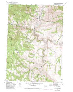
Aldrich Gulch Topo Map Oregon
To zoom in, hover over the map of Aldrich Gulch
USGS Topo Quad 44119c5 - 1:24,000 scale
| Topo Map Name: | Aldrich Gulch |
| USGS Topo Quad ID: | 44119c5 |
| Print Size: | ca. 21 1/4" wide x 27" high |
| Southeast Coordinates: | 44.25° N latitude / 119.5° W longitude |
| Map Center Coordinates: | 44.3125° N latitude / 119.5625° W longitude |
| U.S. State: | OR |
| Filename: | o44119c5.jpg |
| Download Map JPG Image: | Aldrich Gulch topo map 1:24,000 scale |
| Map Type: | Topographic |
| Topo Series: | 7.5´ |
| Map Scale: | 1:24,000 |
| Source of Map Images: | United States Geological Survey (USGS) |
| Alternate Map Versions: |
Aldrich Gulch OR 1972, updated 1976 Download PDF Buy paper map Aldrich Gulch OR 1972, updated 1985 Download PDF Buy paper map Aldrich Gulch OR 1992, updated 1997 Download PDF Buy paper map Aldrich Gulch OR 2011 Download PDF Buy paper map Aldrich Gulch OR 2014 Download PDF Buy paper map |
| FStopo: | US Forest Service topo Aldrich Gulch is available: Download FStopo PDF Download FStopo TIF |
1:24,000 Topo Quads surrounding Aldrich Gulch
> Back to 44119a1 at 1:100,000 scale
> Back to 44118a1 at 1:250,000 scale
> Back to U.S. Topo Maps home
Aldrich Gulch topo map: Gazetteer
Aldrich Gulch: Flats
Deadman Flat elevation 940m 3083′Aldrich Gulch: Reservoirs
Happy Reservoir elevation 1334m 4376′Lost Indian Reservoir elevation 1196m 3923′
North Corner Reservoir elevation 1227m 4025′
Ringsmeyer Reservoir elevation 1415m 4642′
Rock Pit Reservoir elevation 1448m 4750′
Seven Sixty Reservoir elevation 1608m 5275′
Thicket Reservoir elevation 1375m 4511′
Wigwam Reservoir elevation 1372m 4501′
Aldrich Gulch: Springs
Big Spring elevation 1246m 4087′Clark Spring elevation 902m 2959′
Dry Corner Spring elevation 1202m 3943′
Roop Spring elevation 1076m 3530′
Seven Sixty Spring elevation 1606m 5269′
Soup Spring elevation 1143m 3750′
Aldrich Gulch: Streams
Black Canyon Creek elevation 870m 2854′Black Pine Creek elevation 907m 2975′
Cameron Creek elevation 947m 3106′
Congleton Creek elevation 1117m 3664′
Corner Creek elevation 897m 2942′
Dry Prong elevation 1013m 3323′
Frazier Creek elevation 1025m 3362′
Jackass Creek elevation 850m 2788′
Martin Creek elevation 950m 3116′
Murderers Creek elevation 894m 2933′
North Fork Wind Creek elevation 1018m 3339′
Payten Creek elevation 982m 3221′
South Prong Black Canyon Creek elevation 976m 3202′
Twin Stoves Creek elevation 1129m 3704′
Wind Creek elevation 984m 3228′
Youngs Creek elevation 853m 2798′
Aldrich Gulch: Summits
Battle Creek Mountain elevation 1819m 5967′Groundhog Knoll elevation 1292m 4238′
Jackass Mountain elevation 1337m 4386′
Youngs Butte elevation 1653m 5423′
Aldrich Gulch: Trails
Lost Indian Trail elevation 1253m 4110′Payten Trail elevation 1112m 3648′
Aldrich Gulch: Valleys
Aldrich Gulch elevation 869m 2851′Black Canyon elevation 870m 2854′
Chickenhouse Gulch elevation 935m 3067′
Cow Gulch elevation 916m 3005′
Deer Gulch elevation 862m 2828′
Doghouse Gulch elevation 926m 3038′
Elbow Gulch elevation 969m 3179′
Placedor Gulch elevation 901m 2956′
Aldrich Gulch digital topo map on disk
Buy this Aldrich Gulch topo map showing relief, roads, GPS coordinates and other geographical features, as a high-resolution digital map file on DVD:


