Long Creek Topo Map Oregon
To zoom in, hover over the map of Long Creek
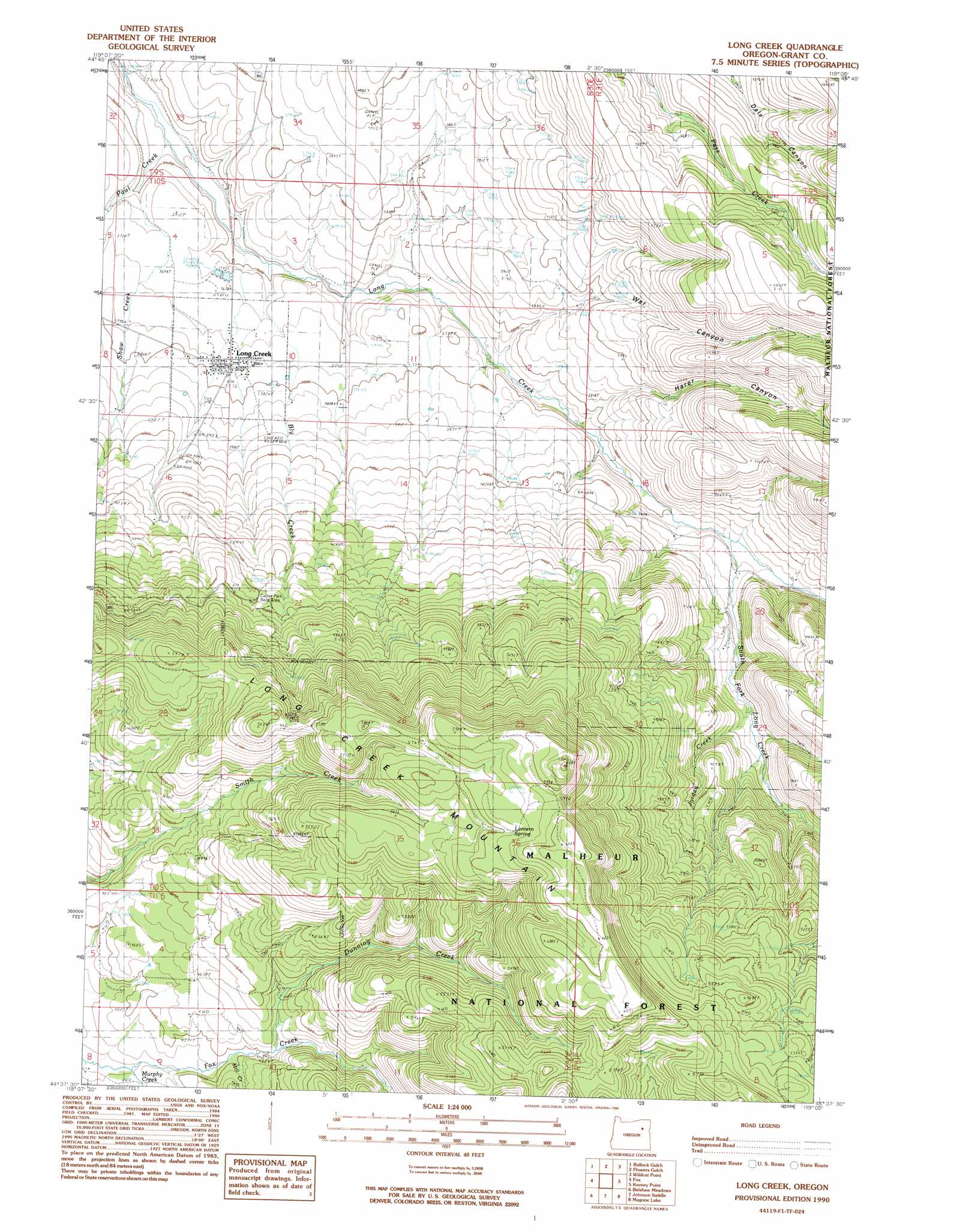
USGS Topo Quad 44119f1 - 1:24,000 scale
| Topo Map Name: | Long Creek |
| USGS Topo Quad ID: | 44119f1 |
| Print Size: | ca. 21 1/4" wide x 27" high |
| Southeast Coordinates: | 44.625° N latitude / 119° W longitude |
| Map Center Coordinates: | 44.6875° N latitude / 119.0625° W longitude |
| U.S. State: | OR |
| Filename: | o44119f1.jpg |
| Download Map JPG Image: | Long Creek topo map 1:24,000 scale |
| Map Type: | Topographic |
| Topo Series: | 7.5´ |
| Map Scale: | 1:24,000 |
| Source of Map Images: | United States Geological Survey (USGS) |
| Alternate Map Versions: |
Long Creek OR 1990, updated 1990 Download PDF Buy paper map Long Creek OR 1999, updated 2002 Download PDF Buy paper map Long Creek OR 2011 Download PDF Buy paper map Long Creek OR 2014 Download PDF Buy paper map |
| FStopo: | US Forest Service topo Long Creek is available: Download FStopo PDF Download FStopo TIF |
1:24,000 Topo Quads surrounding Long Creek
Slickear Mountain |
Ritter |
Meadow Brook Summit |
Dale |
The Cockscomb |
Steet Mountain |
Bullock Gulch |
Flowers Gulch |
Wildcat Point |
Sharp Ridge |
Hamilton |
Fox |
Long Creek |
Keeney Point |
Susanville |
Donaldson Creek |
Belshaw Meadows |
Beech Creek Summit |
Magone Lake |
Cougar Rock |
Shop Gulch |
Wolfinger Butte |
Mount Vernon |
John Day |
Castle Creek |
> Back to 44119e1 at 1:100,000 scale
> Back to 44118a1 at 1:250,000 scale
> Back to U.S. Topo Maps home
Long Creek topo map: Gazetteer
Long Creek: Basins
Long Creek Municipal Watershed elevation 1331m 4366′Long Creek: Bridges
Coles Bridge elevation 1226m 4022′Long Creek: Populated Places
Long Creek elevation 1141m 3743′Long Creek: Post Offices
Long Creek Post Office elevation 1141m 3743′Long Creek: Reservoirs
Long Creek Reservoir elevation 1193m 3914′Long Creek: Springs
Lantern Spring elevation 1789m 5869′Willow Spring elevation 1140m 3740′
Long Creek: Streams
Alder Brook elevation 1158m 3799′Bingville Creek elevation 1116m 3661′
Bly Creek elevation 1097m 3599′
Dunning Creek elevation 1408m 4619′
Everett Creek elevation 1145m 3756′
Gander Creek elevation 1369m 4491′
Jordan Creek elevation 1248m 4094′
Mill Creek elevation 1394m 4573′
Murphy Creek elevation 1365m 4478′
Paul Creek elevation 1074m 3523′
Pole Creek elevation 1282m 4206′
Shaw Creek elevation 1498m 4914′
South Fork Long Creek elevation 1174m 3851′
Spring Creek elevation 1141m 3743′
Long Creek: Summits
Long Creek Mountain elevation 1772m 5813′Long Creek: Valleys
Harer Canyon elevation 1136m 3727′War Canyon elevation 1127m 3697′
Long Creek digital topo map on disk
Buy this Long Creek topo map showing relief, roads, GPS coordinates and other geographical features, as a high-resolution digital map file on DVD: