Fox Topo Map Oregon
To zoom in, hover over the map of Fox
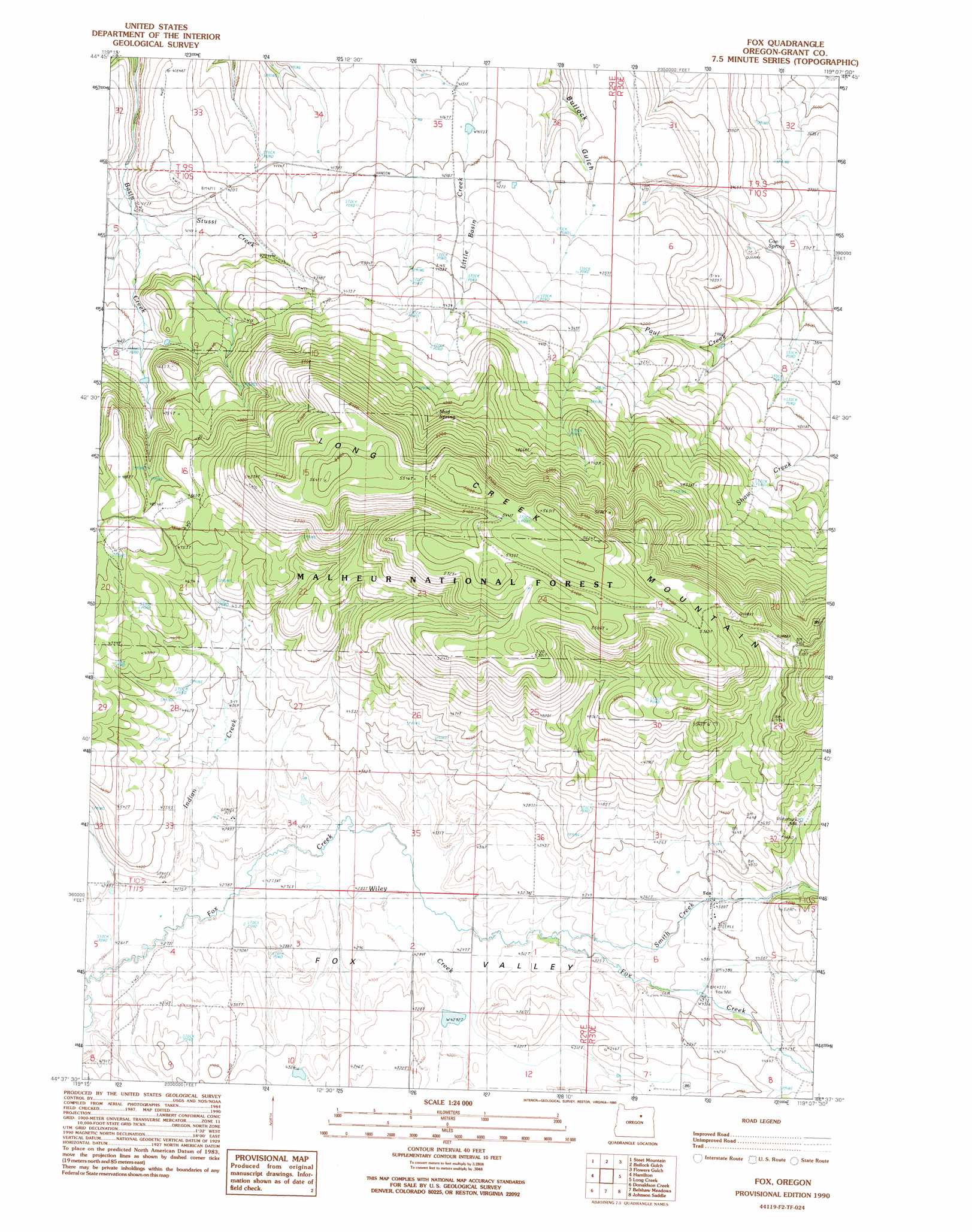
USGS Topo Quad 44119f2 - 1:24,000 scale
| Topo Map Name: | Fox |
| USGS Topo Quad ID: | 44119f2 |
| Print Size: | ca. 21 1/4" wide x 27" high |
| Southeast Coordinates: | 44.625° N latitude / 119.125° W longitude |
| Map Center Coordinates: | 44.6875° N latitude / 119.1875° W longitude |
| U.S. State: | OR |
| Filename: | o44119f2.jpg |
| Download Map JPG Image: | Fox topo map 1:24,000 scale |
| Map Type: | Topographic |
| Topo Series: | 7.5´ |
| Map Scale: | 1:24,000 |
| Source of Map Images: | United States Geological Survey (USGS) |
| Alternate Map Versions: |
Fox OR 1990, updated 1990 Download PDF Buy paper map Fox OR 1999, updated 2002 Download PDF Buy paper map Fox OR 2011 Download PDF Buy paper map Fox OR 2014 Download PDF Buy paper map |
| FStopo: | US Forest Service topo Fox is available: Download FStopo PDF Download FStopo TIF |
1:24,000 Topo Quads surrounding Fox
Johnny Cake Mountain |
Slickear Mountain |
Ritter |
Meadow Brook Summit |
Dale |
Monument |
Steet Mountain |
Bullock Gulch |
Flowers Gulch |
Wildcat Point |
Courthouse Rock |
Hamilton |
Fox |
Long Creek |
Keeney Point |
Sheep Ridge |
Donaldson Creek |
Belshaw Meadows |
Beech Creek Summit |
Magone Lake |
Aldrich Mountain North |
Shop Gulch |
Wolfinger Butte |
Mount Vernon |
John Day |
> Back to 44119e1 at 1:100,000 scale
> Back to 44118a1 at 1:250,000 scale
> Back to U.S. Topo Maps home
Fox topo map: Gazetteer
Fox: Gaps
Long Creek Mountain Summit elevation 1553m 5095′Fox: Populated Places
Fox elevation 1337m 4386′Fox: Post Offices
Fox Post Office elevation 1337m 4386′Trester Post Office (historical) elevation 1332m 4370′
Fox: Springs
Coe Spring elevation 1171m 3841′Mud Spring elevation 1497m 4911′
Fox: Streams
Indian Creek elevation 1300m 4265′Smith Creek elevation 1311m 4301′
Stussi Creek elevation 1235m 4051′
Wiley Creek elevation 1302m 4271′
Fox: Valleys
Smokers Canyon elevation 1310m 4297′Fox digital topo map on disk
Buy this Fox topo map showing relief, roads, GPS coordinates and other geographical features, as a high-resolution digital map file on DVD: